Niles, Michigan
| Niles, Michigan | |
|---|---|
| City | |
|
Main Street of Niles, looking up hill from the river. | |
| Nickname(s): The City of Four Flags | |
 Location of Niles, Michigan | |
| Coordinates: 41°49′48″N 86°15′15″W / 41.83000°N 86.25417°W | |
| Country | United States |
| State | Michigan |
| Counties | Berrien, Cass |
| Area[1] | |
| • Total | 5.95 sq mi (15.41 km2) |
| • Land | 5.79 sq mi (15.00 km2) |
| • Water | 0.16 sq mi (0.41 km2) |
| Elevation | 686 ft (209 m) |
| Population (2010)[2] | |
| • Total | 11,600 |
| • Estimate (2012[3]) | 11,502 |
| • Density | 2,003.5/sq mi (773.6/km2) |
| Time zone | Eastern (EST) (UTC-5) |
| • Summer (DST) | EDT (UTC-4) |
| ZIP codes | 49120-49121 |
| Area code(s) | 269 |
| FIPS code | 26-57760[4] |
| GNIS feature ID | 0633412[5] |
| Website | http://www.ci.niles.mi.us/Default.htm |

Niles is a city in Berrien and Cass counties in the U.S. state of Michigan, near South Bend, Indiana. In 2010, the population was 11,600 according to the 2010 census. It is the larger, by population, of the two principal cities in the Niles-Benton Harbor, Michigan Metropolitan Statistical Area, an area with 156,813 people.[6]
Niles lies on the banks of the St. Joseph River, at the site of the French Fort St. Joseph, first built in 1697 to protect the Jesuit Mission established in 1691. After 1761, it was held by the British and was captured on May 25, 1763, by Native Americans during Pontiac's Rebellion. The British retook the fort but it was not re-garrisoned and served as a trading post. During the American Revolutionary War, the fort was held for a short time by a Spanish force. The occupation of the fort by the four nations of France, Britain, Spain, and the United States has earned Niles the nickname City of Four Flags.[7]
The town was named after Hezekiah Niles, editor of the Niles Register, a Baltimore newspaper. The town of Niles as it exists today was settled in 1827. Between 1820 and 1865, Niles was an integral part of the Underground Railroad, helping slaves escape from as far south as New Orleans through the Heartland, and eventually into Canada.[8][9][10]
Geography
The city is situated on the St. Joseph River and is mostly surrounded by Niles Township. Glacial deposits of large boulders and smooth stones mingle with heavy sedimentary deposits, producing rolling hills and steep river banks. The soil is rich and fertile. Crinoida and related fossils are easily found south of the city.
According to the United States Census Bureau, the city has a total area of 5.95 square miles (15.41 km2), of which 5.79 square miles (15.00 km2) is land and 0.16 square miles (0.41 km2) is water.[1]
Climate
| Climate data for Niles. Michigan | |||||||||||||
|---|---|---|---|---|---|---|---|---|---|---|---|---|---|
| Month | Jan | Feb | Mar | Apr | May | Jun | Jul | Aug | Sep | Oct | Nov | Dec | Year |
| Record high °F (°C) | 49 (9) |
43 (6) |
76 (24) |
83 (28) |
89 (32) |
88 (31) |
92 (33) |
92 (33) |
90 (32) |
86 (30) |
71 (22) |
56 (13) |
92 (33) |
| Average high °F (°C) | 29.3 (−1.5) |
32.2 (0.1) |
52.1 (11.2) |
65.5 (18.6) |
71.1 (21.7) |
78.9 (26.1) |
85.2 (29.6) |
80.5 (26.9) |
73.7 (23.2) |
60.6 (15.9) |
52.1 (11.2) |
32.2 (0.1) |
59.4 (15.2) |
| Average low °F (°C) | 19.0 (−7.2) |
21.9 (−5.6) |
31.8 (−0.1) |
42.8 (6) |
52.0 (11.1) |
60.9 (16.1) |
65.3 (18.5) |
62.4 (16.9) |
54.0 (12.2) |
41.9 (5.5) |
34.2 (1.2) |
21.5 (−5.8) |
42.3 (5.7) |
| Record low °F (°C) | 1 (−17) |
6 (−14) |
18 (−8) |
31 (−1) |
31 (−1) |
48 (9) |
48 (9) |
44 (7) |
40 (4) |
30 (−1) |
20 (−7) |
5 (−15) |
−21 (−29) |
| Average precipitation inches (mm) | 2.34 (59.4) |
1.97 (50) |
2.76 (70.1) |
3.53 (89.7) |
3.98 (101.1) |
3.90 (99.1) |
3.45 (87.6) |
3.84 (97.5) |
3.92 (99.6) |
3.46 (87.9) |
3.45 (87.6) |
3.19 (81) |
39.79 (1,010.7) |
| Average snowfall inches (cm) | 17.8 (45.2) |
11.4 (29) |
6.8 (17.3) |
1.6 (4.1) |
0 (0) |
0 (0) |
0 (0) |
0 (0) |
0 (0) |
0.4 (1) |
6.8 (17.3) |
17.2 (43.7) |
62.0 (157.5) |
| Average precipitation days (≥ 0.01 in) | 16.2 | 11.6 | 12.4 | 13.2 | 11.4 | 10.3 | 9.8 | 10.1 | 10.6 | 11.3 | 13.7 | 15.8 | 146.5 |
| Average snowy days (≥ 0.1 in) | 13.1 | 8.1 | 4.8 | 1.5 | 0 | 0 | 0 | 0 | 0 | 0.3 | 4.7 | 10.6 | 43.2 |
| Source #1: Midwestern Regional Climate Center (normals 1971−2000)[11] | |||||||||||||
| Source #2: Weatherbase[12] | |||||||||||||
Demographics
| Historical population | |||
|---|---|---|---|
| Census | Pop. | %± | |
| 1870 | 4,630 | — | |
| 1880 | 4,197 | −9.4% | |
| 1890 | 4,197 | 0.0% | |
| 1900 | 4,287 | 2.1% | |
| 1910 | 5,156 | 20.3% | |
| 1920 | 7,311 | 41.8% | |
| 1930 | 11,326 | 54.9% | |
| 1940 | 11,328 | 0.0% | |
| 1950 | 13,145 | 16.0% | |
| 1960 | 13,842 | 5.3% | |
| 1970 | 12,988 | −6.2% | |
| 1980 | 13,115 | 1.0% | |
| 1990 | 12,458 | −5.0% | |
| 2000 | 12,204 | −2.0% | |
| 2010 | 11,600 | −4.9% | |
| Est. 2015 | 11,333 | [13] | −2.3% |
2010 census
As of the census[2] of 2010, there were 11,600 people, 4,806 households, and 2,836 families residing in the city. The population density was 2,003.5 inhabitants per square mile (773.6/km2). There were 5,428 housing units at an average density of 937.5 per square mile (362.0/km2). The racial makeup of the city was 80.3% White, 12.4% African American, 0.6% Native American, 0.6% Asian, 0.1% Pacific Islander, 1.5% from other races, and 4.5% from two or more races. Hispanic or Latino of any race were 5.7% of the population.
There were 4,806 households of which 32.2% had children under the age of 18 living with them, 35.8% were married couples living together, 17.7% had a female householder with no husband present, 5.5% had a male householder with no wife present, and 41.0% were non-families. 34.8% of all households were made up of individuals and 12.4% had someone living alone who was 65 years of age or older. The average household size was 2.37 and the average family size was 3.05.
The median age in the city was 36.1 years. 25.6% of residents were under the age of 18; 9.1% were between the ages of 18 and 24; 26.6% were from 25 to 44; 24.4% were from 45 to 64; and 14.4% were 65 years of age or older. The gender makeup of the city was 47.1% male and 52.9% female.
2000 census
As of the census[4] of 2000, there were 12,204 people, 5,096 households, and 3,052 families residing in the city. The population density was 2,109.5 per square mile (813.8/km²). There were 5,531 housing units at an average density of 956.0 per square mile (368.8/km²). The racial makeup of the city was 82.19% White, 12.36% African American, 0.66% Native American, 0.52% Asian, 0.08% Pacific Islander, 1.26% from other races, and 2.93% from two or more races. Hispanic or Latino of any race were 3.97% of the population.
There were 5,096 households out of which 30.8% had children under the age of 18 living with them, 39.2% were married couples living together, 16.3% had a female householder with no husband present, and 40.1% were non-families. 34.3% of all households were made up of individuals and 13.8% had someone living alone who was 65 years of age or older. The average household size was 2.35 and the average family size was 3.02.
In the city the population was spread out with 26.9% under the age of 18, 8.8% from 18 to 24, 28.1% from 25 to 44, 20.8% from 45 to 64, and 15.4% who were 65 years of age or older. The median age was 35 years. For every 100 females there were 87.9 males. For every 100 females age 18 and over, there were 80.9 males.
The median income for a household in the city was $31,208, and the median income for a family was $38,870. Males had a median income of $31,395 versus $22,991 for females. The per capita income for the city was $16,584. About 9.9% of families and 13.6% of the population were below the poverty line, including 17.8% of those under age 18 and 7.2% of those age 65 or over.
Points of interest
Chapin Mansion, built by Henry A. Chapin and formerly serving as Niles City Hall, is located downtown.
The Riverfront Park in Niles stretches about a mile and a half of the St. Joseph River. The park and the immediate surrounding down town area is the main stage for many of the city's seasonal cultural events, including the Niles Riverfest, the Bluegrass Festival, the Hunter Ice Festival, and the Apple Festival Parade. The park also includes the Armed Forces Memorial, public stage, City's free skateboard park, playground, and sand volleyball courts. Niles includes two other smaller but still notable parks. The Saint Joseph River Park, parts of which are now being excavated, is south of the French Paper Mill Factory Dam and includes part of the original Fort St. Joseph. Archaeologists from Western Michigan University have uncovered numerous artifacts at this location. Excavations are ongoing, and in the summer they host an "Open House" that allows patrons to visit the dig site, see displays of some of the artifacts, and also see demonstrations of historical reenactments. Niles also has a small park, Island Park, that is on an island in the middle of the St. Joseph River. The park has been known to become completely submerged during high flood waters.
In 2003, the City of Niles was awarded a MEDC Community Development Block Grant which, together with private and city funds, allowed for the removal of aluminum fronts from two blocks on Main St. Basic facade restoration along with streetscape improvements were also made, including brick sidewalks and numerous brick flower beds. The still fully functioning Jerry Taylor Airport, also the location of the City's annual Fourth of July celebration, lies at the eastern edge of the City.
Near Niles to the northwest is Fernwood Botanical Garden and Nature Preserve. Barron Lake and its adjacent community is to the east. The University of Notre Dame is six miles to the south in South Bend, Indiana.
Transportation
Rail
The two rail lines currently serving Niles are Amtrak's Blue Water and Wolverine services. The Blue Water line serves the Port Huron-Chicago route. The Wolverine line serves the Pontiac-Chicago route. Freight service provided by the Norfolk Southern Railway. However, it was once served by several other lines. The Amtrak line was the Michigan Central Railroad's main line, opened through Niles in 1848 and 1849. The St. Joseph Valley Railroad opened in 1870 as the Michigan Central's South Bend Branch, and the Michigan Air-Line Railroad, leased to the Michigan Central, opened a line heading east from Niles in 1871, known as the Air Line Branch. The final line through Niles was the southeast-northwest Benton Harbor Branch of the Cleveland, Cincinnati, Chicago and St. Louis Railway (also known as the Big Four), originally opened by the Elkhart, Niles and Lake Michigan Railroad in 1881. All of these lines were part of the New York Central Railroad system. The Air Line Branch was abandoned at Niles in 1937, and the Benton Harbor Branch (Big Four) was removed north of Niles in 1980. The South Bend Branch was removed later that decade.[15]
The Amtrak station is located along the main line east of the former Benton Harbor Branch crossing and west of the former junctions with the South Bend and Air Line Branches. Amtrak uses the old Michigan Central station; the current structure was built in 1892 and is listed on the National Register of Historic Places.[16] Scenes in films such as Continental Divide, Midnight Run and Only the Lonely were shot here. Baggage cannot be checked at this location; however, up to two suitcases in addition to any "personal items" such as briefcases, purses, laptop bags, and infant equipment are allowed on board as carry-ons.
Major highways
Transit
Niles is served by Niles Dial-A-Ride Transportation System (DART).[17] The service has been running since 1974. It is run by Niles City Council and operated under contract by McDonald Transit. The agency is based in the same building as the city's Amtrak station. In addition to Dial-a-Ride service, it offers fixed route service via Route 2. The route runs through Niles throughout the weekdays. As of January 1, 2011, it also stops at South Bend, Indiana once every two hours. The route connects to South Bend TRANSPO Route 5 at Auten Road/Route 933 intersection.[18]
Media
The newspaper for the town is the Niles Daily Star.[19] Niles is served by South Bend, Indiana, television and radio.
Notable people
- Joanna Beasley (born 1986), musician
- Fred Bonine (1863–1941), held world's record in the 100-meter dash from 1886 until 1921; became internationally known eye doctor who saw over one million patients at his office in Niles
- Jake Cinninger (born 1975), musician, Umphrey's McGee
- Greydon Clark (born 1943), film director
- John Francis Dodge (1864–1920), automobile industry pioneer
- Horace Elgin Dodge (1868–1920), automobile industry pioneer
- Edward L. Hamilton (1857–1923), U.S. Representative from 1897 until 1921. Served as chair of the United States House Committee on Territories from 1903 until 1911.
- Thomas Fitzgerald (1796–1855), U.S. Senator and probate judge
- Tommy James (born 1947), musician, Tommy James and the Shondells
- Ring Lardner (1885–1933), Sr., satirist, short story writer and sports columnist
- Guy Murray, college runner at Detroit, Detroit head cross country/track coach
- Dave Schmidt (born 1957), Major League Baseball pitcher
- Michael Tanke (born 1989), professional soccer player, Rochester Rhinos
- Michael D. West, founder of Geron, now CEO of BioTime[20]
- Aaron Montgomery Ward (1844–1913), founder, Montgomery Ward
Education
The Niles Community Schools[21] consist of four elementary buildings: Northside (grades pre-K and K), Ellis (grades K & 1), Howard (grades 2-5), and Ballard (grades K-5). The Niles District also has two middle schools: Oak Manor (grade 6) and Ring Lardner (grades 7-8). Niles High School contains grades 9-12. In addition, the Niles Schools also have Cedar Lane (alternative education), Southside (special education), and Westside (adult education and administration).
References
- 1 2 "US Gazetteer files 2010". United States Census Bureau. Retrieved 2012-11-25.
- 1 2 "American FactFinder". United States Census Bureau. Retrieved 2012-11-25.
- ↑ "Population Estimates". United States Census Bureau. Retrieved 2013-06-03.
- 1 2 "American FactFinder". United States Census Bureau. Retrieved 2008-01-31.
- ↑ "US Board on Geographic Names". United States Geological Survey. 2007-10-25. Retrieved 2008-01-31.
- ↑ Population of Michigan Regions and Statistical Areas, 2000 and 2010, at www.michigan.gov
- ↑ "Getting to Know the Four Flags Area: The Story of Fort St. Joseph". Four Flags Area Council on Tourism website.
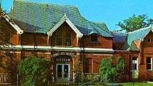
- ↑ Fort St. Joseph Museum Overview, City of Niles, Michigan (MI)
- ↑ http://www.motopera.org/mg_ed/educational/UndergroundRR.html
- ↑ http://driscoll-class.wikispaces.com/file/view/underground_railroad.jpg/86344275/underground_railroad.jpg
- ↑ "Climate Summaries". Midwestern Regional Climate Center. Retrieved November 26, 2012.
- ↑ "Weatherbase: Historical Weather for Niles, Michigan". Weatherbase. Retrieved November 26, 2012.
- ↑ "Annual Estimates of the Resident Population for Incorporated Places: April 1, 2010 to July 1, 2015". Retrieved July 2, 2016.
- ↑ "Census of Population and Housing". Census.gov. Retrieved June 4, 2015.
- ↑ Michigan's Internet Railroad History Museum: Niles, Michigan
- ↑ Michigan Historical Marker: Michigan Central Railroad Niles Depot
- ↑ Dial A Ride Transportation SystemCity of Niles website.
- ↑ http://www.ci.niles.mi.us/DeptsAndServices/NilesDialARide/RouteServiceToSouthBend1210.pdf
- ↑ Niles Daily Star website
- ↑ "Who Is Doctor West, And Why Has He Got George Bush So Ticked Off?". Fortune Small Business. April 1, 2002.
- ↑ Niles Community Schools website
External links
| Wikimedia Commons has media related to Niles, Michigan. |
Municipalities and communities of Berrien County, Michigan, United States | ||
|---|---|---|
| Cities | 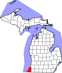 | |
| Villages | ||
| Charter townships | ||
| General law townships | ||
| CDPs | ||
| Other unincorporated communities | ||
| Footnotes | ‡This populated place also has portions in an adjacent county or counties | |
Municipalities and communities of Cass County, Michigan, United States | ||
|---|---|---|
| Cities | 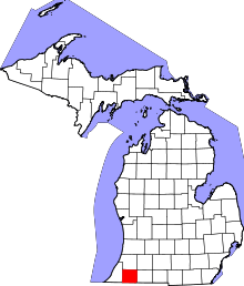 | |
| Villages | ||
| Townships | ||
| Unincorporated communities | ||
| Footnotes | ‡This populated place also has portions in an adjacent county or counties | |
Coordinates: 41°49′48″N 86°15′12″W / 41.83000°N 86.25333°W