Iosco County, Michigan
| Iosco County, Michigan | ||
|---|---|---|
| ||
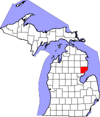 Location in the U.S. state of Michigan | ||
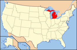 Michigan's location in the U.S. | ||
| Founded | 1840, organized in 1857[1] | |
| Seat | Tawas City | |
| Largest city | East Tawas | |
| Area | ||
| • Total | 1,890 sq mi (4,895 km2) | |
| • Land | 549 sq mi (1,422 km2) | |
| • Water | 1,341 sq mi (3,473 km2), 71% | |
| Population | ||
| • (2010) | 25,887 | |
| • Density | 47/sq mi (18/km²) | |
| Congressional district | 5th | |
| Time zone | Eastern: UTC-5/-4 | |
| Website |
iosco | |
Iosco County is a county located in the U.S. state of Michigan. As of the 2010 census, the population was 25,887.[2] The county seat is Tawas City.[3]
Etymoloogy of Iosco
Iosco is traditionally said to be a Native American word meaning "water of light,"[4] though it is actually a pseudo-Native American name coined by Henry Schoolcraft, a Michigan geographer and ethnologist.[5]
History

The county was created by the Michigan Legislature in 1840 as Kanotin County, and renamed Iosco County in 1843. It was administered by a succession of other Michigan counties prior to the organization of county government in 1857.[6][1]
Geography
According to the U.S. Census Bureau, the county has a total area of 1,890 square miles (4,900 km2), of which 549 square miles (1,420 km2) is land and 1,341 square miles (3,470 km2) (71%) is water.[7] The county is considered to be part of Northern Michigan.
Geographic features
- Tawas Bay
- Pine River, rises in Alcona County and flows into Iosco County, where it empties into Van Etten Lake at [show location on an interactive map] 44°29′38″N, 83°23′16″W northwest of Oscoda
- Au Sable River
- Tuttle Marsh Wildlife Area
- Van Etten Lake
- Tawas Lake
- Foote Dam Pond
- The county is part of the Au Sable State Forest, specifically the
- Grayling FMU (Alcona, Crawford, Oscoda, and northern Iosco counties).
Major highways
 US 23 is known as the Sunrise Side Coastal Highway.
 M-55 is one of only three state highways that extend across the U.S. state of Michigan's Lower Peninsula from Lake Huron to Lake Michigan. Its east end terminates in Tawas City at the junction with US 23.[8]
 M-65
M-65 F-41
F-41- River Road National Scenic Byway starts at M-65 and runs parallel with the Au Sable River for 23 miles (37 km) eastward to end at US 23 in Oscoda, Michigan. It is a designated National Scenic Byway.[9] The road passes by the Lumberman's Monument.
Adjacent counties
- Alcona County - north
- Arenac County - southwest
- Ogemaw County - west
- Oscoda County - northwest
National protected area
- Huron National Forest (part)
Demographics
| Historical population | |||
|---|---|---|---|
| Census | Pop. | %± | |
| 1860 | 175 | — | |
| 1870 | 3,163 | 1,707.4% | |
| 1880 | 6,873 | 117.3% | |
| 1890 | 15,224 | 121.5% | |
| 1900 | 10,246 | −32.7% | |
| 1910 | 9,753 | −4.8% | |
| 1920 | 8,199 | −15.9% | |
| 1930 | 7,517 | −8.3% | |
| 1940 | 8,560 | 13.9% | |
| 1950 | 10,906 | 27.4% | |
| 1960 | 16,505 | 51.3% | |
| 1970 | 24,905 | 50.9% | |
| 1980 | 28,349 | 13.8% | |
| 1990 | 30,209 | 6.6% | |
| 2000 | 27,339 | −9.5% | |
| 2010 | 25,887 | −5.3% | |
| Est. 2015 | 25,345 | [10] | −2.1% |
| U.S. Decennial Census[11] 1790-1960[12] 1900-1990[13] 1990-2000[14] 2010-2013[2] | |||
As of the census[15] of 2000, there were 27,339 people, 11,727 households, and 7,857 families residing in the county. The population density was 50 people per square mile (19/km²). There were 20,432 housing units at an average density of 37 per square mile (14/km²). The racial makeup of the county was 96.92% White, 0.41% Black or African American, 0.66% Native American, 0.46% Asian, 0.05% Pacific Islander, 0.23% from other races, and 1.27% from two or more races. 0.98% of the population were Hispanic or Latino of any race. 23.2% were of German, 12.3% English, 10.6% Irish, 9.9% American, 8.3% Polish and 7.1% French ancestry according to Census 2000. 97.4% spoke English and 1.0% Spanish as their first language.
There were 11,727 households out of which 24.90% had children under the age of 18 living with them, 55.20% were married couples living together, 8.40% had a female householder with no husband present, and 33.00% were non-families. 28.60% of all households were made up of individuals and 14.00% had someone living alone who was 65 years of age or older. The average household size was 2.30 and the average family size was 2.79.
In the county the population was spread out with 22.40% under the age of 18, 5.40% from 18 to 24, 23.40% from 25 to 44, 27.30% from 45 to 64, and 21.60% who were 65 years of age or older. The median age was 44 years. For every 100 females there were 96.30 males. For every 100 females age 18 and over, there were 93.60 males.
The median income for a household in the county was $31,321, and the median income for a family was $37,452. Males had a median income of $30,338 versus $21,149 for females. The per capita income for the county was $17,115. About 9.50% of families and 12.70% of the population were below the poverty line, including 18.50% of those under age 18 and 7.60% of those age 65 or over.
Government
The county government operates the jail, maintains rural roads, operates the major local courts, keeps files of deeds and mortgages, maintains vital records, administers public health regulations, and participates with the state in the provision of welfare and other social services. The county board of commissioners controls the budget but has only limited authority to make laws or ordinances. In Michigan, most local government functions — police and fire, building and zoning, tax assessment, street maintenance, etc. — are the responsibility of individual cities and townships.
Elected officials
- Prosecuting Attorney: Nichol Palumbo
- Sheriff: Allen MacGregor
- County Clerk: Nancy Huebel
- County Treasurer: Elite Shellenbarger
- Register of Deeds: Bonita Coyle
- Drain Commissioner: Gary Adams
County commissioners
- District 1: Robert Huebel III
- District 2: Jeff Johnston
- District 3: Bob Cudney
- District 4: John Moehring
- District 5: Donald "Jay" O'Farrell
Education
Iosco County contains four public school districts: Hale Area Schools, Oscoda Area Schools, Tawas Area Schools, and Whittemore-Prescott Area Schools.
There are also 3 private elementary schools in the county: Emanuel Lutheran School in Tawas City, Holy Family School in East Tawas, and Shady Grove School in Whittemore.
Alpena Community College offers college-level courses at its campus on the former Wurtsmith Air Force Base in Oscoda and local public school facilities.
Media
- The Iosco County News-Herald is the newspaper of record for Iosco County.[16]
- The Oscoda Press is a weekly newspaper serving northern Iosco County and southern Alcona County[17]
Communities
Cities
- East Tawas
- Tawas City (county seat)
- Whittemore
Unincorporated communities
Townships
See also
- List of Michigan State Historic Sites in Iosco County, Michigan
- National Register of Historic Places listings in Iosco County, Michigan
References
- 1 2 "Bibliography on Iosco County". Clarke Historical Library, Central Michigan University. Retrieved January 19, 2013.
- 1 2 "State & County QuickFacts". United States Census Bureau. Retrieved August 27, 2013.
- ↑ "Find a County". National Association of Counties. Retrieved 2011-06-07.
- ↑ Gannett, Henry (1905). The Origin of Certain Place Names in the United States. Govt. Print. Off. p. 165.
- ↑ "Michigan Counties". Michigan.gov. Archive.org. Archived from the original on March 13, 2009. Retrieved 14 February 2016.
- 1 2 Newberry Library. "Michigan: Individual County Chronologies". Atlas of County Historical Boundaries. Retrieved 2016-11-04.
- ↑ "2010 Census Gazetteer Files". United States Census Bureau. August 22, 2012. Retrieved September 25, 2014.
- ↑ "Picture of M-55 end point.". state-ends.com.
- ↑ River Road Scenic Byway at America's Byways.
- ↑ "County Totals Dataset: Population, Population Change and Estimated Components of Population Change: April 1, 2010 to July 1, 2015". Retrieved July 2, 2016.
- ↑ "U.S. Decennial Census". United States Census Bureau. Retrieved September 26, 2014.
- ↑ "Historical Census Browser". University of Virginia Library. Retrieved September 26, 2014.
- ↑ "Population of Counties by Decennial Census: 1900 to 1990". United States Census Bureau. Retrieved September 26, 2014.
- ↑ "Census 2000 PHC-T-4. Ranking Tables for Counties: 1990 and 2000" (PDF). United States Census Bureau. Retrieved September 26, 2014.
- ↑ "American FactFinder". United States Census Bureau. Retrieved 2008-01-31.
- ↑ Iosco County News Herald home page
- ↑ "Iosco County News Herald". Iosco County News Herald.
Further reading
- Romig, Walter (1986) [1973]. Michigan Place Names: The History of the Founding and the Naming of More than Five Thousand Past and Present Michigan Communities. Great Lakes Books. Detroit: Wayne State University Press. ISBN 978-0814318386.
External links
- "Bibliography on Iosco County". Clarke Historical Library, Central Michigan University. Retrieved January 19, 2013.
- County of Iosco, links, media, history, parks, services and more.
- Enchanted forest, Northern Michigan source for information, calendars, etc.
 |
Oscoda County | Alcona County | | |
| Ogemaw County | |
Lake Huron | ||
| ||||
| | ||||
| Arenac County | Saginaw Bay |
Municipalities and communities of Iosco County, Michigan, United States | ||
|---|---|---|
| Cities | | |
| Charter townships | ||
| General law townships | ||
| CDPs | ||
| Other unincorporated communities | ||
| Central cities | |
|---|---|
| Counties | |
| Geography | |
| Transportation | |
| Economy | |
Coordinates: 44°17′N 83°20′W / 44.28°N 83.34°W