Lenawee County, Michigan
| Lenawee County, Michigan | |
|---|---|
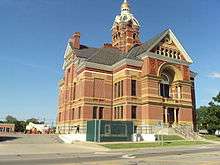 Lenawee County Courthouse | |
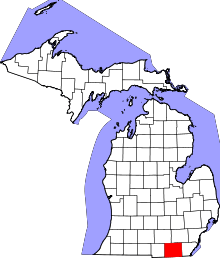 Location in the U.S. state of Michigan | |
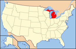 Michigan's location in the U.S. | |
| Founded | September 10, 1826, split off Monroe County[1] |
| Seat | Adrian |
| Largest city | Adrian |
| Area | |
| • Total | 761 sq mi (1,971 km2) |
| • Land | 750 sq mi (1,942 km2) |
| • Water | 12 sq mi (31 km2), 1.6% |
| Population (est.) | |
| • (2013) | 99,188 |
| • Density | 132/sq mi (51/km²) |
| Congressional district | 7th |
| Time zone | Eastern: UTC-5/-4 |
| Website |
www |
Lenawee County ("LENN-a-way") is a county located in the U.S. state of Michigan. As of the 2010 census, the population was 99,892.[2] The county seat is Adrian.[3] The county was created in 1822 and organized in 1826.[1]
Lenawee County comprises the Adrian, MI Micropolitan Statistical Area and is included in the Detroit-Warren-Ann Arbor, MI Combined Statistical Area.
History
The county was created in 1826. It was split off from Monroe County, Michigan.[1] This Henry Schoolcraft neologism is thought to be derived from a Native American word meaning "man"—from the Delaware "leno or lenno" or the Shawnee "lenawai."[1][4]
Geography
According to the U.S. Census Bureau, the county has a total area of 761 square miles (1,970 km2), of which 750 square miles (1,900 km2) is land and 12 square miles (31 km2) (1.6%) is water.[5] Lenawee County is considered to be part of Southeastern Michigan.
Adjacent counties
- Washtenaw County (northeast)
- Jackson County (northwest)
- Monroe County (east)
- Hillsdale County (west)
- Lucas County, Ohio (southeast)
- Fulton County, Ohio (southwest)
Major highways
Within Lenawee County's townships, north-south roads are referred to as "highways", while east-west roads are referred to as "roads".
Government and politics
In Michigan county governments serve to maintain county roads and streets, tax assessment, zoning, operate county courts, fire and police, maintain vital records, participates with the state to administer public services. The county board of commissioners approves the budget, but has limited authority to make laws or ordinances. Separately, Adrian College and Siena Heights University are located within the county.
Lenawee County has supported candidates from both political parties in statewide elections making it a swing county. Tecumseh and Adrian have tended to lean Democrat, while Dover, Madison, and Riga Townships have tended to lean Republican. The rural areas of the county are bastions of populism and libertarianism which helped the Tea Party Movement gain considerable support. During the 2010 midterm elections, the county favored Republican Gubernatorial candidate Rick Snyder, Congressional candidate Tim Walberg, State Senate candidate Bruce Caswell, and State Representative candidates Nancy Jenkins and Mike Shirkey.
Lenawee County is located in Michigan's 7th congressional district, which is represented by Tea-Party backed Tim Walberg, who is a resident of the County. Walberg previously served as Lenawee's state representative. Walberg won the district, which includes all of Lenawee County, Jackson County, Hillsdale County, Branch County, and Eaton County, as well as parts of Calhoun County and Washtenaw County, after defeating then-incumbent Democrat Mark Schauer. Schauer had defeated Walberg in the 2008 congressional election, after Walberg's first stint in Congress. Walberg defeated incumbent Republican Joe Schwarz, a former State Representative and gubernatorial candidate, during the 2006 primary election. Also during the 2006 midterm elections, Lenawee County voted for businessman Dick DeVos, the Republican nominee.
Most of Lenawee County is represented by Republican Nancy Jenkins in the Michigan House of Representatives. Jenkins represents the 57th District, previously held by brothers Doug and Dudley Spade, both Democrats. Each of the Spade brothers served for the maximum three terms. In 2008, Dudley Spade defeated Nancy Jenkin's mother, Republican Emma Jenkins. Cambridge Township, which includes Onsted, is part of the 65th District, which covers much of the Irish Hills and is represented by Republican Mike Shirkey. Adrian is part of the 17th Senate District, represented by Dale Zorn of Ida, Michigan. Until the 2014 state senate election, Lenawee County was part of the 16th State Senate District, represented by Republican Bruce Caswell of Hillsdale. Caswell was preceded by Republican Cameron Brown. The district contained all of Lenawee, Hillsdale, and Branch Counties.
In Presidential politics, the county is considered a bellwether, as it has voted for the winner of the presidential election in every election since 1976, when the county voted for Republican President Gerald R. Ford, a Michigan Native, in his failed re-election bid against Jimmy Carter, Democratic Governor of Georgia. This trend ended in 2012.

Elected officials
- Prosecuting Attorney: R. Burke Castleberry, Jr. (R)
- Sheriff: Jack Welsh (R)
- County Clerk: Roxann Hollaway (R)
- County Treasurer: Marilyn Woods (R)
- Register of Deeds: Carolyn S. Bater (R)
- Drain Commissioner: Jennifer Escott (R)
- County Surveyor: Kevin Pickford (R)
County Commission
- District 1: David Stimpson (R)
- District 2: John Lapham (R)
- District 3: Jim Driskill (R)
- District 4: Dawn Bales (R)
- District 5: Karol "Kz" Bolton (D)
- District 6: Terry Collins (R)
- District 7: Bob Knoblauch (R)
- District 8: Ralph Tillotson (R)
- District 9: Chris Wittenbach (R)
Demographics
| Historical population | |||
|---|---|---|---|
| Census | Pop. | %± | |
| 1830 | 1,491 | — | |
| 1840 | 17,889 | 1,099.8% | |
| 1850 | 26,372 | 47.4% | |
| 1860 | 38,112 | 44.5% | |
| 1870 | 45,595 | 19.6% | |
| 1880 | 48,343 | 6.0% | |
| 1890 | 48,448 | 0.2% | |
| 1900 | 48,406 | −0.1% | |
| 1910 | 47,907 | −1.0% | |
| 1920 | 47,767 | −0.3% | |
| 1930 | 49,849 | 4.4% | |
| 1940 | 53,110 | 6.5% | |
| 1950 | 64,629 | 21.7% | |
| 1960 | 77,789 | 20.4% | |
| 1970 | 81,609 | 4.9% | |
| 1980 | 89,948 | 10.2% | |
| 1990 | 91,476 | 1.7% | |
| 2000 | 98,890 | 8.1% | |
| 2010 | 99,892 | 1.0% | |
| Est. 2015 | 98,573 | [6] | −1.3% |
| U.S. Decennial Census[7] 1790-1960[8] 1900-1990[9] 1990-2000[10] 2010-2013[2] | |||
As of the census of 2000, there were 98,890 people, 35,930 households, and 26,049 families residing in the county. The population density was 132 people per square mile (51/km²). There were 39,769 housing units at an average density of 53 per square mile (20/km²). The racial makeup of the county was 92.51% White, 2.12% Black or African American, 0.41% Native American, 0.46% Asian, 0.01% Pacific Islander, 3.01% from other races, and 1.49% from two or more races. 6.96% of the population were Hispanic or Latino of any race. 30.4% were of German, 11.6% English, 10.2% American and 9.9% Irish ancestry according to the 2000 United States Census. 94.7% spoke English and 4.2% Spanish as their first language.
There were 35,930 households out of which 34.20% had children under the age of 18 living with them, 58.70% were married couples living together, 10.00% had a female householder with no husband present, and 27.50% were non-families. 22.90% of all households were made up of individuals and 9.70% had someone living alone who was 65 years of age or older. The average household size was 2.61 and the average family size was 3.07.
In the county the population was spread out with 25.90% under the age of 18, 9.10% from 18 to 24, 28.60% from 25 to 44, 23.70% from 45 to 64, and 12.70% who were 65 years of age or older. The median age was 36 years. For every 100 females there were 100.10 males. For every 100 females age 18 and over, there were 98.00 males.
The median income for a household in the county was $45,739, and the median income for a family was $53,661. Males had a median income of $38,458 versus $25,510 for females. The per capita income for the county was $20,186. About 4.40% of families and 6.70% of the population were below the poverty line, including 7.10% of those under age 18 and 9.20% of those age 65 or over.
Communities
Cities
Villages
- Addison
- Blissfield
- Britton
- Cement City (partially)
- Clayton
- Clinton
- Deerfield
- Onsted
Census-designated places
Unincorporated communities
Townships
- Adrian Charter Township
- Blissfield Township
- Cambridge Township
- Clinton Township
- Deerfield Township
- Dover Township
- Fairfield Township
- Franklin Township
- Hudson Township
- Macon Township
- Madison Charter Township
- Medina Township
- Ogden Township
- Palmyra Township
- Raisin Charter Township
- Ridgeway Township
- Riga Township
- Rollin Township
- Rome Township
- Seneca Township
- Tecumseh Township
- Woodstock Township
See also
- List of Michigan State Historic Sites in Lenawee County, Michigan
- National Register of Historic Places listings in Lenawee County, Michigan
Notes
- 1 2 3 4 "Bibliography on Lenawee County". Clarke Historical Library, Central Michigan University. Retrieved January 20, 2013.
- 1 2 "State & County QuickFacts". United States Census Bureau. Retrieved August 28, 2013.
- ↑ "Find a County". National Association of Counties. Retrieved 2011-06-07.
- ↑ Michigan History, Arts and Libraries on sources of County names.
- ↑ "2010 Census Gazetteer Files". United States Census Bureau. August 22, 2012. Retrieved September 26, 2014.
- ↑ "County Totals Dataset: Population, Population Change and Estimated Components of Population Change: April 1, 2010 to July 1, 2015". Retrieved July 2, 2016.
- ↑ "U.S. Decennial Census". United States Census Bureau. Retrieved September 26, 2014.
- ↑ "Historical Census Browser". University of Virginia Library. Retrieved September 26, 2014.
- ↑ "Population of Counties by Decennial Census: 1900 to 1990". United States Census Bureau. Retrieved September 26, 2014.
- ↑ "Census 2000 PHC-T-4. Ranking Tables for Counties: 1990 and 2000" (PDF). United States Census Bureau. Retrieved September 26, 2014.
Further reading
- Romig, Walter (1986) [1973]. Michigan Place Names: The History of the Founding and the Naming of More than Five Thousand Past and Present Michigan Communities. Great Lakes Books. Detroit: Wayne State University Press. ISBN 978-0814318386.
External links
- Lenawee County Conference & Visitors Bureau
- Lenawee County Drain Commissioner
- Lenawee County Government Site
- Lenawee County Road Commission
- Complete text of History of Lenawee County published in 1909 by the Western Historical Society
- "Bibliography on Lenawee County". Clarke Historical Library, Central Michigan University. Retrieved January 19, 2013.
- Lenawee County Directory Site
 |
Jackson County | Washtenaw County | | |
| Hillsdale County | |
Monroe County | ||
| ||||
| | ||||
| Fulton County, Ohio | Lucas County, Ohio |
Municipalities and communities of Lenawee County, Michigan, United States | ||
|---|---|---|
| Cities | | |
| Villages | ||
| Charter townships | ||
| General law townships | ||
| CDPs | ||
| Other unincorporated communities | ||
| Footnotes | ‡This populated place also has portions in an adjacent county or counties | |
Coordinates: 41°53′N 84°04′W / 41.89°N 84.07°W