Iron County, Michigan
| Iron County, Michigan | |
|---|---|
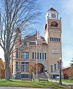 Iron County Courthouse | |
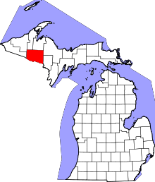 Location in the U.S. state of Michigan | |
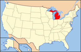 Michigan's location in the U.S. | |
| Founded | April 3, 1885[1][2] |
| Named for | Iron ore |
| Seat | Crystal Falls |
| Largest city | Iron River |
| Area | |
| • Total | 1,211 sq mi (3,136 km2) |
| • Land | 1,166 sq mi (3,020 km2) |
| • Water | 45 sq mi (117 km2), 3.7% |
| Population | |
| • (2010) | 11,817 |
| • Density | 10/sq mi (4/km²) |
| Congressional district | 1st |
| Time zone | Central: UTC-6/-5 |
| Website |
ironmi |
Iron County is a county in the Upper Peninsula of the U.S. state of Michigan. As of the 2010 census, the population was 11,817.[3] The county seat is Crystal Falls.[4]
History
Iron County was organized in 1885 from territory taken from Marquette and Menominee counties. In 1890, the county's population was 4,432.[1][5] It was named for the valuable iron ore found within its borders.[1][6]
Geography
According to the U.S. Census Bureau, the county has an area of 1,211 square miles (3,140 km2), of which 1,166 square miles (3,020 km2) is land and 45 square miles (120 km2) (3.7%) is water.[7]
Major highways

Adjacent counties
- Houghton County (north/EST Border)
- Baraga County (north/EST Border)
- Marquette County (northeast/EST Border)
- Dickinson County (east)
- Florence County, Wisconsin (southeast)
- Forest County, Wisconsin (south)
- Vilas County, Wisconsin (southwest)
- Gogebic County (west)
- Ontonagon County (northwest/EST Border)
National protected area
- Ottawa National Forest (part)
Demographics
| Historical population | |||
|---|---|---|---|
| Census | Pop. | %± | |
| 1890 | 4,432 | — | |
| 1900 | 8,990 | 102.8% | |
| 1910 | 15,164 | 68.7% | |
| 1920 | 22,107 | 45.8% | |
| 1930 | 20,805 | −5.9% | |
| 1940 | 20,243 | −2.7% | |
| 1950 | 17,692 | −12.6% | |
| 1960 | 17,184 | −2.9% | |
| 1970 | 13,813 | −19.6% | |
| 1980 | 13,635 | −1.3% | |
| 1990 | 13,175 | −3.4% | |
| 2000 | 13,138 | −0.3% | |
| 2010 | 11,817 | −10.1% | |
| Est. 2015 | 11,348 | [8] | −4.0% |
| U.S. Decennial Census[9] 1790-1960[10] 1900-1990[11] 1990-2000[12] 2010-2013[3] | |||
The 2010 United States Census[13] indicates Iron County had a population of 11,817. This is a decrease of 1,321 people from the 2000 United States Census. This is a -10.1% change in population. In 2010 there were 5,577 households and 3,284 families residing in the county. The population density was 10 people per square mile (4/km²). There were 9,197 housing units at an average density of 8 per square mile (3/km²). 97.1% of the population were White, 0.9% Native American, 0.3% Asian, 0.1% Black or African American, 0.2% of some other race and 1.4% of two or more races. 1.4% were Hispanic or Latino (of any race). 14.3% were of German, 11.5% Finnish, 11.3% Italian, 8.6% French, French Canadian or Cajun, 8.0% Swedish, 6.5% English, 5.8% American and 5.4% Irish ancestry.[14]
There were 5,577 households out of which 18.1% had children under the age of 18 living with them, 46.6% were married couples living together, 8.3% had a female householder with no husband present, and 41.1% were non-families. 36.8% of all households were made up of individuals and 19.1% had someone living alone who was 65 years of age or older. The average household size was 2.06 and the average family size was 2.65.
In the county the population was spread out with 17.1% under the age of 18, 5.4% from 18 to 24, 17.2% from 25 to 44, 34.1% from 45 to 64, and 26.3% who were 65 years of age or older. The median age was 51.9 years. 49.3% of the population was male, 50.7% was female.
The median income for a household in the county was $35,390, and the median income for a family was $46,337. The per capita income for the county was $20,099. About 6.5% of families and 11.7% of the population were below the poverty line, including 18.0% of those under age 18 and 8.8% of those age 65 or over.
Government
The county government operates the jail, maintains rural roads, operates the major local courts, keeps files of deeds and mortgages, maintains vital records, administers public health regulations, and participates with the state in the provision of welfare and other social services. The county board of commissioners controls the budget but has only limited authority to make laws or ordinances. In Michigan, most local government functions — police and fire, building and zoning, tax assessment, street maintenance, etc. — are the responsibility of individual cities and townships.
Education
Communities
Cities
- Caspian
- Crystal Falls (county seat)
- Gaastra
- Iron River
Village
Unincorporated community
Townships
- Bates Township
- Crystal Falls Township
- Hematite Township
- Iron River Township
- Mansfield Township
- Mastodon Township
- Stambaugh Township
See also
- Iron County MRA
- List of Michigan State Historic Sites in Iron County, Michigan
- National Register of Historic Places listings in Iron County, Michigan
References
- 1 2 3 "Bibliography on Iron County". Clarke Historical Library, Central Michigan University. Retrieved June 29, 2013.
- ↑ "jengod.com". jengod.com.
- 1 2 "State & County QuickFacts". United States Census Bureau. Retrieved August 27, 2013.
- ↑ "Find a County". National Association of Counties. Retrieved 2011-06-07.
- ↑ Michigan Department of State (1893). Michigan and Its Resources, pp. 241-42. Robert Smith & Co.
- ↑ Gannett, Henry (1905). The Origin of Certain Place Names in the United States. Govt. Print. Off. p. 166.
- ↑ "2010 Census Gazetteer Files". United States Census Bureau. August 22, 2012. Retrieved September 25, 2014.
- ↑ "County Totals Dataset: Population, Population Change and Estimated Components of Population Change: April 1, 2010 to July 1, 2015". Retrieved July 2, 2016.
- ↑ "U.S. Decennial Census". United States Census Bureau. Retrieved September 25, 2014.
- ↑ "Historical Census Browser". University of Virginia Library. Retrieved September 25, 2014.
- ↑ "Population of Counties by Decennial Census: 1900 to 1990". United States Census Bureau. Retrieved September 25, 2014.
- ↑ "Census 2000 PHC-T-4. Ranking Tables for Counties: 1990 and 2000" (PDF). United States Census Bureau. Retrieved September 25, 2014.
- ↑ "Census 2010 American Fact Finder". Retrieved July 6, 2013.
- ↑ Data Access and Dissemination Systems (DADS). "American FactFinder". census.gov.
Further reading
- "Bibliography on Iron County". Clarke Historical Library, Central Michigan University. Retrieved January 19, 2013.
External links
- Iron County's Website
- Sam M Cohodas Regional Economist
- Hunt's Guide to the Iron Mountain area
- Western Upper Peninsula Planning & Development Region
 |
Ontonagon County | Houghton County and Baraga County | Marquette County | |
| Gogebic County | |
Dickinson County | ||
| ||||
| | ||||
| Vilas County, Wisconsin | Forest County, Wisconsin | Florence County, Wisconsin |
Municipalities and communities of Iron County, Michigan, United States | ||
|---|---|---|
| Cities | | |
| Village | ||
| Townships | ||
| CDP | ||
| Unincorporated communities | ||
| Central cities | |
|---|---|
| Counties | |
| Geography | |
| Transportation | |
| Economy | |
Coordinates: 46°13′N 88°31′W / 46.21°N 88.51°W