Vayk
Coordinates: 39°41′30″N 45°27′55″E / 39.69167°N 45.46528°E
| Vayk Վայք | |
|---|---|
|
Vayk | |
 Vayk Վայք | |
| Coordinates: 39°41′30″N 45°27′55″E / 39.69167°N 45.46528°E | |
| Country | Armenia |
| Marz (Province) | Vayots Dzor |
| Founded | 1828 |
| Area | |
| • Total | 3 km2 (1 sq mi) |
| Elevation | 1,300 m (4,300 ft) |
| Population (2011 census) | |
| • Total | 5,877 |
| • Density | 2,000/km2 (5,100/sq mi) |
| Time zone | (UTC+4) |
| Website | Official website |
| Sources: Population[1] | |

Vayk (Armenian: Վայք), is a town in the Vayots Dzor Province of Armenia. As of the 2011 census, the population of the town is 5,877, down from 6,024 reported in the 2001 census.
Etymology
Literally meaning "sorrows", the name Vayk is derived from the Vayots Dzor canton of the historic Armenian province of Syunik.
History
Historically, the area of Vayk belongs to the Vayots Dzor canton of Syunik province; the 9th province of Armenia Major, ruled by the Siunia dynasty.
As a result of the Treaty of Turkmenchay signed between the Russian Empire and Persia in 1828, many Armenian families from the Iranian towns of Salmas and Khoy were resettled in Eastern Armenia, particularly in the Erivan Governorate of the Russian Empire. The first wave of Armenian settlers arrived in the Vayots Dzor region in 1828 and 1829, forming the small rural community of Soylan in the area of modern-day Vayk. In 1850, it became part of the Sharur-Daralagyoz uyezd of the Erivan Governorate. After the short-lived independence of Armenia between 1918 and 1920, the region became one of the main centres of the resistance against the Soviet rule, becoming part of the unrecognized Republic of Mountainous Armenia under the leadership of Garegin Nzhdeh.
After falling to the Bolsheviks in July 1921, Soylan became part of the Armenian SSR. In 1931, it became the centre of the newly-formed Azizbekov raion. In 1956, Soylan was given the status of an urban-type settlement and renamed Azizbekov in honor of the Bolshevik revolutionary Meshadi Azizbekov.[2]
Shortly before the independence of Armenia, Azizbekov was renamed Vayk on 23 November 1990. Later in 1995, Vayk was given the status of a town.[3]
There is a historic bridge at the western vicinity of the town, that was rebuilt by General Ivan Paskevich in 1827.
Geography
Vayk is located on the Yerevan-Goris highway, 140 km south of the capital Yerevan and 20 km southeast of the regional capital Yeghegnadzor.[4] With an elevation of 1300 meters above sea level, Vayk is situated on the left bank of Arpa River surrounded with the Yeghegis mountains from the northwest and Vayots Dzor mountain range from the south.
Transportation
The M-2 Motorway that connect Armenia from north to south, passes through the town.
Economy
The economy of Vayk is based on agriculture and cattle-breeding.
The town is home to the "Vayk Group" company that produces wine, vodka and dried fruits.
A branch of the "Jermuk Group" mineral water factory is also operating in Vayk.
Gallery
-

General view
-

Saint Trdat church opened in 2000
-

Arpa River at Vayk
-
.jpg)
Khachkar-memorial to Holy Resurrection
References
Capital: Yeghegnadzor | ||
| Towns | 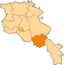 | |
| Villages |
| |
| Non-community villages | ||
| Former villages | ||