Charentsavan
Coordinates: 40°24′35″N 44°38′35″E / 40.40972°N 44.64306°E
| Charentsavan Չարենցավան | |
|---|---|
|
Charentsavan | |
 Charentsavan | |
| Coordinates: 40°24′35″N 44°38′35″E / 40.40972°N 44.64306°E | |
| Country | Armenia |
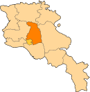
| Marz (Province) | Kotayk |
| Founded | 1947 |
| Area | |
| • Total | 5 km2 (2 sq mi) |
| Elevation | 1,660 m (5,450 ft) |
| Population (2011 census) | |
| • Total | 20,363 |
| • Density | 4,100/km2 (11,000/sq mi) |
| Time zone | UTC+4 |
| Area code(s) | +374 (226) |
| Website | Sources: Population[1] |

Charentsavan (Armenian: Չարենցավան), is a town located in the Kotayk Province of Armenia. It was founded in 1947 as Lusavan, and renamed in 1967 after the poet Yeghishe Charents.[2] According to the 2011 census, the population of Charentsavan is 20,363.
Geography and climate
Charentsavan was built on the left side of Hrazdan River at a height ranging between 1600 and 1700 meters above sea level. It is located at the south of the Alapars village.
The town experiences very cold winters with highs in the 30s and lows in the teens and low 20s. Summers are warm with brisk, cool nights. Snow sticks on the ground from December until March, but it may snow anytime from October through May.
| Climate data for Charentsavan | |||||||||||||
|---|---|---|---|---|---|---|---|---|---|---|---|---|---|
| Month | Jan | Feb | Mar | Apr | May | Jun | Jul | Aug | Sep | Oct | Nov | Dec | Year |
| Average high °F (°C) | 32 (0) |
33 (1) |
41 (5) |
53 (12) |
62 (17) |
70 (21) |
77 (25) |
77 (25) |
71 (22) |
60 (16) |
47 (8) |
36 (2) |
54.9 (12.8) |
| Average low °F (°C) | 15 (−9) |
16 (−9) |
24 (−4) |
32 (0) |
40 (4) |
46 (8) |
52 (11) |
53 (12) |
45 (7) |
37 (3) |
29 (−2) |
21 (−6) |
34.2 (1.3) |
| Average precipitation inches (mm) | 0.71 (18) |
0.91 (23.1) |
1.26 (32) |
2.61 (66.3) |
3.27 (83.1) |
2.68 (68.1) |
1.57 (39.9) |
1.30 (33) |
1.06 (26.9) |
1.50 (38.1) |
1.14 (29) |
0.75 (19) |
18.76 (476.5) |
| Source: http://en.climate-data.org/location/21593/ | |||||||||||||
Demographics
Population
The population of Charentsavan are mainly Armenians. The population has grown significantly after the inauguration of the Hydroelectric power plant in 1953 near the town. It became more than 30,000 during the 1980s. However, after the break-up of the Soviet Union, the town lost almost 1/3 of its population.
Here is the population timeline of Byureghavan since 1979:
| Year | 1979 | 1989 | 2001 | 2011 | 2016 |
|---|---|---|---|---|---|
| Population | 24,590 | 32,229 | 25,039 | 20,363 | 20,500 |
Religion
The residents of Charentsavan belong to the Armenian Apostolic Church, regulated by the Diocese of Kotayq based in Tsaghkadzor, monastery of Kecharis. The town's Holy Saviour's church was opened in 2000 with the financial assistance of the Dervishian family from Canada.
Economy
Charentsavan used to be one of the major industrial centres of Soviet Armenia. Unfortunately, many of the industrial plants were abandoned after the collapse of the USSR. However, many plants in Charentsavan have been revived after the independence of Armenia, mainly during the first decade of the 21st century.
Currently, Charentsavan is home to many types of industries including the "Dzulakentron" metal casting plant founded in 1962, the "Charentsavan Precision Tool-Making Plant" founded in 1964,[3] the "Khorda Hydroturbines Manufacturing Enterprise" founded in 2006,[4] the "Bjni and Noy" mineral waters factory founded in 2010, the "Lubawa Armenia" safety equipments production founded in 2014.
Sport
FC Moush Charentsavan was a football club representing the town of Charentsavan. They used to play their games at the Charentsavan City Stadium. However, it was dissolved in 1994 and is currently inactive from professional football.
Gallery
 Charentsavan in winter
 Charentsavan landscape
 Statue in the town
References
| Wikimedia Commons has media related to Charentsavan. |
- ↑ Kotayk
- ↑ Kiesling, Rediscovering Armenia, p. 56, available online at the US embassy to Armenia's website Archived June 26, 2008, at the Wayback Machine.
- ↑ About factory
- ↑ About Khorda