Ayrum
Coordinates: 41°11′42″N 44°53′33″E / 41.19500°N 44.89250°E
| Ayrum Այրում | |
|---|---|
|
Ayrum | |
 Ayrum | |
| Coordinates: 41°11′42″N 44°53′33″E / 41.19500°N 44.89250°E | |
| Country | Armenia |
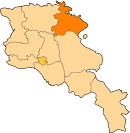
| Province | Tavush |
| Founded | 1937 |
| Government | |
| • Mayor | Gigol Yeganyan |
| Area | |
| • Total | 1.6 km2 (0.6 sq mi) |
| Elevation | 550 m (1,800 ft) |
| Population (2011 census) | |
| • Total | 2,126 |
| • Density | 1,300/km2 (3,400/sq mi) |
| Time zone | UTC+4 |
| Sources: Population[1] | |

Ayrum (Armenian: Այրում) is a town in the Tavush Province of Armenia. The town is located 206 km (128 mi) northeast of the capital Yerevan and 73 km (45 mi) north of the provincial capital Ijevan. It is situated on the shores of Debed river, only 2 km (1 mi) away from the Armenian-Georgian borderline. As of the 2011 census, Ayrum had a population of 2,126. As of the 2016 official estimate, the population of Ayrum is 2,000.[2]
Etymology
The name of the town is derived from the presence of the Ayrum people, who are a sub-ethnic group of Azerbaijanis in the Caucasus.[3] During the late nineteenth and early twentieth centuries, some migrated to Iran and to Turkey.[4]
History
The settlement was founded in 1937 as a small village called Banavan within the Armenian SSR. It was founded as a labour settlement for the newly established food canning factory. The village has rapidly grown as a centre for food canning industry and received the status of small town in 1960.
With the new regulations of the administrative subdivisions of Armenia in 1995, Ayrum was classified as a village (rural settlement) within the Tavush Province. Later in 2006, Ayrum received the status of town (urban settlement).
The importance of the town is derived from its geographical location as a northern gate and railway hub for the entire republic.
Geography and climate
Ayrum has a mild temperature in summer with an average degree of 24 °C (75 °F). The temperature is quite cold during winter with an average degree of 1 °C (34 °F). The town has an elevation of 550 metres (1,804 feet) above sea level and an area of around 1.6 km2 (0.6 sq mi).
Demographics
Around 1/8th of the population are Armenian refugees from Azerbaijan who were forced to leave their settlements during the Nagorno-Karabakh War. The population is mainly involved in agricultural activities.[5]
Here is the population timeline of Ayrum since 1926:[6]
| Year | 1926 | 1939 | 1959 | 1979 | 1989 | 2001 | 2011 | 2016 |
|---|---|---|---|---|---|---|---|---|
| Population | 46 | 100 | 282 | 2,252 | 2,620 | 2,351 | 2,126 | 2,000 |
Economy
Ayrum was considered a large centre for the production of canned food during the Soviet years. Currently, the town is home to the "Ayrum Cannery" operating since 1937, and the "Ayrum Fruits" food-processing factory operating since 2014.[7]
References
- ↑ Tavush
- ↑ Population estimate of Armenia as of 01.01.2016
- ↑ Azerbaijanis. Great Soviet Encyclopædia.
- ↑ Mansoori, Firooz (2008). "17". Studies in History,Language and Culture of Azerbaijan (in Persian). Tehran: Hazar-e Kerman. p. 245. ISBN 978-600-90271-1-8.
- ↑ Communities of Tavush
- ↑ Dictionary of the Armenian settlements
- ↑ Ayrum Fruits