Tashir
| Tashir Տաշիր | |
|---|---|
|
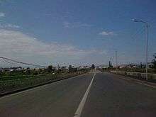
The centre of Tashir | |
| Coordinates: 41°07′28″N 44°16′55″E / 41.12444°N 44.28194°E | |
| Country |
|
| Marz | Lori |
| Established | 1844 |
| Government | |
| • Mayor | Edgar Arshakyan |
| Area | |
| • Total | 5.6 km2 (2.2 sq mi) |
| Elevation | 1,500 m (4,900 ft) |
| Population (2011 census) | |
| • Total | 7,773 |
| • Density | 1,400/km2 (3,600/sq mi) |
| Time zone | UTC +4 |
| Area code(s) | 2101 |
| Website | Official website |
| Sources: Population[1] | |

Coordinates: 41°07′28″N 44°16′55″E / 41.12444°N 44.28194°E Tashir (Armenian: Տաշիր), is a town located in Lori Province of Armenia. It is located 42 km north of the provincial centre Vanadzor and 154 north of the capital Yerevan. As of the 2011 census, the population of the town is 7,773.
Etymology
Tashir was founded in 1844 as Vorontsovka named after the Russian prince and field-marshal Mikhail Semyonovich Vorontsov who was leader in the Caucasian War from 1844 to 1853. In 1935, the town was renamed Kalinino by the Soviets, in honor of the Bolshevik revolutionary Mikhail Kalinin. With the independence of Armenia in 1991, the town was renamed Tashir after the historic Armenian region of Tashir, a canton within the Gugark province of Armenia Major.
History
Historically, the area of modern-day Tumanyan was included in the Tashir canton of the historic Gugark province, the 13th province of Greater Armenia.
Throughout the history, the region was one of the prominent centres of the Armenian culture and scholars, mainly during the period of the Zakarid princes of Armenia.
In 1801, most of the territories in northern Armenia were annexed from Qajar Persia in favour of the Russian Empire. The region of Lori became officially part of the Russian Empire at the Treaty of Gulistan signed on 1 January 1813 between Imperial Russia and Qajar Persia.
Tashir town was founded in 1844 by Russian migrants who had arrived in the region from the Russian Empire, mainly from the region of Saratov. The newly established settlement was called Vorontsovka after the Viceroy of the Caucasus Mikhail Semyonovich Vorontsov.[2] In 1846, it was included in the Borchali uyezd of Tiflis Governorate.
In 1935, during the Soviet rule, the settlement was renamed Kalinino after the Russian Bolshevik revolutionary leader Mikhail Kalinin and was called. In 1961, Kalinino was granted the statues of an urban-type settlement to become the centre pf Kalinino raion. In 1983, it was granted the status of a town.
With the independence of Armenia in 1991, the town was renamed Tashir after the historic Tashir canton of Gugark.
Geography
Tashir is situated on the shores of Tashir river, at an elevation of 1500 meters.[3] The town is surrounded by black prairies, Alpine meadows and many marshes.
The town is characterized with a subtropical climate, with an average temperature of -5 in January, and 19 in July. The annual precipitation level is 420 mm.
Demographics
Until the 1960s, the majority of the residents in Tashir were ethnic Russians. Until 1988-1989 there were also Azerbaijanis in the town who left for Azerbaijan as a result of the Nagorno-Karabakh war.
Here is the population timeline of Tashir since 1886:
| Year | 1886 | 1897 | 1926 | 1939 | 1959 | 2001 | 2011 |
|---|---|---|---|---|---|---|---|
| Population | 2,284 | 3,076 | 4,042 | 4,245 | 4,766 | 7,856 | 7,773 |
Culture
Tashir has a house of culture, a public library, and a music school. a dispensary, a hospital, a maternity house, and a knot of communication. street lighting and reconstruction of monuments.
Transportation
Tashir is located on the M-3 Motorway that connects on Yerevan with Tbilisi. The town is also connected with eastern and western Armenia through the H-31 Road.
Economy
The majority of the residents of Tashir are involved in industry, mainly food-processing. Tashir is the site of a Swiss cheese factory, which produces the cheeses Lori and Chanakh. There are also bread, milk and dairy factories. The majority of the inhabitants are employed in agriculture. 32% of the lands are privatized, 71% of which are arable lands and 29% of which are pastures. Half of the state importance lands is 1660 hectare. The lands are also used as arable lands and meadows, which cover 951 and 581 hectares, respectively. Other agricultural products and activities include grain, melons and gourds, potatoes and fruits, cattle-breeding, pig-breeding, poultry farming and bee-keeping.
Currently, the town is mainly suffering from its outdated inter-community roads, the sewage system of and the Water supply networز,
Education
Tashir has 3 public education schools as well as many kindergartens. In 2015, the number of the students in the town reached up to 1186.[4]
However, among the main problems of the community are the outdated school buildings and complexes.
Sport
There are two sport schools in the town mainly dedicated to individual sports including wrestling, weightlifting, martial arts and chess.
As of 2015, the number of children attending the sport schools is around 120 children.[5]
References
| Wikimedia Commons has media related to Tashir. |