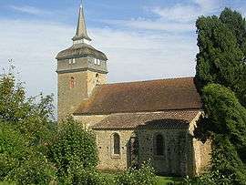
Termes-d'Armagnac
| Termes d'Armagnac | ||
|---|---|---|
 | ||
| ||
 Termes d'Armagnac | ||
|
Location within Occitanie region  Termes d'Armagnac | ||
| Coordinates: 43°40′19″N 0°00′34″W / 43.6719°N 0.0094°WCoordinates: 43°40′19″N 0°00′34″W / 43.6719°N 0.0094°W | ||
| Country | France | |
| Region | Occitanie | |
| Department | Gers | |
| Arrondissement | Mirande | |
| Canton | Aignan | |
| Intercommunality | Terres d'Armagnac | |
| Government | ||
| • Mayor (2008–2014) | Danièle Renaudin | |
| Area1 | 10.05 km2 (3.88 sq mi) | |
| Population (2008)2 | 197 | |
| • Density | 20/km2 (51/sq mi) | |
| Time zone | CET (UTC+1) | |
| • Summer (DST) | CEST (UTC+2) | |
| INSEE/Postal code | 32443 / 32400 | |
| Elevation | 111–206 m (364–676 ft) | |
|
1 French Land Register data, which excludes lakes, ponds, glaciers > 1 km² (0.386 sq mi or 247 acres) and river estuaries. 2 Population without double counting: residents of multiple communes (e.g., students and military personnel) only counted once. | ||
.svg.png)
Termes-d'Armagnac is a commune in the Gers department in southwestern France.
Population
| Historical population | ||
|---|---|---|
| Year | Pop. | ±% |
| 1962 | 228 | — |
| 1968 | 213 | −6.6% |
| 1975 | 198 | −7.0% |
| 1982 | 192 | −3.0% |
| 1990 | 190 | −1.0% |
| 1999 | 215 | +13.2% |
| 2008 | 197 | −8.4% |
Personalities
- Thibault d'Armagnac (1405-1457) companion of Joan of Arc
See also
References
| Wikimedia Commons has media related to Termes-d'Armagnac. |
This article is issued from Wikipedia - version of the 4/21/2014. The text is available under the Creative Commons Attribution/Share Alike but additional terms may apply for the media files.