Arblade-le-Haut
| Arblade-le-Haut | |
|---|---|
.jpg) | |
 Arblade-le-Haut | |
|
Location within Occitanie region  Arblade-le-Haut | |
| Coordinates: 43°44′23″N 0°03′31″W / 43.7397°N 0.0586°WCoordinates: 43°44′23″N 0°03′31″W / 43.7397°N 0.0586°W | |
| Country | France |
| Region | Occitanie |
| Department | Gers |
| Arrondissement | Condom |
| Canton | Nogaro |
| Government | |
| • Mayor (2008–2014) | Jean-Marie Verrier |
| Area1 | 12.2 km2 (4.7 sq mi) |
| Population (2008)2 | 275 |
| • Density | 23/km2 (58/sq mi) |
| Time zone | CET (UTC+1) |
| • Summer (DST) | CEST (UTC+2) |
| INSEE/Postal code | 32005 / 32110 |
| Elevation |
87–177 m (285–581 ft) (avg. 154 m or 505 ft) |
|
1 French Land Register data, which excludes lakes, ponds, glaciers > 1 km² (0.386 sq mi or 247 acres) and river estuaries. 2 Population without double counting: residents of multiple communes (e.g., students and military personnel) only counted once. | |
Arblade-le-Haut is a commune in the Gers department in southwestern France.
Geography
Arblade-le-Haut is located in the canton of Nogaro and in the arrondissement of Condom.
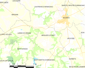
Map of Arblade-le-Haut and its surrounding communes
Population
| Historical population | ||
|---|---|---|
| Year | Pop. | ±% |
| 1962 | 262 | — |
| 1968 | 246 | −6.1% |
| 1975 | 225 | −8.5% |
| 1982 | 261 | +16.0% |
| 1990 | 260 | −0.4% |
| 1999 | 276 | +6.2% |
| 2008 | 275 | −0.4% |
See also
References
External links
| Wikimedia Commons has media related to Arblade-le-Haut. |
This article is issued from Wikipedia - version of the 9/6/2016. The text is available under the Creative Commons Attribution/Share Alike but additional terms may apply for the media files.