Pouy-Roquelaure
| Pouy-Roquelaure | ||
|---|---|---|
| ||
 Pouy-Roquelaure | ||
|
Location within Occitanie region  Pouy-Roquelaure | ||
| Coordinates: 44°02′16″N 0°31′11″E / 44.0378°N 0.5197°ECoordinates: 44°02′16″N 0°31′11″E / 44.0378°N 0.5197°E | ||
| Country | France | |
| Region | Occitanie | |
| Department | Gers | |
| Arrondissement | Condom | |
| Canton | Lectoure | |
| Government | ||
| • Mayor (2008–2014) | Bertrand Stiers | |
| Area1 | 11.04 km2 (4.26 sq mi) | |
| Population (2008)2 | 141 | |
| • Density | 13/km2 (33/sq mi) | |
| Time zone | CET (UTC+1) | |
| • Summer (DST) | CEST (UTC+2) | |
| INSEE/Postal code | 32328 / 32480 | |
| Elevation |
96–216 m (315–709 ft) (avg. 198 m or 650 ft) | |
|
1 French Land Register data, which excludes lakes, ponds, glaciers > 1 km² (0.386 sq mi or 247 acres) and river estuaries. 2 Population without double counting: residents of multiple communes (e.g., students and military personnel) only counted once. | ||
.svg.png)
Pouy-Roquelaure is a commune in the Gers department in southwestern France.
Geography
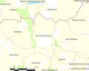
Pouy-Roquelaure and its surrounding communes
Population
| Historical population | ||
|---|---|---|
| Year | Pop. | ±% |
| 1962 | 168 | — |
| 1968 | 141 | −16.1% |
| 1975 | 128 | −9.2% |
| 1982 | 139 | +8.6% |
| 1990 | 152 | +9.4% |
| 1999 | 137 | −9.9% |
| 2008 | 141 | +2.9% |
See also
References
| Wikimedia Commons has media related to Pouy-Roquelaure. |
This article is issued from Wikipedia - version of the 10/21/2016. The text is available under the Creative Commons Attribution/Share Alike but additional terms may apply for the media files.