Razengues
| Razengues | ||
|---|---|---|
| ||
 Razengues | ||
|
Location within Occitanie region  Razengues | ||
| Coordinates: 43°38′32″N 0°59′53″E / 43.6422°N 0.9981°ECoordinates: 43°38′32″N 0°59′53″E / 43.6422°N 0.9981°E | ||
| Country | France | |
| Region | Occitanie | |
| Department | Gers | |
| Arrondissement | Auch | |
| Canton | Isle-Jourdain | |
| Intercommunality | Save Lisloise | |
| Government | ||
| • Mayor (2008–2014) | Yves Druilhet | |
| Area1 | 4.35 km2 (1.68 sq mi) | |
| Population (2008)2 | 179 | |
| • Density | 41/km2 (110/sq mi) | |
| Time zone | CET (UTC+1) | |
| • Summer (DST) | CEST (UTC+2) | |
| INSEE/Postal code | 32339 / 32600 | |
| Elevation |
178–231 m (584–758 ft) (avg. 147 m or 482 ft) | |
|
1 French Land Register data, which excludes lakes, ponds, glaciers > 1 km² (0.386 sq mi or 247 acres) and river estuaries. 2 Population without double counting: residents of multiple communes (e.g., students and military personnel) only counted once. | ||
.svg.png)
Razengues is a commune in the Gers department in southwestern France.
Geography
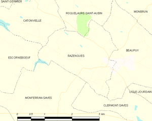
Razengues and its surrounding communes
Population
| Historical population | ||
|---|---|---|
| Year | Pop. | ±% |
| 1793 | 223 | — |
| 1800 | 282 | +26.5% |
| 1806 | 303 | +7.4% |
| 1821 | 275 | −9.2% |
| 1831 | 288 | +4.7% |
| 1841 | 332 | +15.3% |
| 1846 | 321 | −3.3% |
| 1851 | 313 | −2.5% |
| 1856 | 290 | −7.3% |
| 1861 | 243 | −16.2% |
| 1866 | 248 | +2.1% |
| 1872 | 241 | −2.8% |
| 1876 | 215 | −10.8% |
| 1881 | 205 | −4.7% |
| 1886 | 199 | −2.9% |
| 1891 | 208 | +4.5% |
| 1896 | 182 | −12.5% |
| 1901 | 179 | −1.6% |
| 1906 | 170 | −5.0% |
| 1911 | 162 | −4.7% |
| 1921 | 143 | −11.7% |
| 1926 | 159 | +11.2% |
| 1931 | 161 | +1.3% |
| 1936 | 144 | −10.6% |
| 1946 | 121 | −16.0% |
| 1954 | 116 | −4.1% |
| 1962 | 103 | −11.2% |
| 1968 | 96 | −6.8% |
| 1975 | 95 | −1.0% |
| 1982 | 84 | −11.6% |
| 1990 | 93 | +10.7% |
| 1999 | 104 | +11.8% |
| 2008 | 179 | +72.1% |
See also
References
| Wikimedia Commons has media related to Razengues. |
This article is issued from Wikipedia - version of the 10/21/2016. The text is available under the Creative Commons Attribution/Share Alike but additional terms may apply for the media files.