Saint-Blancard
| Saint-Blancard | |
|---|---|
|
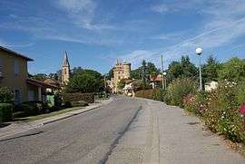
The main road in the village | |
 Saint-Blancard | |
|
Location within Occitanie region  Saint-Blancard | |
| Coordinates: 43°20′42″N 0°38′51″E / 43.345°N 0.6475°ECoordinates: 43°20′42″N 0°38′51″E / 43.345°N 0.6475°E | |
| Country | France |
| Region | Occitanie |
| Department | Gers |
| Arrondissement | Mirande |
| Canton | Masseube |
| Intercommunality | Hautes Vallées |
| Government | |
| • Mayor (2008–2014) | Georges Barthe |
| Area1 | 14.87 km2 (5.74 sq mi) |
| Population (2008)2 | 334 |
| • Density | 22/km2 (58/sq mi) |
| Time zone | CET (UTC+1) |
| • Summer (DST) | CEST (UTC+2) |
| INSEE/Postal code | 32365 / 32140 |
| Elevation |
227–357 m (745–1,171 ft) (avg. 356 m or 1,168 ft) |
|
1 French Land Register data, which excludes lakes, ponds, glaciers > 1 km² (0.386 sq mi or 247 acres) and river estuaries. 2 Population without double counting: residents of multiple communes (e.g., students and military personnel) only counted once. | |
Saint-Blancard (Gascon: Sent Blancat) is a commune in the Gers department in the Occitanie region in southwestern France.
Geography
Localisation
Saint-Blancard is located on the ridge between the valley of the Gimone in the east and the valley of the Arrats in the west . The D228 crosses the D576 in the village. Auch is at 40 km, Toulouse at 80 km and Tarbes at 60 km from Saint-Blancard.

Hydrography
The Arrats runs in the west of the commune.
South of the village is a small lake for the farmers.
There is a privately owned watermill. To the southeast lies a 6 km long reservoir with a surface area of 263 hectares, Lac de la Gimone. The lake forms the border between Gers and Haute-Garonne. It was created by the placement of a dam on the river Gimone. The commune has a system of streams and small lakes that serve the agriculture.

Politics
The office of nine communes united under the name Les Hautes Vallees,[1] is located in the village.
Population
| Historical population | ||
|---|---|---|
| Year | Pop. | ±% |
| 1962 | 273 | — |
| 1968 | 255 | −6.6% |
| 1975 | 217 | −14.9% |
| 1982 | 229 | +5.5% |
| 1990 | 205 | −10.5% |
| 1999 | 257 | +25.4% |
| 2008 | 334 | +30.0% |
The inhabitants are called Saint Blancardais.
Services
With a small shop, the village is still self-supporting. At the store is a gas depot. There is a hairdresser and a post office in Saint-Blancard. The municipality encourages the middle class by counting low rents for buildings. In a former convent school is now a hotel / pub / restaurant next to the town hall. There is a school. There are Bed & Breakfast and there are cottages. There is a football field. In the village is radio Coteaux, 97.7 and 104.5 FM located . At the lake is a nautical center. There is a swimming facility. There is a field for motorized paragliding.
The village has a rehabilitation center. There are also homes for rehabilitation treatment.
Sites of interest


The most striking building in town is the castle. The 15th century church Saint-Pancrare is build next to the castle. At the junktion west of the castle is a monument to a former Count Armand who was also mayor of the village. In a pasture north of the castle stand on a hill, the remains of the windmill (moulin à vent fr) from Saint-Blancard.[2] That place is called Chez Baptiste. In front of the castle is a monument to the fallen, a cross and a statue of Mary. Between these statues is a boules alley with lights located.
In the middle of the village stands a cross aging from 1895 in memory of the famille (family) Furgatte. In the east of the village stands a twelve-foot-high wooden cross back from the seventeenth century.
Notable people
In the village is the Château de Saint-Blancard (Castle of Saint-Blancard). Among the barons and marquesses that lived in the castle were:
- Bernard d'Ornezan,[3] Baron of Saint-Blancard in the diocese of Lombez, around 1400,
- and Armand de Gontaut, baron de Biron and Maréchal de camp, mid sixteenth century.
See also
| Wikimedia Commons has media related to Saint-Blancard. |