South Windham, Maine
| South Windham, Maine | |
|---|---|
| Census-designated place | |
 Location in Cumberland County and the state of Maine. | |
| Coordinates: 43°44′10″N 70°25′19″W / 43.73611°N 70.42194°WCoordinates: 43°44′10″N 70°25′19″W / 43.73611°N 70.42194°W | |
| Country | United States |
| State | Maine |
| County | Cumberland |
| Town | Windham |
| Area | |
| • Total | 1.3 sq mi (3.3 km2) |
| • Land | 1.2 sq mi (3.1 km2) |
| • Water | 0.08 sq mi (0.2 km2) |
| Elevation | 154 ft (47 m) |
| Population (2010) | |
| • Total | 1,374 |
| • Density | 1,100/sq mi (420/km2) |
| Time zone | Eastern (EST) (UTC-5) |
| • Summer (DST) | EDT (UTC-4) |
| Area code(s) | 207 |
South Windham is a census-designated place (CDP) in the town of Windham in Cumberland County, Maine, United States. The population of the CDP was 1,374 at the 2010 census.[1] Prior to 2010, South Windham was part of the Little Falls-South Windham census-designated place.
It is part of the Portland–South Portland–Biddeford, Maine Metropolitan Statistical Area.
Geography
South Windham is located at 43°44′10″N 70°25′19″W / 43.73611°N 70.42194°W, along the Presumpscot River. According to the United States Census Bureau, the CDP has a total area of 1.3 square miles (3.3 km2), of which 1.2 square miles (3.1 km2) is land and 0.077 square miles (0.2 km2), or 5.31%, is water.[2]
The CDP of Little Falls is located directly across the Presumpscot River, in the town of Gorham. U.S. Route 202 and Maine State Route 4 run north-south in a concurrency through both communities.
History
The Presumpscot River was an early transportation corridor to interior Maine; and provided reliable water power at Little Falls. Major William Knight was operating a sawmill at the falls in 1756. As the local forests were cleared, the sawmill was replaced by William Johnson's grist mill and a wool carding mill operated by Leonard Bacon and Lathrop Crockett. Locks were constructed around the falls to complete the Cumberland and Oxford Canal in 1832.[3] The canal fell into disuse after the Portland and Ogdensburg Railway was completed through South Windham in 1875.[4] Maine Central Railroad leased the railway as their Mountain Division in 1888.[5] Availability of year-round transportation encouraged C.A. Brown and Company to build a large brick wood-paper board factory at South Windham in 1875. Androscoggin Pulp Company purchased the factory, and the industrial village of South Windham developed around the pulp mill.[6] On April 4, 1919, the legislature passed an act creating the Reformatory for Men at South Windham. It is now the Maine Correctional Center, a minimum to medium security facility for men and women.
Notable people
- Jeff Donnell, actress (The Iron Maiden, The Amazing Spider-Man, and General Hospital); born in South Windham
References
- ↑ "Profile of General Population and Housing Characteristics: 2010 Demographic Profile Data (DP-1): South Windham CDP, Maine". U.S. Census Bureau, American Factfinder. Retrieved June 13, 2012.
- ↑ "Geographic Identifiers: 2010 Demographic Profile Data (G001): South Windham CDP, Maine". U.S. Census Bureau, American Factfinder. Retrieved June 13, 2012.
- ↑ Ward, Ernest E. My First Sixty Years in Harrison, Maine Cardinal Printing 1967 p.7
- ↑ Bruce D. Heald, A History of the Boston & Maine Railroad: Exploring New Hampshire's Rugged Heart by Rail; The History Press; Charleston, South Carolina 2007
- ↑ Peters, Bradley L. (1976). Maine Central Railroad Company. Maine Central Railroad.
- ↑ Barnes, Diane and Jack. The Sebago Lake Area (1996). Arcadia Publishing, ISBN 978-0-7385-4943-9, p.13
Municipalities and communities of Cumberland County, Maine, United States | ||
|---|---|---|
| Cities | 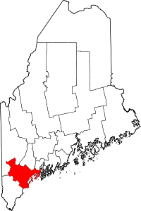 | |
| Towns | ||
| CDPs | ||
| Other villages | ||