Cumberland Center, Maine
| Cumberland Center, Maine | |
|---|---|
| Census-designated place | |
 Location in Cumberland County and the state of Maine. | |
| Coordinates: 43°47′48″N 70°14′59″W / 43.79667°N 70.24972°WCoordinates: 43°47′48″N 70°14′59″W / 43.79667°N 70.24972°W | |
| Country | United States |
| State | Maine |
| County | Cumberland |
| Town | Cumberland |
| Area | |
| • Total | 4.2 sq mi (11.0 km2) |
| • Land | 4.2 sq mi (11.0 km2) |
| • Water | 0.0 sq mi (0.0 km2) |
| Elevation | 187 ft (57 m) |
| Population (2010) | |
| • Total | 2,499 |
| • Density | 600/sq mi (230/km2) |
| Time zone | Eastern (EST) (UTC-5) |
| • Summer (DST) | EDT (UTC-4) |
| ZIP code | 04021 |
| Area code(s) | 207 |
| FIPS code | 23-15500 |
| GNIS feature ID | 0564642 |
Cumberland Center is a census-designated place (CDP) within the town of Cumberland in Cumberland County, Maine, United States. The population was 2,499 at the 2010 census.[1] It is part of the Portland – South Portland – Biddeford, Maine, Metropolitan Statistical Area.
Geography
Cumberland Center is located at 43°47′48″N 70°14′59″W / 43.79667°N 70.24972°W (43.796786, -70.249713).[2]
According to the United States Census Bureau, the CDP has a total area of 4.2 square miles (11 km2), all of it land.
Demographics
As of the census[3] of 2000, there were 2,596 people, 891 households, and 744 families residing in the CDP. The population density was 612.2 people per square mile (236.4/km²). There were 904 housing units at an average density of 213.2/sq mi (82.3/km²). The racial makeup of the CDP was 99.00% White, 0.15% African American, 0.12% Native American, 0.42% Asian, 0.12% from other races, and 0.19% from two or more races. Hispanic or Latino of any race were 0.42% of the population.
There were 891 households out of which 49.5% had children under the age of 18 living with them, 73.1% were married couples living together, 8.0% had a female householder with no husband present, and 16.4% were non-families. 14.0% of all households were made up of individuals and 7.0% had someone living alone who was 65 years of age or older. The average household size was 2.91 and the average family size was 3.22.
In the CDP the population was spread out with 33.9% under the age of 18, 2.7% from 18 to 24, 29.2% from 25 to 44, 24.1% from 45 to 64, and 10.2% who were 65 years of age or older. The median age was 38 years. For every 100 females there were 92.3 males. For every 100 females age 18 and over, there were 86.8 males.
The median income for a household in the CDP was $66,950, and the median income for a family was $72,632. Males had a median income of $47,975 versus $40,125 for females. The per capita income for the CDP was $32,043. About 2.3% of families and 2.0% of the population were below the poverty line, including 2.0% of those under age 18 and 4.2% of those age 65 or over.
School system
The Greely school system comprises five schools which teach grades K–12. Greely High School has a student body composed of 2001 students in grades 9–12.
References
- ↑ "Profile of General Population and Housing Characteristics: 2010 Demographic Profile Data (DP-1): Cumberland Center CDP, Maine". U.S. Census Bureau, American Factfinder. Archived from the original on September 11, 2013. Retrieved June 13, 2012.
- ↑ "US Gazetteer files: 2010, 2000, and 1990". United States Census Bureau. 2011-02-12. Retrieved 2011-04-23.
- ↑ "American FactFinder". United States Census Bureau. Archived from the original on 2013-09-11. Retrieved 2008-01-31.
Municipalities and communities of Cumberland County, Maine, United States | ||
|---|---|---|
| Cities | 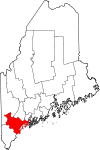 | |
| Towns | ||
| CDPs | ||
| Other villages | ||