Standish (CDP), Maine
| Standish, Maine | |
|---|---|
| Census-designated place | |
_highlighted.svg.png) Location in Cumberland County and the state of Maine. | |
| Coordinates: 43°44′7″N 70°33′9″W / 43.73528°N 70.55250°W | |
| Country | United States |
| State | Maine |
| County | Cumberland |
| Town | Standish |
| Area | |
| • Total | 2.7 sq mi (6.9 km2) |
| • Land | 2.7 sq mi (6.9 km2) |
| • Water | 0.0 sq mi (0.0 km2) |
| Elevation | 433 ft (132 m) |
| Population (2010) | |
| • Total | 469 |
| • Density | 180/sq mi (68/km2) |
| Time zone | Eastern (EST) (UTC-5) |
| • Summer (DST) | EDT (UTC-4) |
| Area code(s) | 207 |
Standish, known locally as Standish Corner,[1] is a census-designated place (CDP) in the town of Standish in Cumberland County, Maine, United States. The population was 469 at the 2010 census.[2] It is part of the Portland–South Portland–Biddeford, Maine Metropolitan Statistical Area.
Geography
Standish is located at 43°44′7″N 70°33′9″W / 43.73528°N 70.55250°W (43.7353, -70.5525),[3] at the intersection of Maine State Routes 25 and 35. Route 25 runs west towards New Hampshire and east to Gorham and Portland, while Route 35 travels north towards North Windham and south to Buxton, Hollis and eventually Kennebunk.
According to the United States Census Bureau, the Standish CDP has a total area of 2.7 square miles (6.9 km2), all land.[4]
References
- ↑ "Standish Corner Village Design Master Plan" (PDF). Town of Standish. 2007. Retrieved June 14, 2012.
- ↑ "Profile of General Population and Housing Characteristics: 2010 Demographic Profile Data (DP-1): Standish CDP, Maine". U.S. Census Bureau, American Factfinder. Retrieved June 14, 2012.
- ↑ "US Gazetteer files: 2010, 2000, and 1990". United States Census Bureau. 2011-02-12. Retrieved 2011-04-23.
- ↑ "Geographic Identifiers: 2010 Demographic Profile Data (G001): Standish CDP, Maine". U.S. Census Bureau, American Factfinder. Retrieved June 14, 2012.
Municipalities and communities of Cumberland County, Maine, United States | ||
|---|---|---|
| Cities | 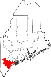 | |
| Towns | ||
| CDPs | ||
| Other villages | ||
This article is issued from Wikipedia - version of the 3/30/2016. The text is available under the Creative Commons Attribution/Share Alike but additional terms may apply for the media files.