South Dennis, New Jersey
| South Dennis, New Jersey | |
|---|---|
| Unincorporated community | |
|
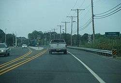
NJ Route 47 southbound approaching NJ Route 83 in South Dennis | |
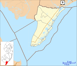 South Dennis  South Dennis  South Dennis Location in Cape May County (Inset: Cape May County in New Jersey) | |
| Coordinates: 39°10′42″N 74°49′12″W / 39.17833°N 74.82000°WCoordinates: 39°10′42″N 74°49′12″W / 39.17833°N 74.82000°W | |
| Country |
|
| State |
|
| County | Cape May |
| Township | Dennis |
| Elevation[1] | 3 m (10 ft) |
| Population (2000) | |
| • Total | 93 |
| • Density | 360/km2 (930/sq mi) |
| Time zone | Eastern (EST) (UTC-5) |
| • Summer (DST) | EDT (UTC-4) |
| ZIP code | 08245 |
| Area code(s) | 609 |
| GNIS feature ID | 880724[1] |
South Dennis is an unincorporated community located within Dennis Township in Cape May County, New Jersey, United States.[2] It is part of the Ocean City Metropolitan Statistical Area. Its postal ZIP Code is 08245.
Demographics
As of the 2000 United States Census, there were 93 people and 41 households residing in the ZIP Code Tabulation Area 08245. The population density was 930 people per square mile.[3]
Geography
South Dennis is located at 39°10′42″N 74°49′12″W / 39.17833°N 74.82000°W (39.099980, -74.848733). It lies 10 ft (3 m) above sea level.[1] According to the United States Census Bureau, ZIP Code 08245 has a total area of 0.3 km² (0.1 mi²), all of which is land.[3] Dennis Creek serves as the northern border of the community.[4]
Climate
South Dennis lies on the cusp of a humid subtropical climate zone and experiences four discernible seasons. It receives an average of 44.52 inches (1,131 mm) of precipitation each year, with the wettest season being August. In January 1942, South Dennis experienced its lowest recorded temperature at -22 °F, while the hottest temperature was 103 °F in July 1993.[5]
| Climate data for South Dennis, NJ | |||||||||||||
|---|---|---|---|---|---|---|---|---|---|---|---|---|---|
| Month | Jan | Feb | Mar | Apr | May | Jun | Jul | Aug | Sep | Oct | Nov | Dec | Year |
| Average high °F (°C) | 44 (7) |
47 (8) |
55 (13) |
66 (19) |
75 (24) |
83 (28) |
88 (31) |
86 (30) |
80 (27) |
69 (21) |
59 (15) |
49 (9) |
66.8 (19.3) |
| Average low °F (°C) | 22 (−6) |
24 (−4) |
30 (−1) |
38 (3) |
48 (9) |
57 (14) |
63 (17) |
61 (16) |
54 (12) |
43 (6) |
34 (1) |
26 (−3) |
41.7 (5.3) |
| Average precipitation inches (mm) | 3.86 (98) |
3.08 (78.2) |
4.18 (106.2) |
3.61 (91.7) |
3.58 (90.9) |
2.88 (73.2) |
3.8 (97) |
5.31 (134.9) |
3.76 (95.5) |
3.62 (91.9) |
3.37 (85.6) |
3.47 (88.1) |
44.52 (1,131.2) |
| Source: The Weather Channel[5] | |||||||||||||
Infrastructure
Transportation

South Dennis lies at the intersection of Route 47 (known as Delsea Drive) and Route 83.[4] A major infrastructure project that realigned Route 47 and added a traffic light was completed in July 2007 at a cost of $6.7 million.[6] Two county routes, County Route 628 and County Route 657, terminate shortly after entering South Dennis.[7][8]
Fire services
References
- 1 2 3 U.S. Geological Survey Geographic Names Information System: South Dennis, New Jersey. Accessed 4 May 2009.
- ↑ Locality Search, State of New Jersey. Accessed June 9, 2016.
- 1 2 "08245 zip code South Dennis". BrainyZip. 2009. Retrieved 2009-05-04.
- 1 2 Map of South Dennis, New Jersey (Map). Cartography by Tele Atlas. Google Maps. 2009. Retrieved 2009-05-05.
- 1 2 "Monthly Weather Averages for South Dennis, New Jersey". The Weather Channel. Retrieved 2009-05-10.
- ↑ "Dennis Road Project Finally Done". Cape May County Herald. July 25, 2007. Retrieved 2008-11-05.
- ↑ "County Route 628 Straight Line Diagram" (PDF). New Jersey Department of Transportation. Retrieved 2009-05-05.
- ↑ "County Route 657 Straight Line Diagram" (PDF). New Jersey Department of Transportation. Retrieved 2009-05-05.
External links
- The Cape May County Gazette Local community newspaper
- The Beachcomber
Municipalities and communities of Cape May County, New Jersey, United States | ||
|---|---|---|
| Cities | 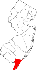 | |
| Boroughs | ||
| Townships | ||
| CDPs | ||
| Other unincorporated communities | ||