Dennisville, New Jersey
| Dennisville, New Jersey | |
|---|---|
| Unincorporated community | |
|
James House in Dennisville Historic District | |
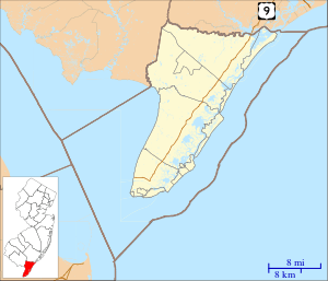 Dennisville  Dennisville  Dennisville Location in Cape May County (Inset: Cape May County in New Jersey) | |
| Coordinates: 39°11′35″N 74°49′31″W / 39.19306°N 74.82528°WCoordinates: 39°11′35″N 74°49′31″W / 39.19306°N 74.82528°W | |
| Country |
|
| State |
|
| County | Cape May |
| Township | Dennis |
| Elevation | 7 ft (2 m) |
| ZIP code | 08214 |
| Area code(s) | 609 |
| GNIS feature ID | 0875895[1] |

Dennisville is an unincorporated community located within Dennis Township, in Cape May County, New Jersey, United States.[2] It is part of the Ocean City Metropolitan Statistical Area. Its postal ZIP Code is 08214.
Dennisville is on the south side of Dennis Creek and is the most important community within Dennis Township. The main transportation artery is New Jersey Route 47 (Delsea Drive). Dennisville was founded in 1726 by Anthony Ludlam.[3] The first post office in the area was Dennis Creek, established September 7, 1802, with Jeremiah Johnson as first postmaster. The name was changed to Dennisville in 1854.[4]
Emergency services
Fire
Main article: Dennis Volunteer Fire Company
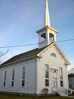 United Methodist Church on Main Street
 Chester House
References
- ↑ "Dennisville". Geographic Names Information System. United States Geological Survey. Retrieved 2012-10-06.
- ↑ Locality Search, State of New Jersey. Accessed June 9, 2016.
- ↑ Cape May County: Dennisville, getnj.com. Accessed September 8, 2007.
- ↑ New Jersey Postal History: The Post Offices and First Postmasters, 1776–1976, p. 51. (1977) Kay, John L. and Smith, Chester M., Jr., Lawrence, Massachusetts: Quarterman Publications, Inc. ISBN 0-88000-095-3
External links
 Media related to Dennisville Historic District at Wikimedia Commons
- The Cape May County Gazette Local community newspaper
- The Beachcomber
Municipalities and communities of Cape May County, New Jersey, United States | ||
|---|---|---|
| Cities | 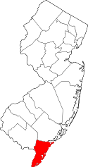 | |
| Boroughs | ||
| Townships | ||
| CDPs | ||
| Other unincorporated communities | ||
This article is issued from Wikipedia - version of the 9/26/2016. The text is available under the Creative Commons Attribution/Share Alike but additional terms may apply for the media files.