West Wildwood, New Jersey
| West Wildwood, New Jersey | |
|---|---|
| Borough | |
| Borough of West Wildwood | |
|
Boat docked behind a house | |
| Motto: Small Town Charm on the Back Bay[1] | |
 West Wildwood Borough highlighted in Cape May County. Inset map: Cape May County highlighted in the State of New Jersey. | |
 Census Bureau map of West Wildwood, New Jersey | |
| Coordinates: 39°00′02″N 74°49′25″W / 39.000598°N 74.823573°WCoordinates: 39°00′02″N 74°49′25″W / 39.000598°N 74.823573°W[2][3] | |
| Country |
|
| State |
|
| County | Cape May |
| Incorporated | April 21, 1920 |
| Government[4] | |
| • Type | Walsh Act |
| • Body | Board of Commissioners |
| • Mayor | Christopher J. Fox (term ends November 2016)[5][6] |
| • Clerk | Donna L. Frederick[7] |
| Area[2] | |
| • Total | 0.346 sq mi (0.894 km2) |
| • Land | 0.276 sq mi (0.714 km2) |
| • Water | 0.070 sq mi (0.181 km2) 20.21% |
| Area rank |
552nd of 566 in state 15th of 16 in county[2] |
| Elevation[8] | 0 ft (0 m) |
| Population (2010 Census)[9][10][11] | |
| • Total | 603 |
| • Estimate (2015)[12] | 572 |
| • Rank |
550th of 566 in state 15th of 16 in county[13] |
| • Density | 2,188.4/sq mi (844.9/km2) |
| • Density rank |
277th of 566 in state 4th of 16 in county[13] |
| Time zone | Eastern (EST) (UTC-5) |
| • Summer (DST) | Eastern (EDT) (UTC-4) |
| ZIP code | 08260[14] |
| Area code(s) | 609[15] |
| FIPS code | 3400980210[2][16][17] |
| GNIS feature ID | 0885441[2][18] |
| Website |
westwildwood |

West Wildwood is a borough in Cape May County, New Jersey, United States. It is part of the Ocean City Metropolitan Statistical Area. As of the 2010 United States Census, the borough's population was 603,[9][10][11] reflecting an increase of 155 (+34.6%) from the 448 counted in the 2000 Census, which had in turn declined by 5 (-1.1%) from the 453 counted in the 1990 Census.[19]
West Wildwood was incorporated as a borough by an act of the New Jersey Legislature on April 21, 1920, from portions of Middle Township.[20]
Geography
According to the United States Census Bureau, the borough had a total area of 0.346 square miles (0.894 km2), including 0.276 square miles (0.714 km2) of land and 0.070 square miles (0.181 km2) of water (20.21%).[2][3]
The borough borders North Wildwood City, Wildwood City, and Middle Township.
Located on a small island connected to Wildwood by a two-lane bridge, the borough is mostly vacation and year-round homes with a single night club, a miniature golf course and several marinas.
Demographics
| Historical population | |||
|---|---|---|---|
| Census | Pop. | %± | |
| 1930 | 178 | — | |
| 1940 | 146 | −18.0% | |
| 1950 | 237 | 62.3% | |
| 1960 | 207 | −12.7% | |
| 1970 | 235 | 13.5% | |
| 1980 | 360 | 53.2% | |
| 1990 | 453 | 25.8% | |
| 2000 | 448 | −1.1% | |
| 2010 | 603 | 34.6% | |
| Est. 2015 | 572 | [12][21] | −5.1% |
| Population sources: 1930-2000[22] 1930[23] 1930-1990[24] 2000[25][26] 2010[9][10][11] | |||
Census 2010
The 2010 United States Census counted 603 people, 276 households, and 160.1 families residing in the borough. The population density was 2,188.4 per square mile (844.9/km2). The borough contained 893 housing units at an average density of 3,240.9 per square mile (1,251.3/km2). The racial makeup of the borough was 95.36% (575) White, 1.49% (9) Black or African American, 0.00% (0) Native American, 0.00% (0) Asian, 0.00% (0) Pacific Islander, 0.66% (4) from other races, and 2.49% (15) from two or more races. Hispanics or Latinos of any race were 2.65% (16) of the population.[9]
Out of a total of 276 households, 14.5% had children under the age of 18 living with them, 42.8% were married couples living together, 9.1% had a female householder with no husband present, and 42.0% were non-families. 35.9% of all households were made up of individuals, and 17.4% had someone living alone who was 65 years of age or older. The average household size was 2.14 and the average family size was 2.78.[9]
In the borough, 17.4% of the population were under the age of 18, 5.5% from 18 to 24, 16.3% from 25 to 44, 33.2% from 45 to 64, and 27.7% who were 65 years of age or older. The median age was 52.8 years. For every 100 females the census counted 97.1 males, but for 100 females at least 18 years old, it was 99.2 males.[9]
The Census Bureau's 2006-2010 American Community Survey showed that (in 2010 inflation-adjusted dollars) median household income was $38,750 (with a margin of error of +/- $10,914) and the median family income was $57,981 (+/- $16,263). Males had a median income of $36,607 (+/- $10,003) versus $36,364 (+/- $10,046) for females. The per capita income for the borough was $27,606 (+/- $4,119). About 6.7% of families and 8.9% of the population were below the poverty line, including 7.5% of those under age 18 and 6.5% of those age 65 or over.[27]
Census 2000
As of the 2000 United States Census[16] there were 448 people, 202 households, and 117 families residing in the borough. The population density was 1,698.0 people per square mile (665.3/km2). There were 775 housing units at an average density of 1, 150.9/km2 (2,937.4/sq mi). The racial makeup of the borough was 95.76% White, 0.22% Asian, 2.23% from other races, and 1.79% from two or more races. Hispanic or Latino of any race were 3.79% of the population.[25][26]
There were 202 households out of which 20.8% had children under the age of 18 living with them, 46.0% were married couples living together, 9.4% had a female householder with no husband present, and 41.6% were non-families. 36.6% of all households were made up of individuals and 17.3% had someone living alone who was 65 years of age or older. The average household size was 2.22 and the average family size was 2.92.[25][26]
In the borough the population was spread out with 18.8% under the age of 18, 5.4% from 18 to 24, 23.7% from 25 to 44, 32.8% from 45 to 64, and 19.4% who were 65 years of age or older. The median age was 47 years. For every 100 females there were 93.9 males. For every 100 females age 18 and over, there were 88.6 males.[25][26]
The median income for a household in the borough was $33,393, and the median income for a family was $50,625. Males had a median income of $38,281 versus $21,190 for females. The per capita income for the borough was $17,839. About 3.2% of families and 6.5% of the population were below the poverty line, including 13.4% of those under age 18 and 5.6% of those age 65 or over.[25][26]
Economy
Portions of West Wildwood are part of an Urban Enterprise Zone in The Wildwoods that was established by legislation in 2002 and operates as a joint zone with North Wildwood, Wildwood, Wildwood Crest. In addition to other benefits to encourage employment within the Zone, shoppers can take advantage of a reduced 3½% sales tax rate at eligible merchants (versus the 7% rate charged statewide).[28]
Government
Local government
West Wildwood has been governed by a three-member commission under the Walsh Act form of New Jersey municipal government since 1964. The commission is elected at-large in non-partisan elections to serve four-year terms of office on a concurrent basis. At a reorganization meeting conducted after each election, the commission selects one of its members to serve as mayor and designates for each commissioner an assigned department to oversee and operate.[4][29][30]
As of 2016, members of the West Wildwood Borough Board of Commissioners are Mayor Chrisopher J. Fox (Commissioner of Public Affairs and Public Safety), Scott W. Golden (Commissioner of Public Works, Parks and Public Property) and Cornelius J. Maxwell (Commissioner of Revenue and Finance), all serving terms of office ending in November 2016.[5][31][32][33][34]
In the same May 2012 election in which the three incumbent commissioners were elected, the voters approved a ballot question shifting elections from May to November, extending the terms of the three elected commissioners by an additional six months, with the next municipal election taking place in November 2016.[35]
Federal, state and county representation
West Wildwood is located in the 2nd Congressional District[36] and is part of New Jersey's 1st state legislative district.[10][37][38]
New Jersey's Second Congressional District is represented by Frank LoBiondo (R, Ventnor City).[39] New Jersey is represented in the United States Senate by Cory Booker (D, Newark, term ends 2021)[40] and Bob Menendez (D, Paramus, 2019).[41][42]
For the 2016–2017 session (Senate, General Assembly), the 1st Legislative District of the New Jersey Legislature is represented in the State Senate by Jeff Van Drew (D, Dennis Township) and in the General Assembly by Bob Andrzejczak (D, Middle Township) and R. Bruce Land (D, Vineland).[43] The Governor of New Jersey is Chris Christie (R, Mendham Township).[44] The Lieutenant Governor of New Jersey is Kim Guadagno (R, Monmouth Beach).[45]
Cape May County is governed by a Board of Chosen Freeholders consisting of five members, elected at-large in partisan elections to three-year terms of office on a staggered basis, with one or two seats coming up for election each year; At an annual reorganization held each January, the freeholders select one member to serve as Director and another to serve as Vice-Director.[46] As of 2015, Cape May County's Freeholders are Freeholder Director Gerald M. Thornton (Middle Township, term ends December 31, 2016),[47] Freeholder Vice-Director Leonard C. Desiderio (Sea Isle City, 2015),[48] Kristine Gabor (Upper Township, 2017)[49], E. Marie Hayes (Ocean City, 2016),[50] and Will Morey (Wildwood Crest, 2017).[51] The county's constitutional officers are Sheriff Gary Schafer (Middle Township, 2017),[52] Surrogate M. Susan Sheppard (Ocean City, 2017),[53] and County Clerk Rita Fulginiti (Ocean City, 2015).[54]
Politics
As of March 23, 2011, there were a total of 463 registered voters in West Wildwood Boro, of which 124 (26.8%) were registered as Democrats, 184 (39.7%) were registered as Republicans and 154 (33.3%) were registered as Unaffiliated. There was one voter registered to another party.[55]
In the 2012 presidential election, Democrat Barack Obama received 51.6% of the vote (165 cast), ahead of Republican Mitt Romney with 48.1% (154 votes), and other candidates with 0.3% (1 vote), among the 323 ballots cast by the borough's 459 registered voters (3 ballots were spoiled), for a turnout of 70.4%.[56][57] In the 2008 presidential election, Republican John McCain received 52.4% of the vote (177 cast), ahead of Democrat Barack Obama, who received 45.0% (152 votes), with 338 ballots cast among the borough's 462 registered voters, for a turnout of 73.2%.[58] In the 2004 presidential election, Democrat John Kerry received 51.4% of the vote (171 ballots cast), outpolling Republican George W. Bush, who received 47.1% (157 votes), with 333 ballots cast among the borough's 422 registered voters, for a turnout percentage of 78.9.[59]
In the 2013 gubernatorial election, Republican Chris Christie received 75.4% of the vote (175 cast), ahead of Democrat Barbara Buono with 23.3% (54 votes), and other candidates with 1.3% (3 votes), among the 236 ballots cast by the borough's 435 registered voters (4 ballots were spoiled), for a turnout of 54.3%.[60][61] In the 2009 gubernatorial election, Republican Chris Christie received 48.2% of the vote (148 ballots cast), ahead of both Democrat Jon Corzine with 41.7% (128 votes) and Independent Chris Daggett with 4.9% (15 votes), with 307 ballots cast among the borough's 493 registered voters, yielding a 62.3% turnout.[62]
Education

West Wildwood is a non-operating school district. Public school students in West Wildwood attend school in Wildwood as part of a sending/receiving relationship with the Wildwood Public School District, which serves students in pre-Kindergarten through twelfth grade.[63] Schools in the district (with 2011-12 enrollment data from the National Center for Education Statistics[64]) are Glenwood Elementary School[65] (PreK-5; 413 students), Wildwood Middle School[66] (6-8; 115 students) and Wildwood High School[67] (9-12; 268 students).[68]
Transportation
As of May 2010, the borough had a total of 5.59 miles (9.00 km) of roadways, of which 4.79 miles (7.71 km) were maintained by the municipality and 0.80 miles (1.29 km) by Cape May County.[69]
County Route 614 (Glenwood Avenue) runs through the borough to its northern tip.[70]
References
- ↑ Home Page, Borough of West Wildwood. Accessed August 23, 2015.
- 1 2 3 4 5 6 2010 Census Gazetteer Files: New Jersey County Subdivisions, United States Census Bureau. Accessed May 21, 2015.
- 1 2 US Gazetteer files: 2010, 2000, and 1990, United States Census Bureau. Accessed September 4, 2014.
- 1 2 2012 New Jersey Legislative District Data Book, Rutgers University Edward J. Bloustein School of Planning and Public Policy, March 2013, p. 8.
- 1 2 Officials, Borough of West Wildwood. Accessed June 29, 2016.
- ↑ 2016 New Jersey Mayors Directory, New Jersey Department of Community Affairs. Accessed June 14, 2016. As of date accessed, Fox is listed as mayor with an incorrect term-end date of December 31, 2016.
- ↑ Borough Clerk, Borough of West Wildwood. Accessed June 29, 2016.
- ↑ U.S. Geological Survey Geographic Names Information System: Borough of West Wildwood, Geographic Names Information System. Accessed March 14, 2013.
- 1 2 3 4 5 6 DP-1 - Profile of General Population and Housing Characteristics: 2010 for West Wildwood borough, Cape May County, New Jersey, United States Census Bureau. Accessed October 17, 2012.
- 1 2 3 4 Municipalities Grouped by 2011-2020 Legislative Districts, New Jersey Department of State, p. 1. Accessed January 6, 2013.
- 1 2 3 Profile of General Demographic Characteristics: 2010 for West Wildwood borough, New Jersey Department of Labor and Workforce Development. Accessed October 17, 2012.
- 1 2 PEPANNRES - Annual Estimates of the Resident Population: April 1, 2010 to July 1, 2015 - 2015 Population Estimates for New Jersey municipalities, United States Census Bureau. Accessed May 22, 2016.
- 1 2 GCT-PH1 Population, Housing Units, Area, and Density: 2010 - State -- County Subdivision from the 2010 Census Summary File 1 for New Jersey, United States Census Bureau. Accessed October 17, 2012.
- ↑ Look Up a ZIP Code, United States Postal Service. Accessed September 4, 2011.
- ↑ Area Code Lookup - NPA NXX for West Wildwood, NJ, Area-Codes.com. Accessed November 11, 2013.
- 1 2 American FactFinder, United States Census Bureau. Accessed September 4, 2014.
- ↑ A Cure for the Common Codes: New Jersey, Missouri Census Data Center. Accessed October 17, 2012.
- ↑ US Board on Geographic Names, United States Geological Survey. Accessed September 4, 2014.
- ↑ Table 7. Population for the Counties and Municipalities in New Jersey: 1990, 2000 and 2010, New Jersey Department of Labor and Workforce Development, February 2011. Accessed October 17, 2012.
- ↑ Snyder, John P. The Story of New Jersey's Civil Boundaries: 1606-1968, Bureau of Geology and Topography; Trenton, New Jersey; 1969. p. 116. Accessed October 17, 2012.
- ↑ Census Estimates for New Jersey April 1, 2010 to July 1, 2015, United States Census Bureau. Accessed May 22, 2016.
- ↑ Barnett, Bob. Population Data for Cape May County Municipalities, 1810 - 2000, WestJersey.org, January 6, 2011. Accessed October 16, 2012.
- ↑ Fifteenth Census of the United States: 1930 - Population Volume I, United States Census Bureau, p. 715. Accessed October 17, 2012.
- ↑ Table 6. New Jersey Resident Population by Municipality: 1930 - 1990, New Jersey Department of Labor and Workforce Development. Accessed June 28, 2015.
- 1 2 3 4 5 Census 2000 Profiles of Demographic / Social / Economic / Housing Characteristics for West Wildwood borough, New Jersey, United States Census Bureau. Accessed October 17, 2012.
- 1 2 3 4 5 DP-1: Profile of General Demographic Characteristics: 2000 - Census 2000 Summary File 1 (SF 1) 100-Percent Data for West Wildwood borough, Cape May County, New Jersey, United States Census Bureau. Accessed October 17, 2012.
- ↑ DP03: Selected Economic Characteristics from the 2006-2010 American Community Survey 5-Year Estimates for West Wildwood borough, Cape May County, New Jersey, United States Census Bureau. Accessed October 17, 2012.
- ↑ Urban Enterprise Zone Tax Questions and Answers, New Jersey Department of Community Affairs, May 2009. Accessed August 23, 2015. "The legislation was amended again in 2002 to include 3 more zones. They include Bayonne City, Roselle Borough, and a joint zone consisting of North Wildwood City, Wildwood City, Wildwood Crest Borough, and West Wildwood Borough."
- ↑ "The Commission Form of Municipal Government", p. 53. Accessed June 3, 2015.
- ↑ "Forms of Municipal Government in New Jersey", p. 8. Rutgers University Center for Government Studies. Accessed June 3, 2015.
- ↑ 2016 Municipal Data Sheet, Borough of West Wildwood. Accessed June 29, 2016.
- ↑ The Official Cape May County 2015 Directory, Cape May County, New Jersey. Accessed June 27, 2016.
- ↑ 2016 COUNTY & MUNICIPAL ELECTED OFFICIALS Cape May County, NJ -- January 2016, Cape May County, New Jersey, January 12, 2016. Accessed June 27, 2016.
- ↑ 2012 Municipal ElectionMay 8, 2012Summary ReportCape May County Official Results, Cape May County, New Jersey, May 15, 2012. Accessed June 29, 2016.
- ↑ Gilfillian, Trudi. "West Wildwood elects Scott Golden, Christopher Fox and Cornelius Maxwell", The Press of Atlantic City, May 8, 2012. Accessed January 12, 2015. "According to unofficial election results, 263 people voted in favor of switching the election to November, a move many towns have taken to save money, while 45 voted against the switch. That means the next election here will be in November 2016."
- ↑ Plan Components Report, New Jersey Redistricting Commission, December 23, 2011. Accessed January 6, 2013.
- ↑ 2016 New Jersey Citizen's Guide to Government, p. 66, New Jersey League of Women Voters. Accessed July 20, 2016.
- ↑ Districts by Number for 2011-2020, New Jersey Legislature. Accessed January 6, 2013.
- ↑ Directory of Representatives: New Jersey, United States House of Representatives. Accessed January 5, 2012.
- ↑ About Cory Booker, United States Senate. Accessed January 26, 2015. "He now owns a home and lives in Newark's Central Ward community."
- ↑ Biography of Bob Menendez, United States Senate, January 26, 2015. "He currently lives in Paramus and has two children, Alicia and Robert."
- ↑ Senators of the 114th Congress from New Jersey. United States Senate. Accessed January 26, 2015. "Booker, Cory A. - (D - NJ) Class II; Menendez, Robert - (D - NJ) Class I"
- ↑ Legislative Roster 2016-2017 Session, New Jersey Legislature. Accessed January 17, 2016.
- ↑ "About the Governor". State of New Jersey. Retrieved 2010-01-21.
- ↑ "About the Lieutenant Governor". State of New Jersey. Retrieved 2010-01-21.
- ↑ Freeholders Home Page, Cape May County, New Jersey. Accessed January 9, 2013.
- ↑ Gerald M. Thornton, Cape May County, New Jersey. Accessed May 11, 2015.
- ↑ Leonard C. Desiderio, Cape May County, New Jersey. Accessed May 11, 2015.
- ↑ Kristine Gabor, Cape May County, New Jersey. Accessed May 11, 2015.
- ↑ E. Marie Hayes, Cape May County, New Jersey. Accessed May 11, 2015.
- ↑ Will Morey, Cape May County, New Jersey. Accessed May 11, 2015.
- ↑ Home Page, Cape May County Sheriff. Accessed May 11, 2015.
- ↑ Surrogate, Cape May County, New Jersey. Accessed May 11, 2015.
- ↑ Clerk's Office, Cape May County, New Jersey. Accessed May 11, 2015.
- ↑ Voter Registration Summary - Cape May, New Jersey Department of State Division of Elections, March 23, 2011. Accessed October 16, 2012.
- ↑ "Presidential General Election Results - November 6, 2012 - Cape May County" (PDF). New Jersey Department of Elections. March 15, 2013. Retrieved December 24, 2014.
- ↑ "Number of Registered Voters and Ballots Cast - November 6, 2012 - General Election Results - Cape May County" (PDF). New Jersey Department of Elections. March 15, 2013. Retrieved December 24, 2014.
- ↑ 2008 Presidential General Election Results: Cape May County, New Jersey Department of State Division of Elections, December 23, 2008. Accessed October 16, 2012.
- ↑ 2004 Presidential Election: Cape May County, New Jersey Department of State Division of Elections, December 13, 2004. Accessed October 16, 2012.
- ↑ "Governor - Cape May County" (PDF). New Jersey Department of Elections. January 29, 2014. Retrieved December 24, 2014.
- ↑ "Number of Registered Voters and Ballots Cast - November 5, 2013 - General Election Results - Cape May County" (PDF). New Jersey Department of Elections. January 29, 2014. Retrieved December 24, 2014.
- ↑ 2009 Governor: Cape May County, New Jersey Department of State Division of Elections, December 31, 2009. Accessed October 16, 2012.
- ↑ Wildwood High School 2015 Report Card Narrative, New Jersey Department of Education. Accessed June 5, 2016. "Wildwood High School services all of the districts on the island (Wildwood, Wildwood Crest, North Wildwood and West Wildwood.)"
- ↑ School Data for the Wildwood Public School District, National Center for Education Statistics. Accessed October 13, 2014.
- ↑ Glenwood Elementary School, Wildwood School District. Accessed July 23, 2013.
- ↑ Wildwood Middle School, Wildwood School District. Accessed July 23, 2013.
- ↑ Wildwood High School, Wildwood School District. Accessed July 23, 2013.
- ↑ New Jersey School Directory for the Wildwood Public School District, New Jersey Department of Education. Accessed July 23, 2013.
- ↑ Cape May County Mileage by Municipality and Jurisdiction, New Jersey Department of Transportation, May 2010. Accessed November 11, 2013.
- ↑ Cape May County Route 614, New Jersey Department of Transportation, August 1999. Accessed November 11, 2013.
External links
Municipalities and communities of Cape May County, New Jersey, United States | ||
|---|---|---|
| Cities | 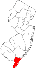 | |
| Boroughs | ||
| Townships | ||
| CDPs | ||
| Other unincorporated communities | ||