Erma, New Jersey
| Erma, New Jersey | |
|---|---|
| Census-designated place | |
|
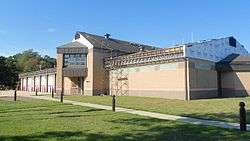
Erma Volunteer Fire Company | |
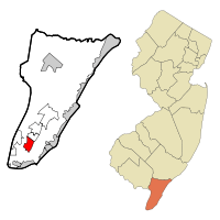 Map of Erma CDP in Cape May County. Inset: Location of Cape May County in New Jersey. | |
| Coordinates: 38°59′49″N 74°53′28″W / 38.996931°N 74.891122°WCoordinates: 38°59′49″N 74°53′28″W / 38.996931°N 74.891122°W | |
| Country |
|
| State |
|
| County | Cape May |
| Township | Lower |
| Area[1] | |
| • Total | 3.360 sq mi (8.702 km2) |
| • Land | 3.260 sq mi (8.443 km2) |
| • Water | 0.100 sq mi (0.258 km2) 2.97% |
| Elevation[2] | 10 ft (3 m) |
| Population (2010 Census)[3] | |
| • Total | 2,134 |
| • Density | 654.6/sq mi (252.7/km2) |
| Time zone | Eastern (EST) (UTC-5) |
| • Summer (DST) | Eastern (EDT) (UTC-4) |
| ZIP code | 08204 - Cape May[4] |
| Area code(s) | 609 |
| FIPS code | 3421660[1][5] |
| GNIS feature ID | 02389049[1][6] |
Erma is an unincorporated community and census-designated place (CDP) located within Lower Township in Cape May County, New Jersey, United States.[7] As of the 2010 United States Census, the CDP's population was 2,134.[3]
Geography
According to the United States Census Bureau, the CDP had a total area of 3.360 square miles (8.702 km2), including 3.260 square miles (8.443 km2) of land and 0.100 square miles (0.258 km2) of water (2.97%).[1][8]
Demographics
| Historical population | |||
|---|---|---|---|
| Census | Pop. | %± | |
| 1990 | 2,045 | — | |
| 2000 | 2,088 | 2.1% | |
| 2010 | 2,134 | 2.2% | |
| Population sources: 2000[9] 2010[3] | |||
Census 2010
At the 2010 United States Census, there were 2,134 people, 821 households, and 596 families residing in the CDP. The population density was 654.6 per square mile (252.7/km2). There were 920 housing units at an average density of 282.2 per square mile (109.0/km2). The racial makeup of the CDP was 95.74% (2,043) White, 1.12% (24) Black or African American, 0.23% (5) Native American, 0.94% (20) Asian, 0.14% (3) Pacific Islander, 0.70% (15) from other races, and 1.12% (24) from two or more races. Hispanics or Latinos of any race were 2.62% (56) of the population.[3]
There were 821 households, of which 26.6% had children under the age of 18 living with them, 55.9% were married couples living together, 10.8% had a female householder with no husband present, and 27.4% were non-families. 22.9% of all households were made up of individuals, and 9.9% had someone living alone who was 65 years of age or older. The average household size was 2.59 and the average family size was 3.04.[3]
In the CDP, 21.2% of the population were under the age of 18, 8.4% from 18 to 24, 21.4% from 25 to 44, 34.3% from 45 to 64, and 14.8% who were 65 years of age or older. The median age was 44.4 years. For every 100 females there were 96.7 males. For every 100 females age 18 and over, there were 94.3 males.[3]
Census 2000
As of the 2000 United States Census[5] of 2000, there were 2,088 people, 751 households, and 561 families residing in the CDP. The population density was 240.7/km2 (623.3/mi2). There were 846 housing units at an average density of 97.5/km2 (252.6/mi2). The racial makeup of the CDP was 97.22% White, 0.48% African American, 0.05% Native American, 1.05% Asian, 0.48% from other races, and 0.72% from two or more races. Hispanic or Latino of any race were 1.68% of the population.[9]
There were 751 households out of which 38.9% had children under the age of 18 living with them, 60.7% were married couples living together, 10.3% had a female householder with no husband present, and 25.2% were non-families. 20.8% of all households were made up of individuals and 8.7% had someone living alone who was 65 years of age or older. The average household size was 2.77 and the average family size was 3.24.[9]
In the CDP the population was spread out with 28.4% under the age of 18, 7.3% from 18 to 24, 27.9% from 25 to 44, 24.1% from 45 to 64, and 12.3% who were 65 years of age or older. The median age was 38 years. For every 100 females there were 97.5 males. For every 100 females age 18 and over, there were 89.6 males.[9]
The median income for a household in the CDP was $64,261, and the median income for a family was $69,063. Males had a median income of $45,694 versus $21,923 for females. The per capita income for the CDP was $20,765. About 1.8% of families and 3.9% of the population were below the poverty line, including 4.9% of those under age 18 and 6.5% of those age 65 or over.[9]
Transportation
The main transportation route for Erma is U.S. Route 9. The Cape May Airport is located in Erma.
Notable people
People who were born in, residents of, or otherwise closely associated with Erma include:
- Charles W. Sandman, Jr. (1921-1985), represented New Jersey's 2nd congressional district from 1967 to 1975.[10]
- Matt Szczur (born 1989), outfielder for the Chicago Cubs.[11]
References
- 1 2 3 4 Gazetteer of New Jersey Places, United States Census Bureau. Accessed July 21, 2016.
- ↑ U.S. Geological Survey Geographic Names Information System: Erma Census Designated Place, Geographic Names Information System. Accessed October 18, 2012.
- 1 2 3 4 5 6 DP-1 - Profile of General Population and Housing Characteristics: 2010 Demographic Profile Data for Erma CDP, New Jersey, United States Census Bureau. Accessed October 18, 2012.
- ↑ Look Up a ZIP Code for Erma, NJ, United States Postal Service. Accessed October 18, 2012.
- 1 2 American FactFinder, United States Census Bureau. Accessed September 4, 2014.
- ↑ US Board on Geographic Names, United States Geological Survey. Accessed September 4, 2014.
- ↑ New Jersey: 2010 - Population and Housing Unit Counts - 2010 Census of Population and Housing (CPH-2-32), United States Census Bureau, August 2012. Accessed October 18, 2012.
- ↑ US Gazetteer files: 2010, 2000, and 1990, United States Census Bureau. Accessed September 4, 2014.
- 1 2 3 4 5 DP-1 - Profile of General Demographic Characteristics: 2000 from the Census 2000 Summary File 1 (SF 1) 100-Percent Data for Erma CDP, New Jersey, United States Census Bureau. Accessed October 18, 2012.
- ↑ Kerr, Peter. "Ex-Rep. Charles Sandman, Nixon Supporter, Dies", The New York Times, August 27, 1985. Accessed October 18, 2012. "He was 64 and lived in Erma Park, N.J"
- ↑ Caldwell, Dave. "Two Sports, One Big Choice", The New York Times, December 16, 2010. Accessed October 20, 2016. "Szczur, a senior from Erma, N.J., gained attention late in the 2009 season after the National Marrow Donor Program determined that his bone marrow was a match for a 13-month-old girl with juvenile leukemia."
External links
Municipalities and communities of Cape May County, New Jersey, United States | ||
|---|---|---|
| Cities | 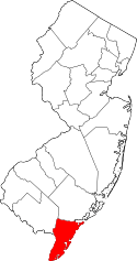 | |
| Boroughs | ||
| Townships | ||
| CDPs | ||
| Other unincorporated communities | ||