Seibert, Colorado
| Town of Seibert, Colorado | |
|---|---|
| Town | |
 Location in Kit Carson County and the state of Colorado | |
| Coordinates: 39°17′58″N 102°52′13″W / 39.29944°N 102.87028°WCoordinates: 39°17′58″N 102°52′13″W / 39.29944°N 102.87028°W | |
| Country |
|
| State |
|
| County[1] | Kit Carson County |
| Incorporated | June 21, 1917[2] |
| Government | |
| • Type | Statutory Town[1] |
| Area | |
| • Total | 0.3 sq mi (0.8 km2) |
| • Land | 0.3 sq mi (0.8 km2) |
| • Water | 0 sq mi (0 km2) |
| Elevation[3] | 4,711 ft (1,436 m) |
| Population (2010) | |
| • Total | 181(Estimated at 220 as of 2,015[4]) |
| Time zone | MST (UTC-7) |
| • Summer (DST) | MDT (UTC-6) |
| ZIP code[5] | 80834 |
| Area code(s) | 970 |
| FIPS code | 08-69040 |
| GNIS feature ID | 0195118 |
Seibert is a Statutory Town in Kit Carson County, Colorado, United States. The population was 181 at the 2010 census and is, as of 2015, estimated to be 220.[4][6]
A post office called Seibert has been in operation since 1888.[7] The community was named after Henry Seibert, a railroad agent.[8]
Geography
Seibert is located at 39°17′58″N 102°52′13″W / 39.29944°N 102.87028°W (39.299456, -102.870204).[9]
According to the United States Census Bureau, the town has a total area of 0.3 square miles (0.78 km2), all of it being land.
Demographics
| Historical population | |||
|---|---|---|---|
| Census | Pop. | %± | |
| 1920 | 311 | — | |
| 1930 | 273 | −12.2% | |
| 1940 | 249 | −8.8% | |
| 1950 | 346 | 39.0% | |
| 1960 | 210 | −39.3% | |
| 1970 | 192 | −8.6% | |
| 1980 | 180 | −6.2% | |
| 1990 | 181 | 0.6% | |
| 2000 | 180 | −0.6% | |
| 2010 | 181 | 0.6% | |
| Est. 2015 | 220 | [10] | 21.5% |
As of the census[12] of 2000, there were 180 people, 93 households, and 54 families residing in the town. The population density was 565.2 people per square mile (217.2/km²). There were 106 housing units at an average density of 332.8 per square mile (127.9/km²). The racial makeup of the town was 95.56% White, 0.56% Native American, and 3.89% from two or more races. Hispanic or Latino of any race were 2.22% of the population.
There were 93 households out of which 16.1% had children under the age of 18 living with them, 48.4% were married couples living together, 7.5% had a female householder with no husband present, and 40.9% were non-families. 36.6% of all households were made up of individuals and 21.5% had someone living alone who was 65 years of age or older. The average household size was 1.94 and the average family size was 2.51.
In the town the population was spread out with 16.1% under the age of 18, 1.7% from 18 to 24, 26.1% from 25 to 44, 26.7% from 45 to 64, and 29.4% who were 65 years of age or older. The median age was 49 years. For every 100 females there were 106.9 males. For every 100 females age 18 and over, there were 93.6 males.
The median income for a household in the town was $24,583, and the median income for a family was $32,083. Males had a median income of $30,000 versus $12,500 for females. The per capita income for the town was $16,806. About 7.8% of families and 13.3% of the population were below the poverty line, including 25.0% of those under the age of eighteen and 8.9% of those sixty five or over.
See also
References
- 1 2 "Active Colorado Municipalities". State of Colorado, Department of Local Affairs. Retrieved 2007-09-01.
- ↑ "Colorado Municipal Incorporations". State of Colorado, Department of Personnel & Administration, Colorado State Archives. 2004-12-01. Retrieved 2007-09-02.
- ↑ "US Board on Geographic Names". United States Geological Survey. 2007-10-25. Retrieved 2008-01-31.
- 1 2 http://factfinder.census.gov/faces/nav/jsf/pages/community_facts.xhtml?src=bkmk
- ↑ "ZIP Code Lookup" (JavaScript/HTML). United States Postal Service. Retrieved January 1, 2008.
- ↑ "2010 City Population and Housing Occupancy Status". U.S. Census Bureau. Retrieved June 7, 2012.
- ↑ "Post offices". Jim Forte Postal History. Retrieved 9 July 2016.
- ↑ Dawson, John Frank. Place names in Colorado: why 700 communities were so named, 150 of Spanish or Indian origin. Denver, CO: The J. Frank Dawson Publishing Co. p. 46.
- ↑ "US Gazetteer files: 2010, 2000, and 1990". United States Census Bureau. 2011-02-12. Retrieved 2011-04-23.
- ↑ "Annual Estimates of the Resident Population for Incorporated Places: April 1, 2010 to July 1, 2015". Retrieved July 2, 2016.
- ↑ "Census of Population and Housing". Census.gov. Retrieved June 4, 2015.
- ↑ "American FactFinder". United States Census Bureau. Retrieved 2008-01-31.
External links
Municipalities and communities of Kit Carson County, Colorado, United States | ||
|---|---|---|
| City | 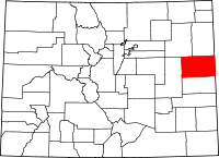 | |
| Towns | ||
