Sande, Møre og Romsdal
| Sande kommune | |||
|---|---|---|---|
| Municipality | |||
|
View of the Rovdefjorden (Sande is to the left) | |||
| |||
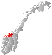
 Sande within Møre og Romsdal | |||
| Coordinates: 62°15′30″N 05°25′53″E / 62.25833°N 5.43139°ECoordinates: 62°15′30″N 05°25′53″E / 62.25833°N 5.43139°E | |||
| Country | Norway | ||
| County | Møre og Romsdal | ||
| District | Sunnmøre | ||
| Administrative centre | Larsnes | ||
| Government | |||
| • Mayor (2007) | Dag Vaagen (H) | ||
| Area | |||
| • Total | 93.13 km2 (35.96 sq mi) | ||
| • Land | 90.10 km2 (34.79 sq mi) | ||
| • Water | 3.03 km2 (1.17 sq mi) | ||
| Area rank | 392 in Norway | ||
| Population (2010) | |||
| • Total | 2,628 | ||
| • Rank | 293 (out of 428) in Norway | ||
| • Density | 29.2/km2 (76/sq mi) | ||
| • Change (10 years) | 1.1 % | ||
| Demonym(s) | Sandeværing[1] | ||
| Time zone | CET (UTC+1) | ||
| • Summer (DST) | CEST (UTC+2) | ||
| ISO 3166 code | NO-1514 | ||
| Official language form | Nynorsk | ||
| Website |
www | ||
|
| |||


Sande is a municipality in Møre og Romsdal county, Norway. It is part of the Sunnmøre region. The administrative centre is the village of Larsnes on the island of Gurskøya. Other villages in Sande include Gursken, Sandshamn, Bringsinghaug, and Voksa.
General information
Sande was established as a municipality on 1 January 1867 when it was separated from the large Herøy Municipality. The initial population was 2,493. On 1 January 1873, a part of eastern Sande (with 362 residents) was transferred back to Herøy. On 1 January 1889, the Eksund area and the island of Ekø (population: 119) were transferred to Herøy Municipality.
On 1 January 1905, the eastern district of Sande was separated to form the separate municipality of Rovde. This left Sande with 2,221 residents. On 1 January 1964, the northern part of the municipality of Rovde (population: 562) plus three farms in the Gurskedalen valley (population: 25) were merged back with Sande (the southern part of Rovde was merged with Vanylven Municipality). The new Sande municipality had a population of 3,465. On 1 January 2002, the Åram area (population: 380) on the mainland was transferred from Sande to Vanylven Municipality.[2][3]
Name
The municipality (originally the parish) is named after the old Sande farm (Old Norse: Sandr), since the first church (Sande Church) was built there. The name is identical with the word sandr which means "sand" or "sandy beach". Before 1892, the name was written Sandø.[4]
Coat-of-arms
The coat-of-arms is from modern times. They were granted in 1987. The arms show a silver line buoy on a blue background. This symbol was chosen since it was historically used by fishermen in ocean and fjords around the island municipality.[5]
Churches
The Church of Norway has two parishes (sokn) within the municipality of Sande. It is part of the Søre Sunnmøre deanery in the Diocese of Møre.
| Parish (Sokn) | Church Name | Location of the Church | Year Built |
|---|---|---|---|
| Sande | Sande Church | Sande on Sandsøya | 1880 |
| Gursken | Gursken Church | Gursken | 1919 |
| Larsnes Chapel | Larsnes | 1989 |
Geography
Sande is composed of many islands including Sandsøya, Kvamsøya, Voksa, Riste, and part of Gurskøya (which is shared with neighboring Herøy). The island municipality sits north of the Rovdefjorden and east of the Vanylvsfjorden. The Haugsholmen Lighthouse sits in the southwest part of the municipality.
Famous residents
- Jan Åge Fjørtoft, (born 1967)
- Bjartmar Gjerde, (born 1931)
- Tore Myklebust, (born 1990)
References
- ↑ "Navn på steder og personer: Innbyggjarnamn" (in Norwegian). Språkrådet. Retrieved 2015-12-01.
- ↑ Jukvam, Dag (1999). "Historisk oversikt over endringer i kommune- og fylkesinndelingen" (PDF) (in Norwegian). Statistisk sentralbyrå.
- ↑ Statistisk sentralbyrå (2001). "1511 Vanylven. Population 1 January and population changes during the year. 1951-" (in Norwegian).
- ↑ Rygh, Oluf (1908). Norske gaardnavne: Romsdals amt (in Norwegian) (13 ed.). Kristiania, Norge: W. C. Fabritius & sønners bogtrikkeri. p. 18.
- ↑ "Møre og Romsdal fylke" (in Norwegian). Retrieved 2008-10-19.
External links
 Media related to Sande, Møre og Romsdal at Wikimedia Commons
 Møre og Romsdal travel guide from Wikivoyage