Giske
| Giske kommune | |||
|---|---|---|---|
| Municipality | |||
 | |||
| |||
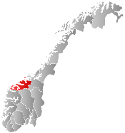
 Giske within Møre og Romsdal | |||
| Coordinates: 62°33′45″N 06°06′07″E / 62.56250°N 6.10194°ECoordinates: 62°33′45″N 06°06′07″E / 62.56250°N 6.10194°E | |||
| Country | Norway | ||
| County | Møre og Romsdal | ||
| District | Sunnmøre | ||
| Administrative centre | Valderhaug | ||
| Government | |||
| • Mayor (2003) | Knut Støbakk (KrF) | ||
| Area | |||
| • Total | 40.19 km2 (15.52 sq mi) | ||
| • Land | 39.53 km2 (15.26 sq mi) | ||
| • Water | 0.66 km2 (0.25 sq mi) | ||
| Area rank | 422 in Norway | ||
| Population (2013) | |||
| • Total | 7,541 | ||
| • Rank | 150 in Norway | ||
| • Density | 190.8/km2 (494/sq mi) | ||
| • Change (10 years) | 16.1 % | ||
| Time zone | CET (UTC+1) | ||
| • Summer (DST) | CEST (UTC+2) | ||
| ISO 3166 code | NO-1532 | ||
| Official language form | Nynorsk | ||
| Website |
www | ||
|
| |||

Giske is an island municipality in Møre og Romsdal county, Norway. The municipality lies north-northwest of the town of Ålesund in the traditional district of Sunnmøre. The municipal center is Valderhaugstrand. Other population centers include the villages of Roald (on Vigra island) and Alnes and Leitebakk (both on Godøy island). The municipality is part of the Ålesund Region.
General information


Giske Municipality was established on 1 January 1908 when it was separated from the large municipality of Borgund. The initial population of the new municipality was 1,708 and it included the islands of Valderøya, Godøya, and Giske. Then on 1 January 1964, the neighboring Vigra Municipality (on the island of Vigra was merged into Giske Municipality. The newly enlarged municipality had a population of 4,644.[1]
Name
The municipality is named after the farm and island Giske (Old Norse: Gizki), since the first church (Giske Church) was built there. The name is (probably) identical with the word gizki which means "tablecloth" or "rag" (maybe because the island is small and flat).[2]
Coat-of-arms
The coat-of-arms is from modern times. It was granted on 14 June 1985, but it has old roots. It is a gold lion rampant (i.e., in walking position) guardant (i.e., facing the viewer) on a blue shield. The arms are based on the old seal of Erling Vidkunsson, who already used the lion on his seal in 1355. His family was one of the most wealthy and influential families in the county, and had their origins and estate on Giske.[3]
Churches
The Church of Norway has three parishes (sokn) within the municipality of Giske. It is part of the Nordre Sunnmøre deanery in the Diocese of Møre.
| Parish (Sokn) | Church Name | Location of the Church | Year Built |
|---|---|---|---|
| Giske | Giske Church | Giske | 1170 |
| Godøy Chapel | Geilevika on Godøy | 1953 | |
| Valderøy | Valderøy Church | Nordstrand | 1961 |
| Vigra | Vigra Church | Vigra | 1894 |
Politics
In the 2007 municipal elections, Giske recorded the highest vote for the Christian Democratic Party in Norway at 43.2 percent.
Municipal council
The municipal council (Kommunestyre) of Giske is made up of 23 representatives that are elected to every four years. For 2011–2015, the party breakdown is as follows:[4]
| Party Name | Name in Norwegian | Number of representatives | |
|---|---|---|---|
| Labour Party | Arbeiderpartiet | 3 | |
| Progress Party | Fremskrittspartiet | 2 | |
| Conservative Party | Høyre | 5 | |
| Christian Democratic Party | Kristelig Folkeparti | 8 | |
| Centre Party | Senterpartiet | 1 | |
| Liberal Party | Venstre | 4 | |
| Total number of members: | 23 | ||
Geography

The municipality is composed of four main islands: Giske, which gives its name to the municipality because of its historical importance, Vigra, which is where Ålesund's airport is located, Valderøya, where the municipal administration is located, and Godøya. There are also many smaller islands within its boundaries. The Alnes Lighthouse, Erkna Lighthouse, and Storholmen lighthouse are all located on islands in the municipality.
The main islands are all connected to the mainland of Norway by a network of tunnels and bridges. Godøy Tunnel connects Godøy to Giske island. Giske Bridge connects Giske island and Valderøy. A causeway connects Vigra island and Valderøy island. All islands are connected to Valderøy island which is where the main Valderøy Tunnel connects the whole municipality to Ellingsøya island in Ålesund Municipality. Finally, the Ellingsøy Tunnel connects that island to the town of Ålesund.
History
Giske is the site of Mjelthaugen, an ancient burial place dating from the Bronze Age. The site was the location of excavations in 1847, 1867 and 1878. Giske is also the place where, according to Snorre Sturlason, Harald Fairhair had his hair cut after uniting Norway. The historic Giske Church is also located on the island of Giske.[5]
References
- ↑ Jukvam, Dag (1999). "Historisk oversikt over endringer i kommune- og fylkesinndelingen" (PDF) (in Norwegian). Statistisk sentralbyrå.
- ↑ Rygh, Oluf (1908). Norske gaardnavne: Romsdals amt (in Norwegian) (13 ed.). Kristiania, Norge: W. C. Fabritius & sønners bogtrikkeri. p. 188.
- ↑ Norske Kommunevåpen (1990). "Nye kommunevåbener i Norden". Retrieved 18 October 2008.
- ↑ "Members of the local councils". Statistics Norway. 2007. Retrieved 19 June 2008.
- ↑ Giske church and Mjelthaugen (Visit Giske)
| Wikimedia Commons has media related to Giske. |
External links
-
 Møre og Romsdal travel guide from Wikivoyage