Rindal
| Rindal kommune | |||
|---|---|---|---|
| Municipality | |||
| |||
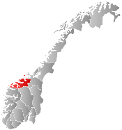
 Rindal within Møre og Romsdal | |||
| Coordinates: 63°02′32″N 09°17′22″E / 63.04222°N 9.28944°ECoordinates: 63°02′32″N 09°17′22″E / 63.04222°N 9.28944°E | |||
| Country | Norway | ||
| County | Møre og Romsdal | ||
| District | Nordmøre | ||
| Administrative centre | Rindal | ||
| Government | |||
| • Mayor (2011) | Ola T. Heggem (Sp) | ||
| Area | |||
| • Total | 631.84 km2 (243.95 sq mi) | ||
| • Land | 611.10 km2 (235.95 sq mi) | ||
| • Water | 20.74 km2 (8.01 sq mi) | ||
| Area rank | 175 in Norway | ||
| Population (2013) | |||
| • Total | 2,061 | ||
| • Rank | 334 in Norway | ||
| • Density | 3.4/km2 (9/sq mi) | ||
| • Change (10 years) | -2.6 % | ||
| Demonym(s) | Rindaling[1] | ||
| Time zone | CET (UTC+1) | ||
| • Summer (DST) | CEST (UTC+2) | ||
| ISO 3166 code | NO-1567 | ||
| Official language form | Neutral | ||
| Website |
www | ||
|
| |||

Rindal is a municipality in Møre og Romsdal county, Norway. It is part of the Nordmøre region. The administrative centre is the village of Rindal. The municipality centres on agriculture and forestry services. The municipality is the only landlocked municipality in the entire county.[2]
General information

The parish of Rindal was established as a municipality in 1858 when it was separated from Surnadal Municipality. The initial population of Rindal was 2,684.[3] On 1 January 2008, the Fossdalen farm (population: 4) was transferred from Rindal (in Møre og Romsdal county) to Hemne Municipality (in Sør-Trøndelag county).[4]
Name
The municipality (originally the parish) is named after the old Rindal farm (Old Norse: Rindudalr), since the first church (Rindal Church) was built there. The first element is the genitive case of the river name Rinda and the last element is dalr which means "valley" or "dale". The river name is derived from the verb rinna which means to "run" or "flow". Before 1918, the name was written Rindalen.[5]
Coat-of-arms
The coat-of-arms is from modern times. They were granted on 20 January 1989. The arms show a yellow gavel on a green background. The gavel is meant to represent John Neergaard, who is considered the father of municipal governments in Norway, (formannskapets far), who was from Rindal. He was responsible for pushing for local government reform which led to the Formannskapsdistrikt law in 1837.[6]
Churches
The Church of Norway has one parish (sokn) within the municipality of Rindal. It is part of the Indre Nordmøre deanery in the Diocese of Møre.
| Parish (Sokn) | Church Name | Location of the Church | Year Built |
|---|---|---|---|
| Rindal | Rindal Church | Rindal | 1874 |
| Øvre Rindal Chapel | Tiset | 1911 |
Geography


The municipality lies in the northeastern part of Møre og Romsdal county, along the border with Sør-Trøndelag county. Rindal is the only landlocked municipality in Møre og Romsdal county. The lakes Foldsjøen and Gråsjøen lie along the border with Surnadal to the southwest. The large river Surna begins in Rindal at the confluence of the rivers Tiåa and Lomunda. The Trollheimen mountain range runs through southern Rindal.
Surnadal Municipality lies to the west in Møre og Romsdal. Rindal shares a border with five other municipalities in Sør-Trøndelag county to the north, east, and south: Hemne, Orkdal, Meldal, Rennebu, and Oppdal.
Notable residents
- Ola T. Heggem (born 1952), politician for the Centre Party
- Thorvald Heggem (1907–1976), Nordic combined skier and cross country skier
- Sigurd Røen (1909–1992) Nordic skier who competed in the 1930s
References
- ↑ "Navn på steder og personer: Innbyggjarnamn" (in Norwegian). Språkrådet. Retrieved 2015-12-01.
- ↑ Store norske leksikon. "Rindal" (in Norwegian). Retrieved 2010-12-10.
- ↑ Jukvam, Dag (1999). "Historisk oversikt over endringer i kommune- og fylkesinndelingen" (PDF) (in Norwegian). Statistisk sentralbyrå.
- ↑ Statistisk sentralbyrå (8 Nov 2012). "Endringer i kommuneinndelingen og andre regionale inndelinger" (in Norwegian).
- ↑ Rygh, Oluf (1908). Norske gaardnavne: Romsdals amt (in Norwegian) (13 ed.). Kristiania, Norge: W. C. Fabritius & sønners bogtrikkeri. p. 423.
- ↑ "Kommunevåpenet til Rindal kommune". Rindal Kommune. Retrieved 2008-10-19.
External links
 Media related to Rindal at Wikimedia Commons
 Møre og Romsdal travel guide from Wikivoyage