Saint-Rémy-de-Provence
| Saint-Rémy-de-Provence | ||
|---|---|---|
|
Roman site 'Les Antiques' of Glanum, with the Mausoleum (left) and the Arch (right) | ||
| ||
 Saint-Rémy-de-Provence | ||
|
Location within Provence-A.-C.d'A. region  Saint-Rémy-de-Provence | ||
| Coordinates: 43°47′24″N 4°49′57″E / 43.79°N 4.8325°ECoordinates: 43°47′24″N 4°49′57″E / 43.79°N 4.8325°E | ||
| Country | France | |
| Region | Provence-Alpes-Côte d'Azur | |
| Department | Bouches-du-Rhône | |
| Arrondissement | Arles | |
| Canton | Saint-Rémy-de-Provence | |
| Intercommunality | Vallée des Baux | |
| Government | ||
| • Mayor (2008–2014) | Hervé Chérubini | |
| Area1 | 89.09 km2 (34.40 sq mi) | |
| Population (2012)2 | 10,406 | |
| • Density | 120/km2 (300/sq mi) | |
| Time zone | CET (UTC+1) | |
| • Summer (DST) | CEST (UTC+2) | |
| INSEE/Postal code | 13100 / 13210 | |
| Elevation |
7–392 m (23–1,286 ft) (avg. 60 m or 200 ft) | |
|
1 French Land Register data, which excludes lakes, ponds, glaciers > 1 km² (0.386 sq mi or 247 acres) and river estuaries. 2 Population without double counting: residents of multiple communes (e.g., students and military personnel) only counted once. | ||

.svg.png)
Saint-Rémy-de-Provence (Provençal Occitan: Sant Romieg de Provença in classical and Sant Roumié de Prouvènço in Mistralian norms) is a commune in the Bouches-du-Rhône department in southern France.
History
The town is named after Saint Remigius.
Geography
Saint-Rémy-de-Provence is situated about 20 km (12 mi) south of Avignon, just north of the Alpilles mountain range.
Transportation
The high-speed train station (TGV) is 20 km from the city. The closest airports are located in Avignon, Nîmes, and Marseille. Also, there are several highways and main roads which serve Saint-Remy. The A7 autoroute, which runs down the Rhone valley and connects Lyon to Marseille via Orange is about 12 km (7.5 mi) east of Saint Remy. The A54 autoroute runs from Nîmes to Salon-de-Provence, and passes through Arles, 17 km (11 mi)away. Finally, the A9 is 20 km to the north-west and runs from Orange to Perpignan via Montpelier.
Climate
The climate in the Alpilles is considered Mediterranean. Winters there are gentle and dry, and summers are hot and dry. The highest average temperature is recorded in July and August 29 °C (84 °F), and the lowest in December and January 3 °C (37 °F). The rainiest month is January with an average of 7 rainy days, compared with July, the driest month, with an average of 2 rainy days. The Alpilles region receives more precipitation than the French Rivera, 1–2 cm more per year. There are about 30 days of frost per year. Snow is rare, but can be heavy when it does fall.
The Mistral
The mistral is a wind which blows violently from the north or the north-west, especially during winter and spring. A strong wind is felt 100 days per year on average, and a weaker wind 83 days. This leaves about 182 days without wind. There are two types of "mistral": the white mistral where the sky clears and the natural light increases, and the black mistral which is rarer but accompanied by rain.
Population
| Historical population | ||
|---|---|---|
| Year | Pop. | ±% |
| 1793 | 5,055 | — |
| 1800 | 5,055 | +0.0% |
| 1806 | 5,737 | +13.5% |
| 1821 | 5,181 | −9.7% |
| 1831 | 5,464 | +5.5% |
| 1836 | 5,007 | −8.4% |
| 1841 | 5,930 | +18.4% |
| 1846 | 6,077 | +2.5% |
| 1851 | 6,124 | +0.8% |
| 1856 | 6,340 | +3.5% |
| 1861 | 6,348 | +0.1% |
| 1866 | 6,315 | −0.5% |
| 1872 | 6,030 | −4.5% |
| 1876 | 5,999 | −0.5% |
| 1881 | 5,815 | −3.1% |
| 1886 | 5,815 | +0.0% |
| 1891 | 5,636 | −3.1% |
| 1896 | 5,976 | +6.0% |
| 1901 | 6,009 | +0.6% |
| 1906 | 6,148 | +2.3% |
| 1911 | 6,174 | +0.4% |
| 1921 | 5,938 | −3.8% |
| 1926 | 6,369 | +7.3% |
| 1931 | 6,598 | +3.6% |
| 1936 | 6,723 | +1.9% |
| 1946 | 6,877 | +2.3% |
| 1954 | 6,893 | +0.2% |
| 1962 | 7,582 | +10.0% |
| 1968 | 8,044 | +6.1% |
| 1975 | 7,923 | −1.5% |
| 1982 | 8,402 | +6.0% |
| 1990 | 9,340 | +11.2% |
| 1999 | 9,806 | +5.0% |
| 2008 | 10,662 | +8.7% |
Sights
On the southern outskirts of the city, the ruins of the Roman city of Glanum can still be seen, including a "triumphal arch".
Notable people
- Saint-Rémy-de-Provence was the birthplace of Nostradamus, a 16th-century author of prophecies.
- Marie Gasquet, a Provençale novelist and queen of the Felibrige, was born in Saint-Remy-de-Provence.
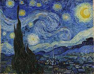
- The painter Vincent van Gogh was treated here in the psychiatric center at Monastery Saint-Paul de Mausole (1889–1890).
- Pierre Daboval (1918-2015), artist, lived for many years in Saint-Rémy-de-Provence.
- Princess Caroline of Monaco and her children lived in Saint-Rémy for several years following the death of her second husband, Stefano Casiraghi.
- In 1952 soaring over the mountains here Charles Atger set the world duration record in a sailplane. He stayed aloft for 56 hours and 15 minutes. Because of concerns over pilot exhaustion, this record category has been discontinued.
See also
References
External links
| Wikimedia Commons has media related to Saint-Rémy-de-Provence. |
- Saint Rémy de Provence Tourist office website
- The Complete Works of Van Gogh, Saint-Rémy
- Official site (in French)
- Google aerial view
- Information and photos from ProvenceBeyond website