Châteauneuf-le-Rouge
| Châteauneuf-le-Rouge | ||
|---|---|---|
|
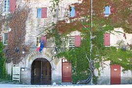
Town hall | ||
| ||
 Châteauneuf-le-Rouge | ||
|
Location within Provence-A.-C.d'A. region  Châteauneuf-le-Rouge | ||
| Coordinates: 43°29′26″N 5°34′14″E / 43.4906°N 5.5706°ECoordinates: 43°29′26″N 5°34′14″E / 43.4906°N 5.5706°E | ||
| Country | France | |
| Region | Provence-Alpes-Côte d'Azur | |
| Department | Bouches-du-Rhône | |
| Arrondissement | Aix-en-Provence | |
| Canton | Trets | |
| Intercommunality | Pays d'Aix | |
| Government | ||
| • Mayor (2008–2014) | Michel Boulan | |
| Area1 | 13.15 km2 (5.08 sq mi) | |
| Population (2008)2 | 2,104 | |
| • Density | 160/km2 (410/sq mi) | |
| Time zone | CET (UTC+1) | |
| • Summer (DST) | CEST (UTC+2) | |
| INSEE/Postal code | 13025 / 13790 | |
| Elevation |
179–511 m (587–1,677 ft) (avg. 348 m or 1,142 ft) | |
|
1 French Land Register data, which excludes lakes, ponds, glaciers > 1 km² (0.386 sq mi or 247 acres) and river estuaries. 2 Population without double counting: residents of multiple communes (e.g., students and military personnel) only counted once. | ||
.svg.png)
Châteauneuf-le-Rouge is a commune in the Bouches-du-Rhône department in southern France.
Population
| Historical population | ||
|---|---|---|
| Year | Pop. | ±% |
| 1793 | 209 | — |
| 1800 | 249 | +19.1% |
| 1806 | 204 | −18.1% |
| 1821 | 367 | +79.9% |
| 1831 | 401 | +9.3% |
| 1836 | 407 | +1.5% |
| 1841 | 380 | −6.6% |
| 1846 | 378 | −0.5% |
| 1851 | 382 | +1.1% |
| 1856 | 382 | +0.0% |
| 1861 | 395 | +3.4% |
| 1866 | 359 | −9.1% |
| 1872 | 325 | −9.5% |
| 1876 | 289 | −11.1% |
| 1881 | 232 | −19.7% |
| 1886 | 158 | −31.9% |
| 1891 | 146 | −7.6% |
| 1896 | 120 | −17.8% |
| 1901 | 127 | +5.8% |
| 1906 | 131 | +3.1% |
| 1911 | 138 | +5.3% |
| 1921 | 113 | −18.1% |
| 1926 | 100 | −11.5% |
| 1931 | 117 | +17.0% |
| 1936 | 114 | −2.6% |
| 1946 | 122 | +7.0% |
| 1954 | 112 | −8.2% |
| 1962 | 113 | +0.9% |
| 1968 | 165 | +46.0% |
| 1975 | 285 | +72.7% |
| 1982 | 1,071 | +275.8% |
| 1990 | 1,283 | +19.8% |
| 1999 | 1,869 | +45.7% |
| 2008 | 2,104 | +12.6% |
See also
References
| Wikimedia Commons has media related to Châteauneuf-le-Rouge. |
This article is issued from Wikipedia - version of the 2/11/2016. The text is available under the Creative Commons Attribution/Share Alike but additional terms may apply for the media files.