Saint-Épain
| Saint-Épain | ||
|---|---|---|
|
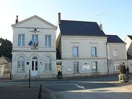
Town hall | ||
| ||
 Saint-Épain | ||
|
Location within Centre-Val de Loire region  Saint-Épain | ||
| Coordinates: 47°08′46″N 0°32′16″E / 47.1461°N 0.5378°ECoordinates: 47°08′46″N 0°32′16″E / 47.1461°N 0.5378°E | ||
| Country | France | |
| Region | Centre-Val de Loire | |
| Department | Indre-et-Loire | |
| Arrondissement | Chinon | |
| Canton | Sainte-Maure-de-Touraine | |
| Intercommunality | Sainte-Maure-de-Touraine | |
| Government | ||
| • Mayor (2009–2014) | Serge Lecomte | |
| Area1 | 62.65 km2 (24.19 sq mi) | |
| Population (2009)2 | 1,540 | |
| • Density | 25/km2 (64/sq mi) | |
| Time zone | CET (UTC+1) | |
| • Summer (DST) | CEST (UTC+2) | |
| INSEE/Postal code | 37216 / 37800 | |
| Elevation | 47–122 m (154–400 ft) | |
|
1 French Land Register data, which excludes lakes, ponds, glaciers > 1 km² (0.386 sq mi or 247 acres) and river estuaries. 2 Population without double counting: residents of multiple communes (e.g., students and military personnel) only counted once. | ||
.svg.png)
Saint-Épain is a commune in the Indre-et-Loire department in central France.
Population
| Historical population | ||
|---|---|---|
| Year | Pop. | ±% |
| 1793 | 2,037 | — |
| 1800 | 1,909 | −6.3% |
| 1806 | 1,884 | −1.3% |
| 1821 | 1,986 | +5.4% |
| 1831 | 2,128 | +7.2% |
| 1836 | 2,011 | −5.5% |
| 1841 | 2,044 | +1.6% |
| 1846 | 1,986 | −2.8% |
| 1851 | 2,010 | +1.2% |
| 1856 | 2,001 | −0.4% |
| 1861 | 1,980 | −1.0% |
| 1866 | 1,962 | −0.9% |
| 1872 | 1,964 | +0.1% |
| 1876 | 2,020 | +2.9% |
| 1881 | 1,966 | −2.7% |
| 1886 | 1,953 | −0.7% |
| 1891 | 1,981 | +1.4% |
| 1896 | 1,890 | −4.6% |
| 1901 | 1,856 | −1.8% |
| 1906 | 1,884 | +1.5% |
| 1911 | 1,853 | −1.6% |
| 1921 | 1,753 | −5.4% |
| 1926 | 1,700 | −3.0% |
| 1931 | 1,700 | +0.0% |
| 1936 | 1,689 | −0.6% |
| 1946 | 1,683 | −0.4% |
| 1954 | 1,685 | +0.1% |
| 1962 | 1,670 | −0.9% |
| 1968 | 1,525 | −8.7% |
| 1975 | 1,338 | −12.3% |
| 1982 | 1,409 | +5.3% |
| 1990 | 1,335 | −5.3% |
| 1999 | 1,418 | +6.2% |
| 2006 | 1,515 | +6.8% |
| 2009 | 1,540 | +1.7% |
See also
References
| Wikimedia Commons has media related to Saint-Épain. |
This article is issued from Wikipedia - version of the 6/9/2014. The text is available under the Creative Commons Attribution/Share Alike but additional terms may apply for the media files.