La Celle-Guenand
| La Celle-Guenand | |
|---|---|
|
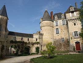
Chateau | |
 La Celle-Guenand | |
|
Location within Centre-Val de Loire region  La Celle-Guenand | |
| Coordinates: 46°56′41″N 0°53′41″E / 46.9447°N 0.8947°ECoordinates: 46°56′41″N 0°53′41″E / 46.9447°N 0.8947°E | |
| Country | France |
| Region | Centre-Val de Loire |
| Department | Indre-et-Loire |
| Arrondissement | Loches |
| Canton | Le Grand-Pressigny |
| Government | |
| • Mayor (2008–2014) | Alain Morève |
| Area1 | 36.7 km2 (14.2 sq mi) |
| Population (2009)2 | 392 |
| • Density | 11/km2 (28/sq mi) |
| Time zone | CET (UTC+1) |
| • Summer (DST) | CEST (UTC+2) |
| INSEE/Postal code | 37044 / 37350 |
| Elevation |
70–144 m (230–472 ft) (avg. 82 m or 269 ft) |
|
1 French Land Register data, which excludes lakes, ponds, glaciers > 1 km² (0.386 sq mi or 247 acres) and river estuaries. 2 Population without double counting: residents of multiple communes (e.g., students and military personnel) only counted once. | |
La Celle-Guenand is a commune in the Indre-et-Loire department in central France.
Population
| Historical population | ||
|---|---|---|
| Year | Pop. | ±% |
| 1793 | 772 | — |
| 1800 | 786 | +1.8% |
| 1806 | 648 | −17.6% |
| 1821 | 754 | +16.4% |
| 1831 | 900 | +19.4% |
| 1836 | 900 | +0.0% |
| 1841 | 898 | −0.2% |
| 1846 | 869 | −3.2% |
| 1851 | 861 | −0.9% |
| 1856 | 910 | +5.7% |
| 1861 | 898 | −1.3% |
| 1866 | 899 | +0.1% |
| 1872 | 850 | −5.5% |
| 1876 | 730 | −14.1% |
| 1881 | 728 | −0.3% |
| 1886 | 704 | −3.3% |
| 1891 | 696 | −1.1% |
| 1896 | 684 | −1.7% |
| 1901 | 702 | +2.6% |
| 1906 | 677 | −3.6% |
| 1911 | 673 | −0.6% |
| 1921 | 603 | −10.4% |
| 1926 | 674 | +11.8% |
| 1931 | 601 | −10.8% |
| 1936 | 624 | +3.8% |
| 1946 | 590 | −5.4% |
| 1954 | 594 | +0.7% |
| 1962 | 543 | −8.6% |
| 1968 | 509 | −6.3% |
| 1975 | 420 | −17.5% |
| 1982 | 365 | −13.1% |
| 1990 | 412 | +12.9% |
| 1999 | 362 | −12.1% |
| 2006 | 371 | +2.5% |
| 2009 | 392 | +5.7% |
See also
References
| Wikimedia Commons has media related to La Celle-Guenand. |
This article is issued from Wikipedia - version of the 6/8/2014. The text is available under the Creative Commons Attribution/Share Alike but additional terms may apply for the media files.