La Ferrière, Indre-et-Loire
| La Ferrière | |
|---|---|
|
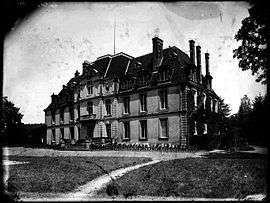
The Château of La Ferrière | |
 La Ferrière | |
|
Location within Centre-Val de Loire region  La Ferrière | |
| Coordinates: 47°37′45″N 0°44′52″E / 47.6292°N 0.7478°ECoordinates: 47°37′45″N 0°44′52″E / 47.6292°N 0.7478°E | |
| Country | France |
| Region | Centre-Val de Loire |
| Department | Indre-et-Loire |
| Arrondissement | Tours |
| Canton | Château-Renault |
| Government | |
| • Mayor (2008–2014) | Claudie Chevallier |
| Area1 | 15.76 km2 (6.08 sq mi) |
| Population (2009)2 | 290 |
| • Density | 18/km2 (48/sq mi) |
| Time zone | CET (UTC+1) |
| • Summer (DST) | CEST (UTC+2) |
| INSEE/Postal code | 37106 / 37110 |
| Elevation | 118–170 m (387–558 ft) |
|
1 French Land Register data, which excludes lakes, ponds, glaciers > 1 km² (0.386 sq mi or 247 acres) and river estuaries. 2 Population without double counting: residents of multiple communes (e.g., students and military personnel) only counted once. | |
La Ferrière is a commune in the Indre-et-Loire department in central France.
Population
| Historical population | ||
|---|---|---|
| Year | Pop. | ±% |
| 1793 | 507 | — |
| 1800 | 517 | +2.0% |
| 1806 | 586 | +13.3% |
| 1821 | 517 | −11.8% |
| 1831 | 494 | −4.4% |
| 1836 | 460 | −6.9% |
| 1841 | 489 | +6.3% |
| 1846 | 440 | −10.0% |
| 1851 | 401 | −8.9% |
| 1856 | 390 | −2.7% |
| 1861 | 366 | −6.2% |
| 1866 | 392 | +7.1% |
| 1872 | 377 | −3.8% |
| 1876 | 381 | +1.1% |
| 1881 | 391 | +2.6% |
| 1886 | 403 | +3.1% |
| 1891 | 392 | −2.7% |
| 1896 | 384 | −2.0% |
| 1901 | 371 | −3.4% |
| 1906 | 370 | −0.3% |
| 1911 | 367 | −0.8% |
| 1921 | 342 | −6.8% |
| 1926 | 363 | +6.1% |
| 1931 | 337 | −7.2% |
| 1936 | 303 | −10.1% |
| 1946 | 326 | +7.6% |
| 1954 | 279 | −14.4% |
| 1962 | 233 | −16.5% |
| 1968 | 222 | −4.7% |
| 1975 | 194 | −12.6% |
| 1982 | 206 | +6.2% |
| 1990 | 198 | −3.9% |
| 1999 | 214 | +8.1% |
| 2006 | 274 | +28.0% |
| 2009 | 290 | +5.8% |
See also
References
| Wikimedia Commons has media related to La Ferrière (Indre-et-Loire). |
This article is issued from Wikipedia - version of the 3/15/2016. The text is available under the Creative Commons Attribution/Share Alike but additional terms may apply for the media files.