Tauxigny
| Tauxigny | ||
|---|---|---|
|
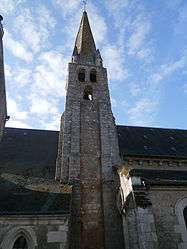
The church in Tauxigny | ||
| ||
 Tauxigny | ||
|
Location within Centre-Val de Loire region  Tauxigny | ||
| Coordinates: 47°12′53″N 0°50′07″E / 47.2147°N 0.8353°ECoordinates: 47°12′53″N 0°50′07″E / 47.2147°N 0.8353°E | ||
| Country | France | |
| Region | Centre-Val de Loire | |
| Department | Indre-et-Loire | |
| Arrondissement | Loches | |
| Canton | Loches | |
| Government | ||
| • Mayor (2008–2014) | André Audurier | |
| Area1 | 36.83 km2 (14.22 sq mi) | |
| Population (2009)2 | 1,240 | |
| • Density | 34/km2 (87/sq mi) | |
| Time zone | CET (UTC+1) | |
| • Summer (DST) | CEST (UTC+2) | |
| INSEE/Postal code | 37254 / 37310 | |
| Elevation | 67–114 m (220–374 ft) | |
|
1 French Land Register data, which excludes lakes, ponds, glaciers > 1 km² (0.386 sq mi or 247 acres) and river estuaries. 2 Population without double counting: residents of multiple communes (e.g., students and military personnel) only counted once. | ||
.svg.png)
Tauxigny is a commune in the Indre-et-Loire department in central France.
Population
| Historical population | ||
|---|---|---|
| Year | Pop. | ±% |
| 1793 | 1,180 | — |
| 1800 | 1,274 | +8.0% |
| 1806 | 1,238 | −2.8% |
| 1821 | 1,215 | −1.9% |
| 1831 | 1,308 | +7.7% |
| 1836 | 1,377 | +5.3% |
| 1841 | 1,311 | −4.8% |
| 1846 | 1,384 | +5.6% |
| 1851 | 1,335 | −3.5% |
| 1856 | 1,362 | +2.0% |
| 1861 | 1,311 | −3.7% |
| 1866 | 1,274 | −2.8% |
| 1872 | 1,242 | −2.5% |
| 1876 | 1,248 | +0.5% |
| 1881 | 1,230 | −1.4% |
| 1886 | 1,209 | −1.7% |
| 1891 | 1,172 | −3.1% |
| 1896 | 1,148 | −2.0% |
| 1901 | 1,150 | +0.2% |
| 1906 | 1,159 | +0.8% |
| 1911 | 1,147 | −1.0% |
| 1921 | 1,026 | −10.5% |
| 1926 | 1,064 | +3.7% |
| 1931 | 1,030 | −3.2% |
| 1936 | 1,017 | −1.3% |
| 1946 | 986 | −3.0% |
| 1954 | 990 | +0.4% |
| 1962 | 896 | −9.5% |
| 1968 | 819 | −8.6% |
| 1975 | 798 | −2.6% |
| 1982 | 866 | +8.5% |
| 1990 | 976 | +12.7% |
| 1999 | 1,090 | +11.7% |
| 2006 | 1,219 | +11.8% |
| 2009 | 1,240 | +1.7% |
See also
References
| Wikimedia Commons has media related to Tauxigny. |
This article is issued from Wikipedia - version of the 2/19/2015. The text is available under the Creative Commons Attribution/Share Alike but additional terms may apply for the media files.