Meldal
| Meldal kommune | |||
|---|---|---|---|
| Municipality | |||
|
View of the lake Frilsjøen | |||
| |||
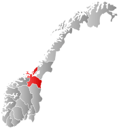
 Meldal within Sør-Trøndelag | |||
| Coordinates: 63°3′4″N 9°44′14″E / 63.05111°N 9.73722°ECoordinates: 63°3′4″N 9°44′14″E / 63.05111°N 9.73722°E | |||
| Country | Norway | ||
| County | Sør-Trøndelag | ||
| District | Orkdalen | ||
| Administrative centre | Meldal | ||
| Government | |||
| • Mayor (2011) | Are Hilstad (Sp) | ||
| Area | |||
| • Total | 613.34 km2 (236.81 sq mi) | ||
| • Land | 592.54 km2 (228.78 sq mi) | ||
| • Water | 20.80 km2 (8.03 sq mi) | ||
| Area rank | 181 in Norway | ||
| Population (2010) | |||
| • Total | 3,920 | ||
| • Rank | 230 in Norway | ||
| • Density | 6.6/km2 (17/sq mi) | ||
| • Change (10 years) | -1.8 % | ||
| Demonym(s) | Meldaling[1] | ||
| Time zone | CET (UTC+1) | ||
| • Summer (DST) | CEST (UTC+2) | ||
| ISO 3166 code | NO-1636 | ||
| Official language form | Neutral | ||
| Website |
www | ||
|
| |||


Meldal is a village and municipality in Sør-Trøndelag county, Norway. It is part of the Orkdalen region.
The administrative centre of the municipality is the village of Meldal. The 0.75-square-kilometre (190-acre) village of Meldal has a population (2013) of 628, giving the village a population density of 837 inhabitants per square kilometre (2,170/sq mi).[2] Other villages include Løkken Verk, Bjørnli, and Storås.
The municipality is most renowned for its mining activities at Løkken Verk, being the birthplace of the Orkla mining company, now Orkla Group. It is also home to the annual Storåsfestivalen music festival.
General information

Meldal was established as a municipality on 1 January 1838 (see formannskapsdistrikt). In 1839, the southern district of Rennebu was separated from Meldal to form a municipality of its own.[3]
Name
The Old Norse form of the name was Meðaldalr. The first element is meðal which means "middle" and the last element is dalr which means "valley" or "dale". The municipality is named this probably because it is located in the middle of the Orkdalen valley. The name was historically spelled Meldalen.[4]
Coat-of-arms
The coat-of-arms is from modern times. They were granted on 5 February 1985. The arms are a combination of a wheel as a symbol for the local industry, and a wheat ear as a symbol for the agriculture. Both items are yellow on a red background.[5]
Churches
The Church of Norway has two parishes (sokn) within the municipality of Meldal. It is part of the Deanery (prosti) of Orkdal and the Diocese of Nidaros.
| Parish (Sokn) | Church Name | Year Built | Location of the Church |
|---|---|---|---|
| Løkken | Løkken kirke | 1929 | Bjørnli |
| Meldal | Meldal kirke | 1988 | Meldal |
Geography
The municipality of Meldal is located along the Orkla River in the middle of the Orkdalen valley. The lakes Hostovatnet and Svorksjøen are located along the northern border of the municipality.
The municipality of Rindal (in Møre og Romsdal) lies to the west, Rennebu lies to the south, Midtre Gauldal and Melhus to the east, and Orkdal to the north.
The Løkken Station is the terminal station on the Thamshavn Line railway.
References
- ↑ "Navn på steder og personer: Innbyggjarnamn" (in Norwegian). Språkrådet. Retrieved 2015-12-01.
- ↑ Statistisk sentralbyrå (1 January 2013). "Urban settlements. Population and area, by municipality.".
- ↑ Jukvam, Dag (1999). "Historisk oversikt over endringer i kommune- og fylkesinndelingen" (PDF) (in Norwegian). Statistisk sentralbyrå.
- ↑ Rygh, Oluf (1901). Norske gaardnavne: Søndre Trondhjems amt (in Norwegian) (14 ed.). Kristiania, Norge: W. C. Fabritius & sønners bogtrikkeri. p. 149.
- ↑ Norske Kommunevåpen (1990). "Nye kommunevåbener i Norden". Retrieved 26 October 2008.
External links
| Wikimedia Commons has media related to Meldal. |
 Sør-Trøndelag travel guide from Wikivoyage
- Municipal fact sheet from Statistics Norway