Pilsen, Kansas
| Pilsen, Kansas | |
|---|---|
| Unincorporated community | |
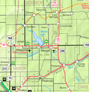 KDOT map of Marion County (legend) | |
 Pilsen  Pilsen | |
| Coordinates: 38°28′17″N 97°2′25″W / 38.47139°N 97.04028°WCoordinates: 38°28′17″N 97°2′25″W / 38.47139°N 97.04028°W[1] | |
| Country | United States |
| State | Kansas |
| County | Marion |
| Township | Clark, Clear Creek |
| Founded | 1874 |
| Elevation[1] | 1,434 ft (437 m) |
| Time zone | CST (UTC-6) |
| • Summer (DST) | CDT (UTC-5) |
| ZIP code | 66861 |
| Area code | 785 |
| FIPS code | 20-55875 [1] |
| GNIS feature ID | 0477246 [1] |
Pilsen is an unincorporated community in Marion County, Kansas, United States.[1][2] It is named after the city Plzeň (German: Pilsen) in Czech Republic, formerly Bohemia.[3] The community has always had a population less than 100, which is too low to incorporate as a city in Kansas.[3][4]
History
Early history
For many millennia, the Great Plains of North America was inhabited by nomadic Native Americans. From the 16th century to 18th century, the Kingdom of France claimed ownership of large parts of North America. In 1762, after the French and Indian War, France secretly ceded New France to Spain, per the Treaty of Fontainebleau.
19th century
In 1802, Spain returned most of the land to France. In 1803, most of the land for modern day Kansas was acquired by the United States from France as part of the 828,000 square mile Louisiana Purchase for 2.83 cents per acre.
In 1854, the Kansas Territory was organized, then in 1861 Kansas became the 34th U.S. state. In 1855, Marion County was established within the Kansas Territory, which included the land for modern day Pilsen.[5]
Pilsen was founded in 1874 and named to honor the city of Plzeň of Bohemia by Bohemian immigrants.[3] The area was settled in the 1870s and 1880s by 46 Bohemian families of Czech and German descent who purchased their land from the Atchison, Topeka and Santa Fe Railway.[6]
In 1888, the first Catholic church was built. It was a two-story frame building; the upper floor was the church and the lower floor was the rectory. The building was converted into a convent after the second church was built.[3]
Up until about 1902, the community was centered around a General Store that was located approximately 1.5 miles (2.4 km) south of the current Pilsen site.[3]
20th century

After the General Store closed in 1902, Mr and Mrs Cerny built a new two-story store at the current Pilsen site, and continued to operate it until 1944, then later it was torn down in 1970.[3]
The current St. John Nepomucene Catholic church as built in 1914-1915. Train carloads of brick were ordered from Kansas City then delivered to the closest station in Lincolnville. The pile of bricks in Pilsen was so large that people often joked "how many churches are you going to build?" The church cost approximately $30,000, but the cost would have been higher if it had not been for the local volunteer labor. In 1924, an eleven room rectory was built. In the early 1940s, Emil Kapaun was pastor at the church and assisted Father Sklenar.[3]
A post office existed in Pilsen from March 17, 1917 to March 8, 1957.[7]
21st century
On June 3, 2001, volunteers dedicated a statue honoring Chaplain Emil Kapaun at St. John Nepomucene Church.
In 2010, the Keystone-Cushing Pipeline (Phase II) was constructed near Pilsen, north to south through Marion County, with much controversy over road damage, tax exemption, and environmental concerns (if a leak ever occurs).[8][9][10]
Geography
Pilsen is located at 38°28′17″N 97°2′25″W / 38.47139°N 97.04028°W (38.4714024, -97.0402972),[1] approximately 7.5 miles (12.1 km) north of Marion.
Area events
- Father Kapaun Day, First Sunday in June
- Military Pilgrimage, November
Area attractions
- St John Nepomucene Catholic Church. The highlight of the small community of Pilsen is St John Nepomucene Catholic Church.[11] The cornerstone was laid in 1914 by Father John Sklenar, the first parish priest.[12] The church can be seen for miles around the flat farming community of Pilsen. The church itself is 120 feet tall, topped by a silver-colored neo-Gothic dome. St John Nepomucene, for whom the church was named is the patron saint of Bohemia and Christian martyr of the 14th Century.[6][13]
- Marion Reservoir, approximately 7 miles (11 km) southwest of Pilsen.
Education
Primary and secondary education
Pilsen is part of Unified School District 397.[14][15] The high school is a member of T.E.E.N., a shared video teaching network between five area high schools.[16] All students attend schools in Lost Springs area.
- Centre High School, located north of Lincolnville.
- Centre Junior High School, located north of Lincolnville.
- Centre Middle School, located north of Lincolnville.
- Centre Grade School, located in Lost Springs.
Infrastructure
Transportation
U.S. Route 77 is 4.5 miles (7.2 km) east, and U.S. Route 56 is 7.5 miles (12.1 km) south of the community.
Utilities
- Internet
- TV
- Satellite is provided by DirecTV, Dish Network.
- Terrestrial is provided by regional digital TV stations.
- Electricity
- Community and Rural areas provided by Flint Hills RECA.
Notable people
- Emil Kapaun, (1916–1951), Roman Catholic priest, United States Army chaplain, candidate for sainthood[17] and recipient of the Medal of Honor.[18]
See also
- Clark Township, Marion County, Kansas (west of Remington Road in Pilsen)
- Clear Creek Township, Marion County, Kansas (east of Remington Road in Pilsen)
- Historical Maps of Marion County, Kansas
- Santa Fe Trail
Further reading
- Early Pilsen Community History; Jane C. Rupp; Marion Record; September 16, 1937.
References
- 1 2 3 4 5 6 Geographic Names Information System (GNIS) details for Pilsen, Kansas; United States Geological Survey (USGS); October 13, 1978.
- ↑ Pilsen - Skyways.
- 1 2 3 4 5 6 7 Marion County Kansas, Past and Present; Sondra Van Meter; 1972.
- ↑ Census - Places; census.gov
- ↑ The History of Marion County and Courthouse
- 1 2 A Shephard in Combat Boots: Chaplain Emil Kapaun of the 1st Cavalry Division; William L. Maher; 1997; Burd Street Press, page 22.
- ↑ "Kansas Post Offices, 1828-1961 (archived)". Kansas Historical Society. Archived from the original on October 9, 2013. Retrieved 14 June 2014.
- ↑ Keystone Pipeline - Marion County Commission calls out Legislative Leadership on Pipeline Deal; April 18, 2010.
- ↑ Keystone Pipeline - TransCanada inspecting pipeline; December 10, 2010.
- ↑ Keystone Pipeline - County ask TransCanada for pipeline emergency plan; Hillsboro Free Press; February 15, 2011.
- ↑ St John Nepomucene Catholic Church
- ↑ The Marion Review, June 18, 1941.
- ↑ St John Nepomucene
- ↑ USD 397
- ↑ Kansas School District Boundary Map
- ↑ T.E.E.N. video teaching network
- ↑ /pilgrimage_draws_hundreds_to_pilsen+37pilgrimage+50696c6772696d6167652064726177732068756e647265647320746f2050696c73656e Pilgrimage draws hundreds to Pilsen
- ↑ http://www.military.com/daily-news/2013/04/11/moh-awarded-to-korean-war-chaplain.html?ESRC=dod.nl
External links
| Wikimedia Commons has media related to Pilsen, Kansas. |
- Community
- Community of Pilsen, archive of former website
- St. John Nepomucene Catholic Church and Emil Kapaun museum
- Schools
- USD 397, Centre school district for Lincolnville, Lost Springs, Pilsen, Tampa, Ramona, Antelope, Burdick, nearby rural areas of Marion / Morris / Dickinson / Chase Counties
- USD 397 School District Boundary Map, KDOT
- Historical
- Marion County cemetery list, archive of KsGenWeb
- Marion County history bibliography, Marion County school bibliography, Kansas Historical Society
- Maps
- Marion County Maps: Current, Historic, KDOT
- Topo Map of Eastshore and Pilsen area, USGS
Municipalities and communities of Marion County, Kansas, United States | ||
|---|---|---|
| Cities | 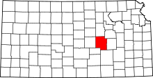 | |
| Unincorporated communities | ||
| Ghost towns | ||
| Townships | ||
| Footnotes | ‡This populated place also has portions in an adjacent county or counties | |