Aulne, Kansas
| Aulne, Kansas | |
|---|---|
| Unincorporated community | |
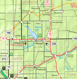 KDOT map of Marion County (legend) | |
 Aulne  Aulne | |
| Coordinates: 38°16′34″N 97°4′36″W / 38.27611°N 97.07667°WCoordinates: 38°16′34″N 97°4′36″W / 38.27611°N 97.07667°W[1] | |
| Country | United States |
| State | Kansas |
| County | Marion |
| Township | Wilson |
| Platted | 1887 |
| Elevation[1] | 1,407 ft (429 m) |
| Time zone | CST (UTC-6) |
| • Summer (DST) | CDT (UTC-5) |
| ZIP code | 66861 |
| Area code | 620 |
| FIPS code | 20-03400 [1] |
| GNIS ID | 477370 [1] |
Aulne is an unincorporated community in Marion County, Kansas, United States.[1] The Aulne name was suggested by officials of the railroad when it was built through Aulne during the 19th century.[2]
History

Early history
For many millennia, the Great Plains of North America was inhabited by nomadic Native Americans. From the 16th century to 18th century, the Kingdom of France claimed ownership of large parts of North America. In 1762, after the French and Indian War, France secretly ceded New France to Spain, per the Treaty of Fontainebleau.
19th century
In 1802, Spain returned most of the land to France. In 1803, most of the land for modern day Kansas was acquired by the United States from France as part of the 828,000 square mile Louisiana Purchase for 2.83 cents per acre.
In 1854, the Kansas Territory was organized, then in 1861 Kansas became the 34th U.S. state. In 1855, Marion County was established within the Kansas Territory, which included the land for modern day Aulne.[3]
In 1872, a railroad contractor, named Col. W. Sherburn, decided the location would be good location for a town and named it after himself, Sherburn, but it was too early and never used.
In 1887, the Chicago, Kansas and Nebraska Railway built a branch line north-south from Herington through Aulne to Caldwell.[4] It foreclosed in 1891 and was taken over by Chicago, Rock Island and Pacific Railway, which shut down in 1980, and reorganized as Oklahoma, Kansas and Texas Railroad which merged in 1988 with Missouri Pacific Railroad, and finally merged in 1997 with Union Pacific Railroad. Most locals still refer to this railroad as the "Rock Island".
A post office existed in Aulne from August 19, 1887 to February 28, 1954.[5]
20th century
Aulne was one of the finalist communities considered for Tabor College before it was established in Hillsboro in 1908.[6]
During World War I, the local telephone company decreed that "No German could be spoken over the telephones", because of anti-German sentiment towards German-Americans.[7]
Geography
Aulne is located roughly halfway between Marion and Peabody next to the Union Pacific Railroad.
Area attractions
- Aulne United Methodist Church, north-east corner of 140th St and Pawnee Rd.
- 1890 Marion County Poor Farm (asylum), 1 mi west, 2.1 mi north. Large 3-story limestone house, now privately owned house, occasional tours by appointment. Darren E. Burrows lived here briefly as a child. Indigent, and somewhat "incompetent" people would live here with adult supervision, work the land, raise their own food, and earn their keep. Unwed pregnant girls could stay there until they delivered their babies, which were put up of adoption. The asylum was self-sustaining for a number of years, even paying taxes to the county.[8][9][10]
- Marion Reservoir, approximately seven miles north of Aulne.
Education
Primary and secondary education
Aulne is part of Unified School District 408.[11][12] The high school is a member of T.E.E.N., a shared video teaching network between five area high schools.[13] All students attend schools in Marion.
- Marion High School, located in Marion.
- Marion Middle School, located in Marion.
- Marion Elementary School, located in Marion.
Infrastructure
Transportation
U.S. Route 56 is 5.75 miles (9.25 km) to the north, and U.S. Route 77 is 4.5 miles (7.2 km) east of the community. The Oklahoma Kansas Texas (OKT)[14] line of the Union Pacific Railroad runs through the community.
Utilities
- Internet
- TV
- Satellite is provided by DirecTV, Dish Network.
- Terrestrial is provided by regional digital TV stations.
- Electricity
- Community and Rural areas provided by Flint Hills RECA.
- Water
- Community and Rural areas provided by Marion County RWD #4.
Notable people
- Floyd B. Danskin, American politician, Washington State House of Representatives from 1921 to 1933, and Speaker of the House from 1925 to 1927.
See also
- Wilson Township, Marion County, Kansas (location of Aulne)
- Historical Maps of Marion County, Kansas
Further reading
References
- 1 2 3 4 5 Geographic Names Information System (GNIS) details for Aulne, Kansas; United States Geological Survey (USGS); October 13, 1978.
- ↑ Marion County Kansas, Past and Present; Sondra Van Meter; 1972.
- ↑ The History of Marion County and Courthouse
- ↑ Rock Island Rail History
- ↑ "Kansas Post Offices, 1828-1961 (archived)". Kansas Historical Society. Archived from the original on October 9, 2013. Retrieved 14 June 2014.
- ↑ Ghost Towns - Aulne, Kansas
- ↑ Mob Violence and Kansas Mennonites in 1918; Kansas Historical Quarterly; Autumn 1977.
- ↑ Marion County Poor Farm - History; Marion County Record; October 14, 1998.
- ↑ Marion County Poor Farm - History; Peabody News; 1901.
- ↑ Marion County Poor Farm - Photo; Peabody News; 1901.
- ↑ USD 408
- ↑ Kansas School District Boundary Map Archived July 21, 2011, at the Wayback Machine.
- ↑ T.E.E.N. video teaching network
- ↑ "UP Railroad Common Line Names" (PDF). Union Pacific Railroad. Retrieved 2010-08-02.
External links
| Wikimedia Commons has media related to Aulne, Kansas. |
- Schools
- USD 408, school district for Marion, Florence, Eastshore, Canada, Aulne, nearby rural areas of Marion County
- USD 408 School District Boundary Map, KDOT
- Historical
- Model railroad layout of 1915 Aulne on YouTube
- Aulne church celebrates 125th anniversary
- Historic Images of Aulne, Special Photo Collections at Wichita State University Library.
- 1905 photo of Aulne Rock Island Depot
- Aulne - Dead towns of Kansas
- Marion County cemetery list, archive of KsGenWeb
- Marion County history bibliography, Marion County school bibliography, Kansas Historical Society
- Maps
- Marion County Maps: Current, Historic, KDOT
- Topo Map of Marion / Aulne / Canada area, USGS
Municipalities and communities of Marion County, Kansas, United States | ||
|---|---|---|
| Cities | 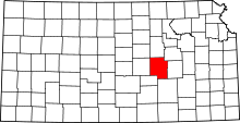 | |
| Unincorporated communities | ||
| Ghost towns | ||
| Townships | ||
| Footnotes | ‡This populated place also has portions in an adjacent county or counties | |