Paulhac, Haute-Loire
| Paulhac | |
|---|---|
|
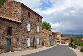
A view within the village of Paulhac | |
 Paulhac | |
|
Location within Auvergne-Rhône-Alpes region  Paulhac | |
| Coordinates: 45°18′06″N 3°20′56″E / 45.3017°N 3.3489°ECoordinates: 45°18′06″N 3°20′56″E / 45.3017°N 3.3489°E | |
| Country | France |
| Region | Auvergne-Rhône-Alpes |
| Department | Haute-Loire |
| Arrondissement | Brioude |
| Canton | Brioude-Nord |
| Government | |
| • Mayor (2008–) | Annie Bard |
| Area1 | 8.4 km2 (3.2 sq mi) |
| Population (1999)2 | 618 |
| • Density | 74/km2 (190/sq mi) |
| Time zone | CET (UTC+1) |
| • Summer (DST) | CEST (UTC+2) |
| INSEE/Postal code | 43147 / 43100 |
| Elevation |
436–646 m (1,430–2,119 ft) (avg. 490 m or 1,610 ft) |
|
1 French Land Register data, which excludes lakes, ponds, glaciers > 1 km² (0.386 sq mi or 247 acres) and river estuaries. 2 Population without double counting: residents of multiple communes (e.g., students and military personnel) only counted once. | |
Paulhac is a commune in the Haute-Loire department in south-central France.
See also
| Wikimedia Commons has media related to Paulhac (Haute-Loire). |
This article is issued from Wikipedia - version of the 2/11/2015. The text is available under the Creative Commons Attribution/Share Alike but additional terms may apply for the media files.