Chanteuges
| Chanteuges | |
|---|---|
|
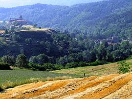
A general view of Chanteuges | |
 Chanteuges | |
|
Location within Auvergne-Rhône-Alpes region  Chanteuges | |
| Coordinates: 45°04′24″N 3°31′56″E / 45.0733°N 3.5322°ECoordinates: 45°04′24″N 3°31′56″E / 45.0733°N 3.5322°E | |
| Country | France |
| Region | Auvergne-Rhône-Alpes |
| Department | Haute-Loire |
| Arrondissement | Brioude |
| Canton | Langeac |
| Government | |
| • Mayor (2008–2014) | Franck Noël-Baron |
| Area1 | 16.33 km2 (6.31 sq mi) |
| Population (2006)2 | 411 |
| • Density | 25/km2 (65/sq mi) |
| Time zone | CET (UTC+1) |
| • Summer (DST) | CEST (UTC+2) |
| INSEE/Postal code | 43056 / 43300 |
| Elevation | 493–894 m (1,617–2,933 ft) |
|
1 French Land Register data, which excludes lakes, ponds, glaciers > 1 km² (0.386 sq mi or 247 acres) and river estuaries. 2 Population without double counting: residents of multiple communes (e.g., students and military personnel) only counted once. | |
Chanteuges is a commune in the Haute-Loire department in south-central France.
See also
| Wikimedia Commons has media related to Chanteuges. |
This article is issued from Wikipedia - version of the 2/11/2015. The text is available under the Creative Commons Attribution/Share Alike but additional terms may apply for the media files.