Lavoûte-Chilhac
| Lavoûte-Chilhac | ||
|---|---|---|
|
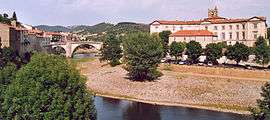
A panoramic view of Lavoûte-Chilhac | ||
| ||
 Lavoûte-Chilhac | ||
|
Location within Auvergne-Rhône-Alpes region  Lavoûte-Chilhac | ||
| Coordinates: 45°08′57″N 3°24′15″E / 45.1492°N 3.4042°ECoordinates: 45°08′57″N 3°24′15″E / 45.1492°N 3.4042°E | ||
| Country | France | |
| Region | Auvergne-Rhône-Alpes | |
| Department | Haute-Loire | |
| Arrondissement | Brioude | |
| Canton | Lavoûte-Chilhac | |
| Government | ||
| • Mayor | Jean-Pierre Vigier | |
| Area1 | 3.61 km2 (1.39 sq mi) | |
| Population (1999)2 | 302 | |
| • Density | 84/km2 (220/sq mi) | |
| Time zone | CET (UTC+1) | |
| • Summer (DST) | CEST (UTC+2) | |
| INSEE/Postal code | 43118 / 43380 | |
| Elevation |
447–640 m (1,467–2,100 ft) (avg. 470 m or 1,540 ft) | |
|
1 French Land Register data, which excludes lakes, ponds, glaciers > 1 km² (0.386 sq mi or 247 acres) and river estuaries. 2 Population without double counting: residents of multiple communes (e.g., students and military personnel) only counted once. | ||

Lavoûte-Chilhac is a commune in the Haute-Loire department in south-central France.
See also
| Wikimedia Commons has media related to Lavoûte-Chilhac. |
This article is issued from Wikipedia - version of the 2/18/2016. The text is available under the Creative Commons Attribution/Share Alike but additional terms may apply for the media files.