Saint-Pal-de-Chalencon
| Saint-Pal-de-Chalencon | |
|---|---|
|
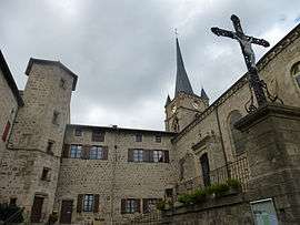
The church in Saint-Pal-de-Chalencon | |
 Saint-Pal-de-Chalencon | |
|
Location within Auvergne-Rhône-Alpes region  Saint-Pal-de-Chalencon | |
| Coordinates: 45°21′27″N 3°57′27″E / 45.3575°N 3.9575°ECoordinates: 45°21′27″N 3°57′27″E / 45.3575°N 3.9575°E | |
| Country | France |
| Region | Auvergne-Rhône-Alpes |
| Department | Haute-Loire |
| Arrondissement | Yssingeaux |
| Canton | Bas-en-Basset |
| Area1 | 28.95 km2 (11.18 sq mi) |
| Population (1999)2 | 1,046 |
| • Density | 36/km2 (94/sq mi) |
| Time zone | CET (UTC+1) |
| • Summer (DST) | CEST (UTC+2) |
| INSEE/Postal code | 43212 / 43500 |
| Elevation |
700–978 m (2,297–3,209 ft) (avg. 878 m or 2,881 ft) |
|
1 French Land Register data, which excludes lakes, ponds, glaciers > 1 km² (0.386 sq mi or 247 acres) and river estuaries. 2 Population without double counting: residents of multiple communes (e.g., students and military personnel) only counted once. | |
Saint-Pal-de-Chalencon is a commune in the Haute-Loire department in south-central France.
See also
References
| Wikimedia Commons has media related to Saint-Pal-de-Chalencon. |
This article is issued from Wikipedia - version of the 2/11/2015. The text is available under the Creative Commons Attribution/Share Alike but additional terms may apply for the media files.