Aubazat
| Aubazat | |
|---|---|
|
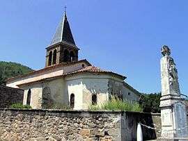
The church of Saint-Roch and the war memorial | |
 Aubazat | |
|
Location within Auvergne-Rhône-Alpes region  Aubazat | |
| Coordinates: 45°08′N 3°26′E / 45.14°N 3.44°ECoordinates: 45°08′N 3°26′E / 45.14°N 3.44°E | |
| Country | France |
| Region | Auvergne-Rhône-Alpes |
| Department | Haute-Loire |
| Arrondissement | Brioude |
| Canton | Lavoûte-Chilhac |
| Government | |
| • Mayor (2008–2014) | Jeanine Brugeyroux |
| Area1 | 16.38 km2 (6.32 sq mi) |
| Population (2009)2 | 188 |
| • Density | 11/km2 (30/sq mi) |
| Time zone | CET (UTC+1) |
| • Summer (DST) | CEST (UTC+2) |
| INSEE/Postal code | 43011 / 43380 |
| Elevation |
464–848 m (1,522–2,782 ft) (avg. 640 m or 2,100 ft) |
|
1 French Land Register data, which excludes lakes, ponds, glaciers > 1 km² (0.386 sq mi or 247 acres) and river estuaries. 2 Population without double counting: residents of multiple communes (e.g., students and military personnel) only counted once. | |
Aubazat is a commune in the Haute-Loire department in south-central France.
Population
| Historical population | ||
|---|---|---|
| Year | Pop. | ±% |
| 1962 | 209 | — |
| 1968 | 200 | −4.3% |
| 1975 | 169 | −15.5% |
| 1982 | 163 | −3.6% |
| 1990 | 155 | −4.9% |
| 1999 | 172 | +11.0% |
| 2009 | 188 | +9.3% |
See also
References
| Wikimedia Commons has media related to Aubazat. |
This article is issued from Wikipedia - version of the 9/16/2015. The text is available under the Creative Commons Attribution/Share Alike but additional terms may apply for the media files.