Parkland, Washington
| Parkland, Washington | |
|---|---|
| Parkland is a CDP | |
 Location of Parkland, Washington | |
| Coordinates: 47°8′28″N 122°26′16″W / 47.14111°N 122.43778°WCoordinates: 47°8′28″N 122°26′16″W / 47.14111°N 122.43778°W | |
| Country | United States |
| State | Washington |
| County | Pierce |
| Area | |
| • Total | 7.4 sq mi (19.1 km2) |
| • Land | 7.4 sq mi (19.1 km2) |
| • Water | 0.0 sq mi (0.1 km2) |
| Elevation | 377 ft (115 m) |
| Population (April 1, 2010) | |
| • Total | 35,803 |
| • Density | 3,267.2/sq mi (1,261.5/km2) |
| Time zone | Pacific (PST) (UTC-8) |
| • Summer (DST) | PDT (UTC-7) |
| ZIP codes | 98444-98446 |
| Area code | 253 |
| FIPS code | 53-53335[1] |
| GNIS feature ID | 1512548[2] |
Parkland is a census-designated place (CDP) in Pierce County, Washington, United States. The population was 24,053 at the 2000 census and grew to 35,803 as of the 2010 census. It is an unincorporated suburb of the city of Tacoma and is home to Pacific Lutheran University.
Parkland is located 8 miles south of Tacoma, on the main route to nearby Mt. Rainier. It was given its name by early white settlers, who thought the vast Garry Oak and blue camas flower prairie, and the many meandering creeks crossing it, was indeed a parkland. In 1890, Norwegian-Americans from the midwest chose it for the location of their new college, which today is Pacific Lutheran University, home to 3,500 full-time students and to the Lutes.
Geography
Parkland is located at 47°8′28″N 122°26′16″W / 47.14111°N 122.43778°W (47.141221, -122.437746).[3]
According to the United States Census Bureau, the CDP has a total area of 7.4 square miles (19.1 km²), of which, 7.4 square miles (19.1 km²) of it is land and 0.04 square miles (0.1 km²) of it (0.41%) is water.
Demographics
| Historical population | |||
|---|---|---|---|
| Census | Pop. | %± | |
| 1980 | 23,355 | — | |
| 1990 | 20,882 | −10.6% | |
| 2000 | 24,053 | 15.2% | |
| 2010 | 35,803 | 48.9% | |
As of the census[1] of 2000, there were 24,053 people, 8,869 households, and 5,782 families residing in the CDP. The population density was 3,267.2 people per square mile (1,261.8/km²). There were 9,340 housing units at an average density of 1,268.7/sq mi (490.0/km²). The racial makeup of the CDP was 73.91% White, 8.07% African American, 1.04% Native American, 6.64% Asian, 1.81% Pacific Islander, 2.06% from other races, and 6.47% from two or more races. Hispanic or Latino of any race were 5.33% of the population.
There were 8,869 households out of which 32.6% had children under the age of 18 living with them, 45.8% were married couples living together, 14.1% had a female householder with no husband present, and 34.8% were non-families. 26.3% of all households were made up of individuals and 7.4% had someone living alone who was 65 years of age or older. The average household size was 2.55 and the average family size was 3.05.
In the CDP the age distribution of the population shows 25.0% under the age of 18, 16.9% from 18 to 24, 28.3% from 25 to 44, 19.7% from 45 to 64, and 10.1% who were 65 years of age or older. The median age was 31 years. For every 100 females there were 94.2 males. For every 100 females age 18 and over, there were 90.8 males.
The median income for a household in the CDP was $39,653, and the median income for a family was $46,210. Males had a median income of $36,169 versus $27,036 for females. The per capita income for the CDP was $18,649. About 10.6% of families and 15.4% of the population were below the poverty line, including 18.7% of those under age 18 and 6.5% of those age 65 or over.
Schools
Public schools in Parkland are organized into the Franklin Pierce School District. As of October 2004 the district had 7,942 students enrolled.[4]
- High schools:
- Franklin Pierce High School - Cardinals
- Washington High School - Patriots
- Middle schools:
- Morris E. Ford Middle School - T-Birds
- Keithley Middle School - Kolts
- Elementary schools:
- Elmhurst Elementary - Eagles
- Brookdale Elementary - Bobcats
- Central Avenue Elementary - Wildcats
- Christensen Elementary - Cougars
- Collins Elementary - Coyotes
- Harvard Elementary - Hawks
- James Sales Elementary - Pioneers
- Midland Elementary - Mustangs
Parkland also holds the private college Pacific Lutheran University.[5]
Notes
| Wikimedia Commons has media related to Parkland, Washington. |
- 1 2 "American FactFinder". United States Census Bureau. Archived from the original on September 11, 2013. Retrieved 2008-01-31.
- ↑ "US Board on Geographic Names". United States Geological Survey. 2007-10-25. Retrieved 2008-01-31.
- ↑ "US Gazetteer files: 2010, 2000, and 1990". United States Census Bureau. 2011-02-12. Retrieved 2011-04-23.
- ↑ http://2465431.remote.schoolcenter.com/education/components/scrapbook/default.php?sectiondetailid=1907&sc_id=1126217866
- ↑ Erickson, Brielle. "THE TALLEST BUILDING IN PARKLAND". Campus Voice. Pacific Lutheran University. Retrieved 20 June 2012.
Municipalities and communities of Pierce County, Washington, United States | ||
|---|---|---|
| Cities | 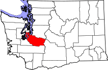 | |
| Towns | ||
| CDPs |
| |
| Other unincorporated communities | ||
| Indian reservation | ||
| Military bases | ||
| Ghost towns | ||
| Footnotes | ‡This populated place also has portions in an adjacent county or counties | |