Bonney Lake, Washington
- For other places called Bonney Lake, see Lake Bonney disambiguation page.
| Bonney Lake, Washington | |
|---|---|
| City | |
 Location of Bonney Lake, Washington | |
| Coordinates: 47°11′13″N 122°10′12″W / 47.18694°N 122.17000°WCoordinates: 47°11′13″N 122°10′12″W / 47.18694°N 122.17000°W | |
| Country | United States |
| State | Washington |
| County | Pierce |
| Incorporated (town) | February 28, 1949 |
| Founded by | Kenneth Simmons |
| Government | |
| • Mayor | Neil Johnson[1] |
| Area[2] | |
| • Total | 8.01 sq mi (20.75 km2) |
| • Land | 7.94 sq mi (20.56 km2) |
| • Water | 0.07 sq mi (0.18 km2) |
| Elevation | 574 ft (175 m) |
| Population (2010)[3] | |
| • Total | 17,374 |
| • Estimate (2015)[4] | 19,903 |
| • Density | 2,188.2/sq mi (844.9/km2) |
| Time zone | Pacific (PST) (UTC-8) |
| • Summer (DST) | PDT (UTC-7) |
| ZIP code | 98391 |
| Area code(s) | 253 |
| FIPS code | 53-07170 |
| GNIS feature ID | 1512017[5] |
| Website | www.ci.bonney-lake.wa.us |
Bonney Lake is a city in Pierce County, Washington, United States. The population was 17,374 at the 2010 census.
Geography
Bonney Lake is located at 47°11′13″N 122°10′12″W / 47.187019°N 122.170035°W (47.187019, -122.170035).[6]
According to the United States Census Bureau, the city has a total area of 8.01 square miles (20.75 km2), of which, 7.94 square miles (20.56 km2) is land and 0.07 square miles (0.18 km2) is water.[2]
Demographics
| Historical population | |||
|---|---|---|---|
| Census | Pop. | %± | |
| 1950 | 275 | — | |
| 1960 | 645 | 134.5% | |
| 1970 | 2,700 | 318.6% | |
| 1980 | 5,328 | 97.3% | |
| 1990 | 7,494 | 40.7% | |
| 2000 | 9,687 | 29.3% | |
| 2010 | 17,374 | 79.4% | |
| Est. 2015 | 19,903 | [7] | 14.6% |
| U.S. Decennial Census[8] 2015 Estimate[4] | |||
2010 census
As of the census[3] of 2010, there were 17,374 people, 5,989 households, and 4,632 families residing in the city. The population density was 2,188.2 inhabitants per square mile (844.9/km2). There were 6,394 housing units at an average density of 805.3 per square mile (310.9/km2). The racial makeup of the city was 88.8% White, 1.3% African American, 1.0% Native American, 2.4% Asian, 0.2% Pacific Islander, 1.8% from other races, and 4.5% from two or more races. Hispanic or Latino of any race were 6.1% of the population.
There were 5,989 households of which 44.5% had children under the age of 18 living with them, 61.0% were married couples living together, 10.1% had a female householder with no husband present, 6.3% had a male householder with no wife present, and 22.7% were non-families. 15.4% of all households were made up of individuals and 4.1% had someone living alone who was 65 years of age or older. The average household size was 2.89 and the average family size was 3.20.
The median age in the city was 34.6 years. 28.5% of residents were under the age of 18; 7.8% were between the ages of 18 and 24; 30.8% were from 25 to 44; 26.5% were from 45 to 64; and 6.4% were 65 years of age or older. The gender makeup of the city was 50.3% male and 49.7% female.
2000 census
As of the census of 2000, there were 9,687 people, 3,266 households, and 2,583 families residing in the city. The population density was 1,780.9 people per square mile (687.5/km2). There were 3,404 housing units at an average density of 625.8 per square mile (241.6/km2). The racial makeup of the city was 94.08% White, 0.60% African American, 1.02% Native American, 1.27% Asian, 0.07% Pacific Islander, 0.62% from other races, and 2.33% from two or more races. Hispanic or Latino of any race were 3.08% of the population.
There were 3,266 households out of which 47.3% had children under the age of 18 living with them, 63.7% were married couples living together, 9.2% had a female householder with no husband present, and 20.9% were non-families. 13.6% of all households were made up of individuals and 2.4% had someone living alone who was 65 years of age or older. The average household size was 2.96 and the average family size was 3.26.
In the city the population was spread out with 32.0% under the age of 18, 7.3% from 18 to 24, 35.7% from 25 to 44, 20.3% from 45 to 64, and 4.6% who were 65 years of age or older. The median age was 33 years. For every 100 females there were 106.5 males. For every 100 females age 18 and over, there were 107.0 males.
The median income for a household in the city was $60,282, and the median income for a family was $62,644. Males had a median income of $46,813 versus $31,837 for females. The per capita income for the city was $21,371. About 3.0% of families and 4.0% of the population were below the poverty line, including 3.8% of those under age 18 and 5.3% of those age 65 or over.
Notable people
- Kenny Christiansen - A suspect in the 1971 D. B. Cooper hijacking of Northwest Orient Airlines Flight 305 between Portland and Seattle.
- Megan Jendrick - Olympic swimming gold medalist
- Melanie Roach - Olympic weightlifter
- Kyle J. White - Veteran of the War in Afghanistan and Medal of Honor recipient
- David D. Hobley - Disabled Veteran of the The Gulf War (2 August 1990 – 28 February 1991) and Outstanding Volunteer Service Medal recipient
References
- ↑ Mayor's Office City of Bonney Lake
- 1 2 "US Gazetteer files 2010". United States Census Bureau. Archived from the original on 2012-01-24. Retrieved 2012-12-19.
- 1 2 "American FactFinder". United States Census Bureau. Retrieved 2012-12-19.
- 1 2 "Population Estimates". United States Census Bureau. Retrieved June 22, 2016.
- ↑ "US Board on Geographic Names". United States Geological Survey. 2007-10-25. Retrieved 2008-01-31.
- ↑ "US Gazetteer files: 2010, 2000, and 1990". United States Census Bureau. 2011-02-12. Retrieved 2011-04-23.
- ↑ "Annual Estimates of the Resident Population for Incorporated Places: April 1, 2010 to July 1, 2015". Retrieved July 2, 2016.
- ↑ United States Census Bureau. "Census of Population and Housing". Archived from the original on May 11, 2015. Retrieved July 25, 2013.
External links
| Wikimedia Commons has media related to Bonney Lake, Washington. |
- City of Bonney Lake
- Bonney Lake Chamber of Commerce
- Bonney Lake & Sumner Courier-Herald - Current articles
Municipalities and communities of Pierce County, Washington, United States | ||
|---|---|---|
| Cities | 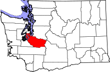 | |
| Towns | ||
| CDPs |
| |
| Other unincorporated communities | ||
| Indian reservation | ||
| Military bases | ||
| Ghost towns | ||
| Footnotes | ‡This populated place also has portions in an adjacent county or counties | |