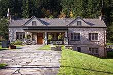
Wilkeson, Washington
| Wilkeson, Washington | |
|---|---|
| Town | |
 | |
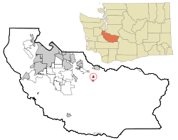 Location of Wilkeson, Washington | |
| Coordinates: 47°6′25″N 122°2′54″W / 47.10694°N 122.04833°WCoordinates: 47°6′25″N 122°2′54″W / 47.10694°N 122.04833°W | |
| Country | United States |
| State | Washington |
| County | Pierce |
| Area[1] | |
| • Total | 0.47 sq mi (1.22 km2) |
| • Land | 0.47 sq mi (1.22 km2) |
| • Water | 0 sq mi (0 km2) |
| Elevation | 804 ft (245 m) |
| Population (2010)[2] | |
| • Total | 477 |
| • Estimate (2015)[3] | 485 |
| • Density | 1,014.9/sq mi (391.9/km2) |
| Time zone | Pacific (PST) (UTC-8) |
| • Summer (DST) | PDT (UTC-7) |
| ZIP code | 98396 |
| Area code | 360 |
| FIPS code | 53-78925 |
| GNIS feature ID | 1528154[4] |
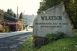
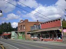
Wilkeson is a town in Pierce County, Washington, United States. The population was 477 at the 2010 census.
History
Wilkeson was officially incorporated on July 24, 1909 and boasts an elementary school building dating from 1909. The town is named for Samuel Wilkeson, father of journalist and pioneer settler Frank Wilkeson.
The following passage is from an online biography of Frank Wilkeson:
"[In] his 1869 report of the Cascades mountain range, Frank [Wilkeson]'s father, Samuel, wrote: 'these forests of trees — so enchain the senses of the grand and so enchant the sense of the beautiful that I linger on the theme and am loathe to depart — surpassing the woods of all the rest of the globe...' Like many writers of that time, Samuel indulged in hyperbole, but his love of the Cascades seems very genuine. Sometime in the period of 1876-78, four large coal veins were discovered and mined near a region known as Carbonado in the Cascade foothills. A small village formed and was named for Samuel after NP extended a rail line there from Tacoma in 1877. He was appointed secretary of the NP board in March 1869. The area became well known for its coal coking ovens as well as the natural sandstone formations that were the source of material for facing the new capitol in Olympia. At one time the town of Wilkeson had a population of about 3,000, but today it hovers around 400. Many of the same principals of the Wilkeson operation built the coking ovens at Cokedale, about 80 miles north in Skagit County, which led to the creation of the town of Sedro, now Sedro-Woolley. As far as we can determine, neither Frank nor any member of his family actually ever lived in the namesake town, but his brother, Samuel G. Wilkeson, invested substantially in coal companies that operated there...
"Frank's father died in 1889 but by then another Wilkeson was investing financially in the Puget Sound: Samuel Gansevoort Wilkeson, Frank's older brother. Samuel G. first came to Tacoma in 1873, the year that town was chosen as the terminus for the Northern Pacific. He was a contemporary of Tacoma boomer Leonard Howarth and became wealthy in his activities with the same companies as Howarth — the St. Paul & Tacoma Lumber Co. and the Wilkeson Coal & Coke Co. That company mined coking coal in the town of Wilkeson, the town near Enumclaw that was named to honor Frank's and Sam's father."
Geography
Near the towns of Buckley and Carbonado, Wilkeson is located at 47°6′25″N 122°2′54″W / 47.10694°N 122.04833°W (47.107066, -122.048263).[5]
Wilkeson is situated near to the northwest corner of Mt. Rainier National Park. To the south of Wilkeson is the Carbon River access to the Park. Unimproved roads from the east of Wilkeson plunge deep into the park. One Road, FS 7720 leads to within 200 yards (180 m) of the Wilderness Boundary.
According to the United States Census Bureau, the town has a total area of 0.47 square miles (1.22 km2), all of it land.[1]
Climate
This region experiences warm (but not hot) and dry summers, with no average monthly temperatures above 71.6 F (22 C). According to the Köppen Climate Classification system, Wilkeson has a warm-summer Mediterranean climate, abbreviated "Csb" on climate maps.[6]
Demographics
| Historical population | |||
|---|---|---|---|
| Census | Pop. | %± | |
| 1880 | 104 | — | |
| 1910 | 899 | — | |
| 1920 | 803 | −10.7% | |
| 1930 | 448 | −44.2% | |
| 1940 | 369 | −17.6% | |
| 1950 | 386 | 4.6% | |
| 1960 | 412 | 6.7% | |
| 1970 | 317 | −23.1% | |
| 1980 | 316 | −0.3% | |
| 1990 | 366 | 15.8% | |
| 2000 | 395 | 7.9% | |
| 2010 | 477 | 20.8% | |
| Est. 2015 | 485 | [7] | 1.7% |
| U.S. Decennial Census[8] 2015 Estimate[3] | |||
Wilkeson was once much larger, boasting a population of 1,437 in the 1910 census.
2010 census
As of the census[2] of 2010, there were 477 people, 169 households, and 129 families residing in the town. The population density was 1,014.9 inhabitants per square mile (391.9/km2). There were 175 housing units at an average density of 372.3 per square mile (143.7/km2). The racial makeup of the town was 96.2% White, 0.6% African American, 0.4% Native American, 2.3% from other races, and 0.4% from two or more races. Hispanic or Latino of any race were 3.4% of the population.
There were 169 households of which 40.2% had children under the age of 18 living with them, 58.0% were married couples living together, 13.0% had a female householder with no husband present, 5.3% had a male householder with no wife present, and 23.7% were non-families. 21.3% of all households were made up of individuals and 5.3% had someone living alone who was 65 years of age or older. The average household size was 2.82 and the average family size was 3.20.
The median age in the town was 33.9 years. 29.4% of residents were under the age of 18; 9% were between the ages of 18 and 24; 25.1% were from 25 to 44; 28.9% were from 45 to 64; and 7.5% were 65 years of age or older. The gender makeup of the town was 50.9% male and 49.1% female.
2000 census
As of the census of 2000, there were 395 people, 140 households, and 100 families residing in the town. The population density was 810.0 people per square mile (311.2/km²). There were 150 housing units at an average density of 307.6 per square mile (118.2/km²). The racial makeup of the town was 95.95% White, 1.01% Native American, and 3.04% from two or more races. Hispanic or Latino of any race were 1.52% of the population.
There were 140 households out of which 38.6% had children under the age of 18 living with them, 58.6% were married couples living together, 10.7% had a female householder with no husband present, and 27.9% were non-families. 20.7% of all households were made up of individuals and 9.3% had someone living alone who was 65 years of age or older. The average household size was 2.82 and the average family size was 3.37.
In the town the age distribution of the population shows 30.4% under the age of 18, 10.4% from 18 to 24, 28.1% from 25 to 44, 21.8% from 45 to 64, and 9.4% who were 65 years of age or older. The median age was 35 years. For every 100 females there were 91.7 males. For every 100 females age 18 and over, there were 97.8 males.
The median income for a household in the town was $44,375, and the median income for a family was $46,875. Males had a median income of $38,250 versus $31,458 for females. The per capita income for the town was $17,481. About 2.0% of families and 4.0% of the population were below the poverty line, including none of those under age 18 and 18.2% of those age 65 or over.
References
- 1 2 "US Gazetteer files 2010". United States Census Bureau. Retrieved 2012-12-19.
- 1 2 "American FactFinder". United States Census Bureau. Retrieved 2012-12-19.
- 1 2 "Population Estimates". United States Census Bureau. Retrieved July 9, 2016.
- ↑ "US Board on Geographic Names". United States Geological Survey. 2007-10-25. Retrieved 2008-01-31.
- ↑ "US Gazetteer files: 2010, 2000, and 1990". United States Census Bureau. 2011-02-12. Retrieved 2011-04-23.
- ↑ Climate Summary for Wilkeson, Washington
- ↑ "Annual Estimates of the Resident Population for Incorporated Places: April 1, 2010 to July 1, 2015". Retrieved July 2, 2016.
- ↑ United States Census Bureau. "Census of Population and Housing". Retrieved July 25, 2013.
External links
| Wikimedia Commons has media related to Wilkeson, Washington. |
Municipalities and communities of Pierce County, Washington, United States | ||
|---|---|---|
| Cities | 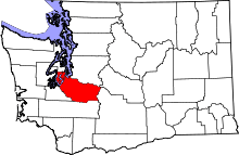 | |
| Towns | ||
| CDPs |
| |
| Other unincorporated communities | ||
| Indian reservation | ||
| Military bases | ||
| Ghost towns | ||
| Footnotes | ‡This populated place also has portions in an adjacent county or counties | |