North Johns, Alabama
| North Johns, Alabama | |
|---|---|
| Town | |
 Location in Jefferson County and the state of Alabama | |
| Coordinates: 33°22′1″N 87°6′5″W / 33.36694°N 87.10139°W | |
| Country | United States |
| State | Alabama |
| County | Jefferson |
| Area | |
| • Total | 0.2 sq mi (0.5 km2) |
| • Land | 0.2 sq mi (0.5 km2) |
| • Water | 0 sq mi (0 km2) |
| Elevation | 502 ft (153 m) |
| Population (2010) | |
| • Total | 145 |
| • Density | 710/sq mi (284/km2) |
| Time zone | Central (CST) (UTC-6) |
| • Summer (DST) | CDT (UTC-5) |
| ZIP code | 35006 |
| Area code(s) | 205 |
| FIPS code | 01-55152 |
| GNIS feature ID | 0124007 |
North Johns is the second smallest incorporated town in Jefferson County, Alabama (after Cardiff), United States. It is located approximately eight miles southwest from the Birmingham suburb of Hueytown. North Johns was a thriving mining town at the beginning of the 20th century, when more than 2000 people lived in and around the community. It is named after a Welsh-born mining engineer, Llewellyn Johns, who opened coal mining operations throughout the area in the 1880s.[1] At the 2010 census the population was 145, an increase of three persons from 2000.
History
North Johns was incorporated in July 1912,[2] although not until 1930 did it first appear on the Census records.[3] It was listed as Johns in that census and North Johns from 1940 to date. Its peak recorded population was in 1950 when it had 454 residents.
Geography
It is located at 33°22′1″N 87°6′5″W / 33.36694°N 87.10139°W (33.366880, -87.101486).[4]
According to the U.S. Census Bureau, the town has a total area of 0.2 square miles (0.52 km2), all land.
Demographics
| Historical population | |||
|---|---|---|---|
| Census | Pop. | %± | |
| 1930 | 344 | — | |
| 1940 | 404 | 17.4% | |
| 1950 | 454 | 12.4% | |
| 1960 | 338 | −25.6% | |
| 1970 | 241 | −28.7% | |
| 1980 | 243 | 0.8% | |
| 1990 | 177 | −27.2% | |
| 2000 | 142 | −19.8% | |
| 2010 | 145 | 2.1% | |
| Est. 2015 | 142 | [5] | −2.1% |
| U.S. Decennial Census[6] 2013 Estimate[7] | |||
As of the census[8] of 2000, there were 142 people, 51 households, and 37 families residing in the town. The population density was 732.3 people per square mile (288.6/km²). There were 56 housing units at an average density of 288.8 per square mile (113.8/km²). The racial makeup of the town was 40.14% White, 59.15% Black or African American and 0.70% Native American.
There were 51 households out of which 29.4% had children under the age of 18 living with them, 47.1% were married couples living together, 17.6% had a female householder with no husband present, and 25.5% were non-families. 21.6% of all households were made up of individuals and 2.0% had someone living alone who was 65 years of age or older. The average household size was 2.78 and the average family size was 3.26.
In the town the population was spread out with 23.2% under the age of 18, 11.3% from 18 to 24, 23.9% from 25 to 44, 23.9% from 45 to 64, and 17.6% who were 65 years of age or older. The median age was 38 years. For every 100 females there were 94.5 males. For every 100 females age 18 and over, there were 101.9 males.
The median income for a household in the town was $23,750, and the median income for a family was $33,750. Males had a median income of $35,375 versus $7,083 for females. The per capita income for the town was $8,149. There were 23.1% of families and 31.2% of the population living below the poverty line, including 47.6% of under eighteens and 60.7% of those over 64.
References
- ↑ The Birmingham District, An Industrial History and Guide, (pub. 1981)Marjorie L. White
- ↑ http://www.encyclopediaofalabama.org/article/h-3560
- ↑ http://www2.census.gov/prod2/decennial/documents/10612963v3p1ch02.pdf
- ↑ "US Gazetteer files: 2010, 2000, and 1990". United States Census Bureau. 2011-02-12. Retrieved 2011-04-23.
- ↑ "Annual Estimates of the Resident Population for Incorporated Places: April 1, 2010 to July 1, 2015". Retrieved July 2, 2016.
- ↑ "U.S. Decennial Census". Census.gov. Retrieved June 6, 2013.
- ↑ "Annual Estimates of the Resident Population: April 1, 2010 to July 1, 2013". Retrieved June 3, 2014.
- ↑ "American FactFinder". United States Census Bureau. Retrieved 2008-01-31.
Coordinates: 33°22′01″N 87°06′05″W / 33.36688°N 87.101486°W
Municipalities and communities of Jefferson County, Alabama, United States | ||
|---|---|---|
| Cities | 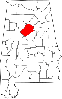 | |
| Towns | ||
| CDPs | ||
| Unincorporated communities | ||
| Former towns | ||
| Footnotes | ‡This populated place also has portions in an adjacent county or counties | |