Concord, Alabama
| Concord, Alabama | |
|---|---|
| CDP | |
 Location in Jefferson County and the state of Alabama | |
| Coordinates: 33°28′8″N 87°2′17″W / 33.46889°N 87.03806°W | |
| Country | United States |
| State | Alabama |
| County | Jefferson |
| Area | |
| • Total | 3.4 sq mi (8.7 km2) |
| • Land | 3.4 sq mi (8.7 km2) |
| • Water | 0 sq mi (0 km2) |
| Elevation | 585 ft (178 m) |
| Population (2010) | |
| • Total | 1,837 |
| • Density | 531.1/sq mi (207.9/km2) |
| Time zone | Central (CST) (UTC-6) |
| • Summer (DST) | CDT (UTC-5) |
| ZIP code | 35023 |
| Area code(s) | 205 |
| FIPS code | 01-16936 |
| GNIS feature ID | 0116480 |
Concord is a census-designated place in Jefferson County, Alabama, United States. At the 2010 census the population was 1,837, up from 1,809 in 2000. It is northwest from the Birmingham suburb of Hueytown. This area was catastrophically damaged by an F5 tornado on April 8, 1998; killing twenty-six people in the stretch of Warrior River Road between Oak Grove and Concord, and again by an EF4 tornado on April 27, 2011 that killed seven people during the multi-state April 2011 tornado outbreak- the same massive tornado that obliterated parts of Tuscaloosa.
Geography
Concord is located at 33°28′9″N 87°2′17″W / 33.46917°N 87.03806°W (33.469092, -87.038163).[1]
According to the U.S. Census Bureau, the CDP has a total area of 3.4 square miles (8.8 km2), of which 3.4 square miles (8.8 km2) is land and 0.04 square miles (0.10 km2) (0.59%) is water.
Demographics
| Historical population | |||
|---|---|---|---|
| Census | Pop. | %± | |
| 2000 | 1,809 | — | |
| 2010 | 1,837 | 1.5% | |
| U.S. Decennial Census[2] | |||
As of the census[3] of 2010, there were 1,837 people, 817 households, and 573 families residing in the CDP. The population density was 536.6 people per square mile (207.3/km2). There were 791 housing units at an average density of 232.6 per square mile (90.5/km2). The racial makeup of the CDP was 98.34% White, 0.28% Black or African American, 0.55% Native American, 0.22% Asian, 0.28% from other races, and 0.33% from two or more races. 0.28% of the population were Hispanic or Latino of any race.
There were 754 households out of which 27.8% had children under the age of 18 living with them, 66.5% were married couples living together, 7.6% had a female householder with no husband present, and 24.0% were non-families. 22.6% of all households were made up of individuals and 12.1% had someone living alone who was 65 years of age or older. The average household size was 2.40 and the average family size was 2.81.
In the CDP the population was spread out with 19.8% under the age of 18, 7.5% from 18 to 24, 27.4% from 25 to 44, 27.2% from 45 to 64, and 18.1% who were 65 years of age or older. The median age was 42 years. For every 100 females there were 91.0 males. For every 100 females age 18 and over, there were 88.3 males.
The median income for a household in the CDP was $63,150, and the median income for a family was $55,129. Males had a median income of $35,825 versus $26,406 for females. The per capita income for the CDP was $24,490. About 1.5% of families and 2.4% of the population were below the poverty line, including none of those under age 18 and 8.0% of those age 65 or over.
References
- ↑ "US Gazetteer files: 2010, 2000, and 1990". United States Census Bureau. 2011-02-12. Retrieved 2011-04-23.
- ↑ "U.S. Decennial Census". Census.gov. Archived from the original on May 11, 2015. Retrieved June 6, 2013.
- ↑ "American FactFinder". United States Census Bureau. Archived from the original on 2013-09-11. Retrieved 2008-01-31.
Coordinates: 33°28′09″N 87°02′17″W / 33.469092°N 87.038163°W
Municipalities and communities of Jefferson County, Alabama, United States | ||
|---|---|---|
| Cities | 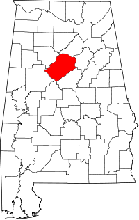 | |
| Towns | ||
| CDPs | ||
| Unincorporated communities | ||
| Former towns | ||
| Footnotes | ‡This populated place also has portions in an adjacent county or counties | |