Trafford, Alabama
| Trafford, Alabama | |
|---|---|
| Town | |
 Location in Jefferson County and the state of Alabama | |
| Coordinates: 33°49′8″N 86°44′48″W / 33.81889°N 86.74667°W | |
| Country | United States |
| State | Alabama |
| Counties | Jefferson, Blount |
| Area | |
| • Total | 2.4 sq mi (6.3 km2) |
| • Land | 2.4 sq mi (6.3 km2) |
| • Water | 0 sq mi (0 km2) |
| Elevation | 489 ft (149 m) |
| Population (2010) | |
| • Total | 646 |
| • Density | 265/sq mi (102.3/km2) |
| Time zone | Central (CST) (UTC-6) |
| • Summer (DST) | CDT (UTC-5) |
| FIPS code | 01-76680 |
| GNIS feature ID | 0153714 |
Trafford is a town in Jefferson County, Alabama, United States. A small portion extends into Blount County. The town was incorporated in 1948.[1] At the 2010 census the population was 646.[2]
Geography
Trafford is located in northern Jefferson County at 33°49′8″N 86°44′48″W / 33.81889°N 86.74667°W (33.818957, -86.746581).[3] The Locust Fork of the Black Warrior River flows through the northwest part of town. The town of County Line borders the town to the east. Trafford is 26 miles (42 km) north of downtown Birmingham.
According to the U.S. Census Bureau, the town has a total area of 2.4 square miles (6.3 km2), all land.[2]
Demographics
| Historical population | |||
|---|---|---|---|
| Census | Pop. | %± | |
| 1950 | 551 | — | |
| 1960 | 529 | −4.0% | |
| 1970 | 628 | 18.7% | |
| 1980 | 673 | 7.2% | |
| 1990 | 739 | 9.8% | |
| 2000 | 523 | −29.2% | |
| 2010 | 646 | 23.5% | |
| Est. 2015 | 634 | [4] | −1.9% |
| U.S. Decennial Census[5] 2013 Estimate[6] | |||
As of the census[7] of 2000, there were 523 people, 220 households, and 159 families residing in the town. The population density was 344.5 people per square mile (132.8/km²). There were 240 housing units at an average density of 158.1 per square mile (61.0/km²). The racial makeup of the town was 98.47% White, 0.96% Black or African American, 0.19% from other races, 0.38% from two or more races and 0.19% of the population were Hispanic or Latino of any race.
There were 220 households out of which 25.5% had children under the age of 18 living with them, 52.7% were married couples living together, 15.0% had a female householder with no husband present, and 27.7% were non-families. 25.5% of all households were made up of individuals and 12.7% had someone living alone who was 65 years of age or older. The average household size was 2.38 and the average family size was 2.82.
In the town the population was spread out with 20.7% under the age of 18, 10.5% from 18 to 24, 27.2% from 25 to 44, 26.8% from 45 to 64, and 14.9% who were 65 years of age or older. The median age was 40 years. For every 100 females there were 90.2 males. For every 100 females age 18 and over, there were 86.1 males.
The median income for a household in the town was $23,611, and the median income for a family was $32,292. Males had a median income of $29,375 versus $18,750 for females. The per capita income for the town was $11,926. About 17.0% of families and 21.3% of the population were below the poverty line, including 34.9% of those under age 18 and 22.0% of those age 65 or over.
References
- ↑ http://www.encyclopediaofalabama.org/article/h-3486
- 1 2 "Geographic Identifiers: 2010 Demographic Profile Data (G001): Trafford town, Alabama". U.S. Census Bureau, American Factfinder. Retrieved September 18, 2013.
- ↑ "US Gazetteer files: 2010, 2000, and 1990". United States Census Bureau. 2011-02-12. Retrieved 2011-04-23.
- ↑ "Annual Estimates of the Resident Population for Incorporated Places: April 1, 2010 to July 1, 2015". Retrieved July 2, 2016.
- ↑ "U.S. Decennial Census". Census.gov. Retrieved June 6, 2013.
- ↑ "Annual Estimates of the Resident Population: April 1, 2010 to July 1, 2013". Retrieved June 3, 2014.
- ↑ "American FactFinder". United States Census Bureau. Retrieved 2008-01-31.
Coordinates: 33°49′08″N 86°44′48″W / 33.818957°N 86.746581°W
Municipalities and communities of Jefferson County, Alabama, United States | ||
|---|---|---|
| Cities | 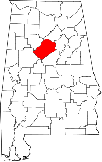 | |
| Towns | ||
| CDPs | ||
| Unincorporated communities | ||
| Former towns | ||
| Footnotes | ‡This populated place also has portions in an adjacent county or counties | |