Morris, Alabama
| Morris, Alabama | |
|---|---|
| Town | |
 Location in Jefferson County and the state of Alabama | |
| Coordinates: 33°44′51″N 86°48′25″W / 33.74750°N 86.80694°W | |
| Country | United States |
| State | Alabama |
| County | Jefferson |
| Area | |
| • Total | 3 sq mi (7.9 km2) |
| • Land | 3 sq mi (7.9 km2) |
| • Water | 0 sq mi (0 km2) |
| Elevation | 417 ft (127 m) |
| Population (2010) | |
| • Total | 1,859 |
| • Density | 609/sq mi (231.3/km2) |
| Time zone | Central (CST) (UTC-6) |
| • Summer (DST) | CDT (UTC-5) |
| ZIP code | 35116 |
| Area code(s) | 205 |
| FIPS code | 01-51456 |
| GNIS feature ID | 0123071 |
Morris is a town in Jefferson County, Alabama, United States. It is north of the Birmingham suburb of Gardendale. It initially incorporated on September 19, 1885. At some point after 1910, its incorporation lapsed and it failed to appear on the census rolls beginning in 1920 through to 1950. It reincorporated on July 11, 1950.[1] The population as of the 2010 U.S. Census was 1,859, up from 1,827 in 2000.
Geography
Morris is located at 33°44′51″N 86°48′25″W / 33.74750°N 86.80694°W (33.747374, -86.807023).[2]
According to the U.S. Census Bureau, the town has a total area of 3.1 square miles (8.0 km2), of which 3.0 square miles (7.8 km2) is land and 0.33% is water.
The town is named after Mary Hunter "Mae" Morris, an early female pioneer of the region.
Morris is named as the most conservative town in Alabama.
Demographics
| Historical population | |||
|---|---|---|---|
| Census | Pop. | %± | |
| 1890 | 156 | — | |
| 1900 | 187 | 19.9% | |
| 1910 | 299 | 59.9% | |
| 1960 | 638 | — | |
| 1970 | 519 | −18.7% | |
| 1980 | 623 | 20.0% | |
| 1990 | 1,136 | 82.3% | |
| 2000 | 1,827 | 60.8% | |
| 2010 | 1,859 | 1.8% | |
| Est. 2015 | 1,934 | [3] | 4.0% |
| U.S. Decennial Census[4] 2013 Estimate[5] | |||
As of the census[6] of 2000, the total population was 1,922. There were 708 households and 575 families residing in the town. The population density was 600.2 people per square mile (232.0/km²). There were 619 housing units at an average density of 225.7 per square mile (87.3/km²). The racial makeup of the town was 98.54% White, 0.5% Black or African American, 0.01% Native American, 0.3% Asian, 0.1% from other races, and 0.60% from two or more races. 0.38% of the population were Hispanic or Latino of any race.
There were 662 households out of which 43.5% had children under the age of 18 living with them, 71.0% were married couples living together, 9.5% had a female householder with no husband present, and 17.1% were non-families. 15.4% of all households were made up of individuals and 5.9% had someone living alone who was 65 years of age or older. The average household size was 2.76 and the average family size was 3.07.
In the town the population was spread out with 28.4% under the age of 18, 8.3% from 18 to 24, 32.5% from 25 to 44, 22.0% from 45 to 64, and 8.9% who were 65 years of age or older. The median age was 34 years. For every 100 females there were 94.2 males. For every 100 females age 18 and over, there were 90.0 males.
The median income for a household in the town was $46,296, and the median income for a family was $51,314. Males had a median income of $38,500 versus $31,224 for females. The per capita income for the town was $19,924. About 0.3% of families and 0.5% of the population were below the poverty line, including none of those under age 18 and 2.0% of those age 65 or over.
2010 census
As of the census[7] of 2010, the total population was 1,859. There were 719 households and 555 families residing in the town. The population density was 619.7 people per square mile (235.3/km²). There were 762 housing units at an average density of 254 per square mile (96.5/km²). The racial makeup of the town was 97.7% White, 1.0% Black or African American, 0.1% Native American, 0.3% Asian, 0.5% from other races, and 0.4% from two or more races. 1.1% of the population were Hispanic or Latino of any race.
There were 719 households out of which 33.1% had children under the age of 18 living with them, 62.4% were married couples living together, 10.4% had a female householder with no husband present, and 22.8% were non-families. 19.9% of all households were made up of individuals and 9.4% had someone living alone who was 65 years of age or older. The average household size was 2.59 and the average family size was 2.98.
In the town the population was spread out with 23.2% under the age of 18, 8.4% from 18 to 24, 24.1% from 25 to 44, 30.0% from 45 to 64, and 14.3% who were 65 years of age or older. The median age was 41.4 years. For every 100 females there were 90.3 males. For every 100 females age 18 and over, there were 90.6 males.
The median income for a household in the town was $61,188, and the median income for a family was $68,333. Males had a median income of $48,125 versus $38,611 for females. The per capita income for the town was $27,390. About 2.6% of families and 3.4% of the population were below the poverty line, including 3.3% of those under age 18 and 2.5% of those age 65 or over.
Education
Bryan Elementary School, North Jefferson Middle School and Mortimer Jordan High School are all located in the nearby City of Kimberly.
Notable person
- Peter Tom Willis, former NFL quarterback
References
- ↑ http://www.encyclopediaofalabama.org/article/h-3452
- ↑ "US Gazetteer files: 2010, 2000, and 1990". United States Census Bureau. 2011-02-12. Retrieved 2011-04-23.
- ↑ "Annual Estimates of the Resident Population for Incorporated Places: April 1, 2010 to July 1, 2015". Retrieved July 2, 2016.
- ↑ "U.S. Decennial Census". Census.gov. Retrieved June 6, 2013.
- ↑ "Annual Estimates of the Resident Population: April 1, 2010 to July 1, 2013". Retrieved June 3, 2014.
- ↑ "American FactFinder". United States Census Bureau. Retrieved 2008-01-31.
- ↑ "American FactFinder". United States Census Bureau. Retrieved 2015-07-28.
Coordinates: 33°44′51″N 86°48′25″W / 33.747374°N 86.807023°W
Municipalities and communities of Jefferson County, Alabama, United States | ||
|---|---|---|
| Cities | 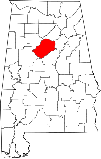 | |
| Towns | ||
| CDPs | ||
| Unincorporated communities | ||
| Former towns | ||
| Footnotes | ‡This populated place also has portions in an adjacent county or counties | |