Grayson Valley, Alabama
| Grayson Valley, Alabama | |
|---|---|
| Census-designated place (CDP) & Unincorporated community | |
 Location in Jefferson County and the state of Alabama | |
| Coordinates: 33°38′55″N 86°38′11″W / 33.64861°N 86.63639°W | |
| Country | United States |
| State | Alabama |
| County | Jefferson |
| Area | |
| • Total | 2.0 sq mi (5.2 km2) |
| • Land | 2.0 sq mi (5.2 km2) |
| • Water | 0 sq mi (0 km2) |
| Elevation | 942 ft (287 m) |
| Population (2010) | |
| • Total | 5,736 |
| • Density | 2,900/sq mi (1,100/km2) |
| Time zone | Central (CST) (UTC-6) |
| • Summer (DST) | CDT (UTC-5) |
| ZIP code | 35235 |
| Area code(s) | 205 |
| FIPS code | 01-31348 |
| GNIS feature ID | 1852797 |
Grayson Valley is an unincorporated community and census-designated place in Jefferson County, Alabama, United States. It is northwest from the Birmingham suburb of Trussville. At the 2010 census the population was 5,736.[1]
Geography
Grayson Valley is located at 33°38′55″N 86°38′11″W / 33.64861°N 86.63639°W (33.648728, -86.636513).[2]
According to the U.S. Census Bureau, the community has a total area of 2.0 square miles (5.2 km2), all land.
Demographics
| Historical population | |||
|---|---|---|---|
| Census | Pop. | %± | |
| 2000 | 5,447 | — | |
| 2010 | 5,736 | 5.3% | |
| U.S. Decennial Census[3] | |||
As of the census[4] of 2000, there were 5,447 people, 2,155 households, and 1,579 families residing in the community. The population density was 2,374.2 people per square mile (918.4/km²). There were 2,210 housing units at an average density of 963.3 per square mile (372.6/km²). The racial makeup of the community was 94.57% White, 3.56% Black or African American, 0.28% Native American, 0.57% Asian, 0.09% from other races, and 0.94% from two or more races. 0.70% of the population were Hispanic or Latino of any race.
There were 2,155 households out of which 36.7% had children under the age of 18 living with them, 58.8% were married couples living together, 12.2% had a female householder with no husband present, and 26.7% were non-families. 23.8% of all households were made up of individuals and 5.1% had someone living alone who was 65 years of age or older. The average household size was 2.53 and the average family size was 3.01.
In the community the population was spread out with 26.1% under the age of 18, 8.9% from 18 to 24, 34.5% from 25 to 44, 22.3% from 45 to 64, and 8.3% who were 65 years of age or older. The median age was 34 years. For every 100 females there were 88.7 males. For every 100 females age 18 and over, there were 82.1 males.
The median income for a household in the community was $50,691, and the median income for a family was $54,301. Males had a median income of $39,680 versus $29,093 for females. The per capita income for the community was $22,840. About 2.5% of families and 4.5% of the population were below the poverty line, including 5.6% of those under age 18 and none of those age 65 or over.
2010 census
As of the census[5] of 2010, there were 5,736 people, 2,374 households, and 1,592 families residing in the community. The population density was 2,900 people per square mile (1,100/km²). There were 2,546 housing units at an average density of 1273 per square mile (489.6/km²). The racial makeup of the community was 70.6% White, 25.8% Black or African American, 0.3% Native American, 0.9% Asian, 0.0% from other races, and 1.8% from two or more races. 2.2% of the population were Hispanic or Latino of any race.
There were 2,374 households out of which 31.2% had children under the age of 18 living with them, 48.0% were married couples living together, 15.7% had a female householder with no husband present, and 32.9% were non-families. 28.9% of all households were made up of individuals and 8.6% had someone living alone who was 65 years of age or older. The average household size was 2.42 and the average family size was 2.98.
In the community the population was spread out with 24.3% under the age of 18, 8.5% from 18 to 24, 32.2% from 25 to 44, 24.2% from 45 to 64, and 10.8% who were 65 years of age or older. The median age was 34.6 years. For every 100 females there were 85.9 males. For every 100 females age 18 and over, there were 86.0 males.
The median income for a household in the community was $45,260, and the median income for a family was $54,503. Males had a median income of $43,750 versus $34,481 for females. The per capita income for the community was $22,950. About 0% of families and 2.0% of the population were below the poverty line, including 0% of those under age 18 and 7.5% of those age 65 or over.
References
- ↑ "American FactFinder". United States Census Bureau. Retrieved 2011-05-14.
- ↑ "US Gazetteer files: 2010, 2000, and 1990". United States Census Bureau. 2011-02-12. Retrieved 2011-04-23.
- ↑ "U.S. Decennial Census". Census.gov. Retrieved June 6, 2013.
- ↑ "American FactFinder". United States Census Bureau. Retrieved 2008-01-31.
- ↑ "American FactFinder". United States Census Bureau. Retrieved 2015-07-29.
Coordinates: 33°38′55″N 86°38′11″W / 33.648728°N 86.636513°W
Municipalities and communities of Jefferson County, Alabama, United States | ||
|---|---|---|
| Cities | 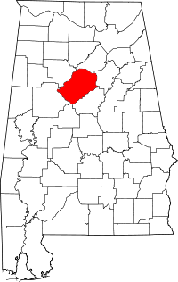 | |
| Towns | ||
| CDPs | ||
| Unincorporated communities | ||
| Former towns | ||
| Footnotes | ‡This populated place also has portions in an adjacent county or counties | |