Lipscomb, Alabama
| Lipscomb | |
|---|---|
| City | |
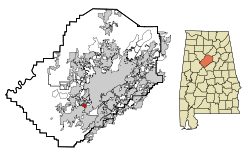 Location in Jefferson County and the state of Alabama | |
| Coordinates: 33°25′38″N 86°55′21″W / 33.42722°N 86.92250°W | |
| Country | United States |
| State | Alabama |
| County | Jefferson |
| Area | |
| • Total | 1.1 sq mi (2.9 km2) |
| • Land | 1.1 sq mi (2.9 km2) |
| • Water | 0 sq mi (0 km2) |
| Elevation | 541 ft (165 m) |
| Population (2013)[1] | |
| • Total | 2,171 |
| • Density | 2,234.5/sq mi (847.6/km2) |
| Time zone | Central (CST) (UTC-6) |
| • Summer (DST) | CDT (UTC-5) |
| FIPS code | 01-43336 |
| GNIS feature ID | 0152078 |
Lipscomb is a city in western Jefferson County, Alabama. It is part of the Birmingham, Alabama, metropolitan area. At the 2010 census the population was 2,210.
It does not have its own U.S. Post Office or ZIP code, instead sharing the Bessemer ZIP code (35020).
Geography
Lipscomb is located at 33°25′38″N 86°55′21″W / 33.42722°N 86.92250°W (33.427308, -86.922475).[2]
According to the U.S. Census Bureau, the town has a total area of 1.1 square miles (2.8 km2), all land.
Demographics
| Historical population | |||
|---|---|---|---|
| Census | Pop. | %± | |
| 1920 | 1,605 | — | |
| 1930 | 1,774 | 10.5% | |
| 1940 | 1,740 | −1.9% | |
| 1950 | 2,550 | 46.6% | |
| 1960 | 2,811 | 10.2% | |
| 1970 | 3,225 | 14.7% | |
| 1980 | 3,741 | 16.0% | |
| 1990 | 2,892 | −22.7% | |
| 2000 | 2,458 | −15.0% | |
| 2010 | 2,210 | −10.1% | |
| Est. 2015 | 2,155 | [3] | −2.5% |
| U.S. Decennial Census[4] 2013 Estimate[5] | |||
As of the census of 2000, there were 2,458 people, 901 households, and 634 families residing in the town. The population density was 2,163.6 people per square mile (832.5/km²). There were 1,108 housing units at an average density of 975.3 per square mile (375.3/km²). The racial makeup of the town was 32.55% White, 65.58% Black or African American, 0.28% Native American, 0.04% Asian, 0.12% Pacific Islander, 0.94% from other races, and 0.49% from two or more races. 2.24% of the population were Hispanic or Latino of any race.
There were 901 households out of which 35.1% had children under the age of 18 living with them, 41.4% were married couples living together, 23.4% had a female householder with no husband present, and 29.6% were non-families. 26.4% of all households were made up of individuals and 9.8% had someone living alone who was 65 years of age or older. The average household size was 2.73 and the average family size was 3.35.
In the town, its population was spread out with 30.1% under the age of 18, 8.5% from 18 to 24, 29.9% from 25 to 44, 21.0% from 45 to 64, and 10.5% who were 65 years of age or older. The median age was 33 years. For every 100 females there were 96.6 males. For every 100 females age 18 and over, there were 86.2 males.
The median income for a household in the town was $30,865, and the median income for a family was $35,556. Males had a median income of $26,908 versus $21,150 for females. The per capita income for the town was $13,582. About 15.9% of families and 16.2% of the population were below the poverty line, including 17.7% of those under age 18 and 16.4% of those age 65 or over.
2010 census
As of the census of 2010, there were 2,210 people, 812 households, and 554 families residing in the town. The population density was 2,009.1 people per square mile (762.1/km²). There were 950 housing units at an average density of 863.6 per square mile (327.6/km²). The racial makeup of the town was 61.0% Black or African American, 22.0% White, 1.1% Native American, 0.0% Asian, 0.0% Pacific Islander, 15.0% from other races, and 0.9% from two or more races. 19.7% of the population were Hispanic or Latino of any race.
There were 812 households out of which 28.9% had children under the age of 18 living with them, 33.5% were married couples living together, 28.1% had a female householder with no husband present, and 31.8% were non-families. 27.6% of all households were made up of individuals and 12.4% had someone living alone who was 65 years of age or older. The average household size was 2.72 and the average family size was 3.31.
In the town, its population was spread out with 26.5% under the age of 18, 9.5% from 18 to 24, 26.2% from 25 to 44, 26.0% from 45 to 64, and 11.8% who were 65 years of age or older. The median age was 34.8 years. For every 100 females there were 92.2 males. For every 100 females age 18 and over, there were 95.7 males.
The median income for a household in the town was $27,600, and the median income for a family was $45,000. Males had a median income of $32,261 versus $19,965 for females. The per capita income for the town was $16,892. About 13.5% of families and 15.1% of the population were below the poverty line, including 19.9% of those under age 18 and 22.4% of those age 65 or over.
History
The city of Lipscomb was first incorporated on June 30, 1910, and was named for L. Y. Lipscomb, one of three brothers who first settled in the area in 1885. As early as the 1880s, the community was called Wheeling and the town had 200-300 residents by 1906. The community was originally named after Wheeling, West Virginia because the owners of Woodward Iron Company, who employed many of the residents, also had business interests in that state. Y. L. Lipscomb ran a general store on the old South Bessemer car line which opened in 1890, though the first settlers actually came to the area in the 1830s, when Vincent Loveless established his farm in the area. The first church was established in the area in June, 1834 when a log structure was built named Union Baptist Church which sat on the site of the present church.[6]
Notable person
- Virginia Hill was a Chicago Outfit courier and was famous for being the steady girlfriend of mobster Bugsy Siegel.
References
- ↑ "Population Estimates". United States Census Bureau. Retrieved 2014-06-07.
- ↑ "US Gazetteer files: 2010, 2000, and 1990". United States Census Bureau. 2011-02-12. Retrieved 2011-04-23.
- ↑ "Annual Estimates of the Resident Population for Incorporated Places: April 1, 2010 to July 1, 2015". Retrieved July 2, 2016.
- ↑ United States Census Bureau. "Census of Population and Housing". Retrieved August 10, 2013.
- ↑ "Annual Estimates of the Resident Population: April 1, 2010 to July 1, 2013". Retrieved June 7, 2014.
- ↑ The Birmingham District, An Industrial History and Guide, page 209, published 1981, Marjorie L. White
Coordinates: 33°25′38″N 86°55′21″W / 33.427308°N 86.922475°W
Municipalities and communities of Jefferson County, Alabama, United States | ||
|---|---|---|
| Cities | 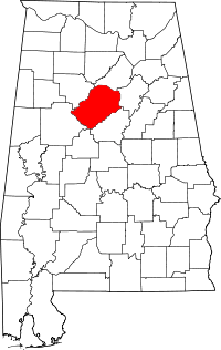 | |
| Towns | ||
| CDPs | ||
| Unincorporated communities | ||
| Former towns | ||
| Footnotes | ‡This populated place also has portions in an adjacent county or counties | |