National Register of Historic Places listings in Dare County, North Carolina

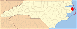
This list includes properties and districts listed on the National Register of Historic Places in Dare County, North Carolina. Click the "Map of all coordinates" link to the right to view a Google map of all properties and districts with latitude and longitude coordinates in the table below.[1]
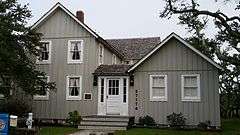
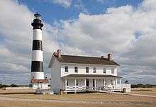
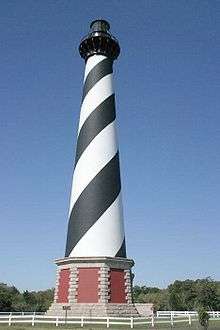
Current listings

This National Park Service list is complete through NPS recent listings posted December 2, 2016.[2]
[3] Name on the Register[4] Image Date listed[5] Location City or town Description
1 Ellsworth and Lovie Ballance House
Ellsworth and Lovie Ballance House
May 25, 2001
(#01000558)
E side M.V. Australia Ln., 0.1 miles S of Stowe Landing Rd.
35°13′21″N 75°41′13″W / 35.2225°N 75.686944°W / 35.2225; -75.686944 (Ellsworth and Lovie Ballance House)
Hatteras
2 Bodie Island Lifesaving/Coast Guard Station
Bodie Island Lifesaving/Coast Guard Station
February 9, 1979
(#79000251)
S of Nags Head on NC 12
35°50′11″N 75°33′33″W / 35.836389°N 75.559167°W / 35.836389; -75.559167 (Bodie Island Lifesaving/Coast Guard Station)
Nags Head
3 Bodie Island Light Station
Bodie Island Light Station
July 4, 2003
(#03000607)
Off NC 12
35°49′12″N 75°33′49″W / 35.82°N 75.563611°W / 35.82; -75.563611 (Bodie Island Light Station)
Nags Head
4 Caffeys Inlet Lifesaving Station Upload image
January 30, 1978
(#78001942)
N of Duck on SR 1200
36°13′33″N 75°46′15″W / 36.225833°N 75.770833°W / 36.225833; -75.770833 (Caffeys Inlet Lifesaving Station)
Duck
5 Cape Hatteras Light Station
Cape Hatteras Light Station
March 29, 1978
(#78000266)
SE of Buxton off NC 12 in Cape Hatteras National Seashore
35°15′16″N 75°31′17″W / 35.254444°N 75.521389°W / 35.254444; -75.521389 (Cape Hatteras Light Station)
Buxton
6 Chicamacomico Life Saving Station
Chicamacomico Life Saving Station
December 12, 1976
(#76000164)
NC 12 and SR 1247
35°35′42″N 75°27′54″W / 35.595°N 75.465°W / 35.595; -75.465 (Chicamacomico Life Saving Station)
Rodanthe
7 George Washington Creef House
George Washington Creef House
August 12, 1982
(#82004798)
304 Budleigh St.
35°54′29″N 75°40′18″W / 35.908056°N 75.671667°W / 35.908056; -75.671667 (George Washington Creef House)
Manteo
8 John T. Daniels House
John T. Daniels House
May 1, 2003
(#03000339)
960 Burnside Rd.
35°54′25″N 75°41′00″W / 35.906944°N 75.683333°W / 35.906944; -75.683333 (John T. Daniels House)
Manteo
9 DIXIE ARROW (shipwreck and remains)
DIXIE ARROW (shipwreck and remains)
September 25, 2013
(#13000781)
Address restricted[6]
34°55′00″N 75°02′00″W / 34.9167°N 75.0333°W / 34.9167; -75.0333 (DIXIE ARROW (shipwreck and remains))
Ocracoke
10 E.M. CLARK (shipwreck and remains) Upload image
September 25, 2013
(#13000780)
Address restricted[6]
Cape Hatteras
11 EMPIRE GEM (shipwreck and remains) Upload image
September 25, 2013
(#13000782)
Address restricted[6]
Cape Hatteras
12 First Colony Inn
First Colony Inn
January 21, 1993
(#92001835)
6720 S. Virginia Dare Trail
35°55′06″N 75°36′13″W / 35.918333°N 75.603611°W / 35.918333; -75.603611 (First Colony Inn)
Nags Head
13 Fort Raleigh National Historic Site
Fort Raleigh National Historic Site
October 15, 1966
(#66000102)
4 miles N of Manteo on U.S. 158
35°56′19″N 75°42′36″W / 35.938611°N 75.71°W / 35.938611; -75.71 (Fort Raleigh National Historic Site)
Manteo
14 Hatteras Weather Bureau Station
Hatteras Weather Bureau Station
February 17, 1978
(#78000268)
Off NC 12
35°13′12″N 75°41′26″W / 35.22°N 75.690556°W / 35.22; -75.690556 (Hatteras Weather Bureau Station)
Hatteras
15 Kitty Hawk Life-Saving Station
Kitty Hawk Life-Saving Station
October 11, 1984
(#84000073)
U.S. 158
36°04′02″N 75°41′28″W / 36.067222°N 75.691111°W / 36.067222; -75.691111 (Kitty Hawk Life-Saving Station)
Kitty Hawk
16 LANCING (shipwreck) Upload image
June 26, 2013
(#13000451)
Address restricted[6]
Buxton
17 LIGHT VESSEL 71 (shipwreck)
LIGHT VESSEL 71 (shipwreck)
August 19, 2015
(#15000541)
Address restricted[6]
Buxton
18 Markham-Albertson-Stinson Cottage
Markham-Albertson-Stinson Cottage
January 13, 2006
(#05001544)
4300 W. Soundside Rd.
35°56′46″N 75°37′46″W / 35.945975°N 75.629425°W / 35.945975; -75.629425 (Markham-Albertson-Stinson Cottage)
Nags Head Destroyed by Hurricane Irene[7]
19 Theodore S. Meekins House
Theodore S. Meekins House
December 17, 1982
(#82001295)
319 Sir Walter Raleigh St.
35°54′31″N 75°40′22″W / 35.908611°N 75.672778°W / 35.908611; -75.672778 (Theodore S. Meekins House)
Manteo
20 Mattie Midgett Store and House
Mattie Midgett Store and House
December 23, 2004
(#04001389)
4008 S. Virginia Dare Trail
35°57′23″N 75°37′28″W / 35.956389°N 75.624444°W / 35.956389; -75.624444 (Mattie Midgett Store and House)
Nags Head
21 Rasmus Midgett House
Rasmus Midgett House
October 21, 2009
(#09000847)
25438 NC Hwy 12
35°32′42″N 75°28′16″W / 35.545108°N 75.471094°W / 35.545108; -75.471094 (Rasmus Midgett House)
Waves
22 Nags Head Beach Cottages Historic District
Nags Head Beach Cottages Historic District
August 19, 1977
(#77000997)
U.S. 158
35°57′50″N 75°35′49″W / 35.963889°N 75.596944°W / 35.963889; -75.596944 (Nags Head Beach Cottages Historic District)
Nags Head
23 Oregon Inlet Station
Oregon Inlet Station
December 23, 1975
(#75001253)
12 miles N of Rodanthe on Pea Island
35°46′06″N 75°31′28″W / 35.768333°N 75.524444°W / 35.768333; -75.524444 (Oregon Inlet Station)
Rodanthe
24 Salvo Post Office
Salvo Post Office
September 23, 1993
(#93000997)
NC 12 W side, 0.1 miles S of jct. with Park Rd.
35°32′24″N 75°28′27″W / 35.54°N 75.474167°W / 35.54; -75.474167 (Salvo Post Office)
Salvo
25 Sam's Diner
Sam's Diner
January 27, 1999
(#99000062)
2008 S. Virginia Dare Trail
35°59′46″N 75°38′50″W / 35.996111°N 75.647222°W / 35.996111; -75.647222 (Sam's Diner)
Kill Devil Hills
26 Sea Foam Motel
Sea Foam Motel
December 23, 2004
(#04001392)
7111 S. Virginia Dare Trail
35°54′37″N 75°35′47″W / 35.910278°N 75.596389°W / 35.910278; -75.596389 (Sea Foam Motel)
Nags Head
27 U-576 and BLUEFIELDS (shipwrecks and remains) Upload image
December 8, 2015
(#15000864)
Address restricted[6]
Hatteras
28 U-701 (submarine) shipwreck and remains
U-701 (submarine) shipwreck and remains
November 12, 2015
(#15000806)
Offshore
Coordinates missing
Buxton
29 U-85 (submarine) shipwreck and remains Upload image
November 12, 2015
(#15000805)
Offshore
Coordinates missing
Nags Head
30 USS HURON
USS HURON
November 15, 1991
(#91001625)
Shipwreck off Nags Head
Coordinates missing
Nags Head
31 USS MONITOR
USS MONITOR
October 11, 1974
(#74002299)
Shipwreck off Cape Hatteras
Coordinates missing
Cape Hatteras
32 Wright Brothers National Memorial
Wright Brothers National Memorial
October 15, 1966
(#66000071)
U.S. 158
36°00′58″N 75°40′12″W / 36.016111°N 75.67°W / 36.016111; -75.67 (Wright Brothers National Memorial)
Kill Devil Hills

See also

Wikimedia Commons has media related to National Register of Historic Places in Dare County, North Carolina.

References

  1. The latitude and longitude information provided in this table was derived originally from the National Register Information System, which has been found to be fairly accurate for about 99% of listings. For about 1% of NRIS original coordinates, experience has shown that one or both coordinates are typos or otherwise extremely far off; some corrections may have been made. A more subtle problem causes many locations to be off by up to 150 yards, depending on location in the country: most NRIS coordinates were derived from tracing out latitude and longitudes off of USGS topographical quadrant maps created under the North American Datum of 1927, which differs from the current, highly accurate WGS84 GPS system used by most on-line maps. Chicago is about right, but NRIS longitudes in Washington are higher by about 4.5 seconds, and are lower by about 2.0 seconds in Maine. Latitudes differ by about 1.0 second in Florida. Some locations in this table may have been corrected to current GPS standards.
  2. "National Register of Historic Places: Weekly List Actions". National Park Service, United States Department of the Interior. Retrieved on December 2, 2016.
  3. Numbers represent an ordering by significant words. Various colorings, defined here, differentiate National Historic Landmarks and historic districts from other NRHP buildings, structures, sites or objects.
  4. National Park Service (2008-04-24). "National Register Information System". National Register of Historic Places. National Park Service.
  5. The eight-digit number below each date is the number assigned to each location in the National Register Information System database, which can be viewed by clicking the number.
  6. 1 2 3 4 5 6 Federal and state laws and practices restrict general public access to information regarding the specific location of sensitive archeological sites in many instances. The main reasons for such restrictions include the potential for looting, vandalism, or trampling. See: Knoerl, John; Miller, Diane; Shrimpton, Rebecca H. (1990), Guidelines for Restricting Information about Historic and Prehistoric Resources, National Register Bulletin (29), National Park Service, U.S. Department of the Interior, OCLC 20706997.
This article is issued from Wikipedia - version of the 10/18/2016. The text is available under the Creative Commons Attribution/Share Alike but additional terms may apply for the media files.