Meelick, County Clare
| Meelick Miliuc | |
|---|---|
| Village | |
 Meelick Location in Ireland | |
| Coordinates: 52°42′N 8°39′W / 52.700°N 8.650°W | |
| Country | Ireland |
| Province | Munster |
| County | County Clare |
| Time zone | WET (UTC+0) |
| • Summer (DST) | IST (WEST) (UTC-1) |
- There are other places called Meelick in County Galway and County Mayo.
Meelick (Irish: Miliuc, meaning "Marshy land") is a small village in County Clare, Ireland, situated a few kilometres north of Limerick in the Midwest region.
History
From 1956, the area was home to 161 Hungarian refugees fleeing the Soviet repression in that country (see 1956 Hungarian Revolution). They were housed in Knockalisheen Camp, a disused army barracks dating from the Emergency. In 1957, complaints and disputes between the refugees and the authorities over living conditions and enforced idleness led to a mass hunger strike. After three days, the Dáil and the Irish Red Cross negotiated an end to the strike. By the summer of 1958, most of the refugees were allowed to move to Germany and the USA while a few chose to remain in Ireland. During their stay at the camp, the 51 children attended the local St Munchin's Girls' School where they were taught both the English and Irish languages. Since the 1990s the camp has again been used to house asylum seekers, now mostly from African countries.
Community
There is a thriving GAA club, Scout Group and other local amenities such as a community centre, tavern, shop etc.
Historically the village of Meelick was located in an area better known as Stonepark, where the church and school are situated. However, during the early 1980s, the development of housing estates began where the majority of Meelick residents now live. Before this, Meelick didn't even warrant a place on the map and even with the development of new housing and the resulting population boost, Meelick can still be seen on very few maps. The three main housing estates built were Ballycannon Heights, Elton Court and Kylevoher. However, with the turn of the 20th century, two new estates, Elmwood and Glen Abhainn have been developed. Other areas near Meelick that can be noted as residential are Cappantymore, Moneen, Stonepark (the original village location), Woodcock Hill and Ballycannon North.
See also
References
Places in County Clare | ||
|---|---|---|
| Towns | 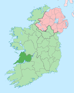 | |
| Villages |
| |
| Regions | ||
| Islands | ||
| ||
Coordinates: 52°42′3.05″N 8°39′11.13″W / 52.7008472°N 8.6530917°W