Aughinish, County Clare
| Aughinish Eachinis | |
|---|---|
| Island and village | |
|
| |
 Aughinish Location in Ireland | |
| Coordinates: 53°09′47″N 9°04′18″W / 53.163147°N 9.071556°WCoordinates: 53°09′47″N 9°04′18″W / 53.163147°N 9.071556°W | |
| Country | Ireland |
| County | County Clare |
| Elevation | 0 m (0 ft) |
| Time zone | WET (UTC+0) |
| • Summer (DST) | IST (WEST) (UTC-1) |

Aughinish (sometimes written as Aughnish) (Eachinis in Irish) is a small island and townland located in Oughtmama Parish of the Barony of Burren in north County Clare, in Ireland on the south shore of Galway Bay.[1] By road it is 10.9 kilometres (6.8 mi) northwest of Kinvarra.[2] The island is approximately two miles (3 km) wide and a mile (1.6 km) from the northernmost tip to the southernmost point and has approximately fifty inhabitants.
The island was originally connected to County Clare, but in 1755 that connection was lost due to the tsunami effect of the massive Portuguese earthquake.[3] The British built the existing 0.5 miles (0.80 km)[4]causeway to County Galway to service their troops in the Martello Tower constructed on the island after 1811.[5] So to this day, land access to Aughinish, County Clare is still only through County Galway.
References
- ↑ "Clare Library: Map of Oughtmama Parish showing Townlands". Clare Library. Retrieved 7 January 2014.
- ↑ Google (9 February 2014). "Aughinish, County Clare" (Map). Google Maps. Google. Retrieved 9 February 2014.
- ↑ Extreme wave events in Ireland: 14 680 BP–2012 p. 634
- ↑ Spellissy, Sean (1 January 1999). The History of Galway. Celtic Bookshop. ISBN 978-0-9534683-3-1.
- ↑ Sheerin, Norbert (2000). Renmore and Its Environs: An Historical Perspective. Renmore Residents Association. p. 14. ISBN 978-0-9538591-0-8.
External links
Further reading
- Glynn, Rose: The Story of Aughinish, 2002. (self-published)
Places in County Clare | ||
|---|---|---|
| Towns | 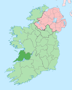 | |
| Villages |
| |
| Regions | ||
| Islands | ||
| ||